
Observation Date
3/27/2025
Observer Name
Kelly, Miller, Miller
Region
Provo » American Fork
Location Name or Route
American Fork
Comments
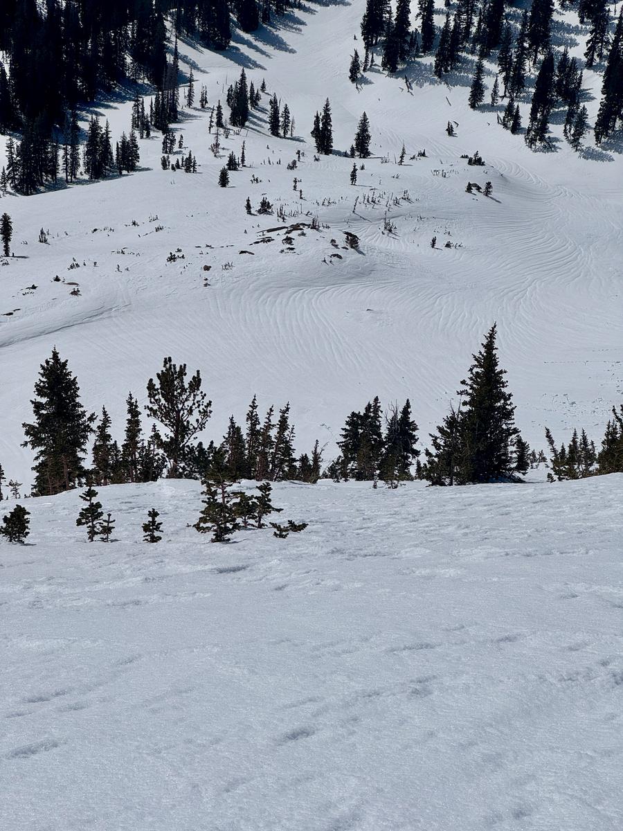
Photo of snow runnels, in the basin and melt-freeze crust on the surface above 10,000' in elevation. Snow runnels can often be seen as signs of stability and show where melt water has run through the snowpack.
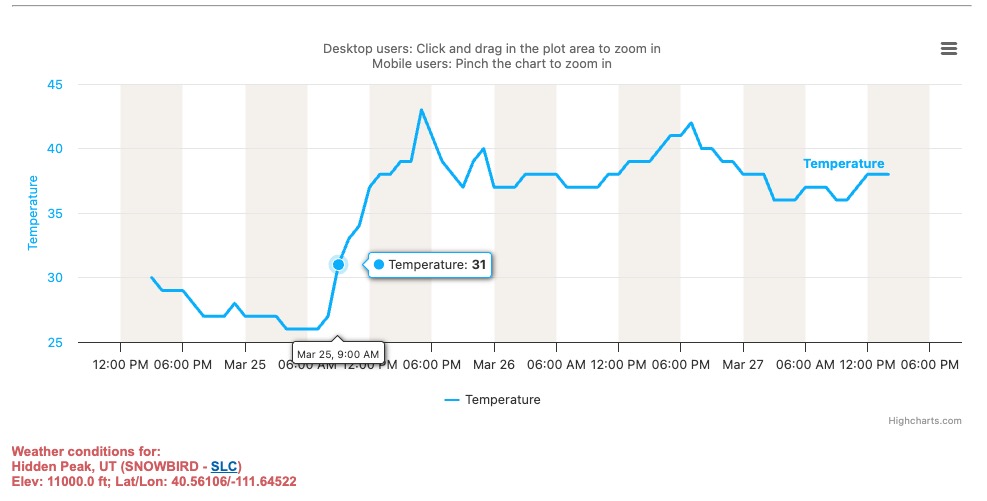
Today, we timed our tour to avoid wet avalanches and poor travel due to wet snow. I would imagine the avalanche danger would rise to considerable later this afternoon. Many weather stations in the forecast region have not had a solid air temperature refreeze in a couple of days at higher elevations. See chart below showing temperature at nearby 11,000' weather station. The snow surface has still been freezing at night due to clear skies, and although the window for soft supportable skiing has become smaller, we are still finding soft turns. If we see cloud cover and no refreeze tonight, then tomorrow could have a damper snow surface and we may be more likely to see wet slab avalanches if temps, cloud cover, and slower wind speeds all line up.
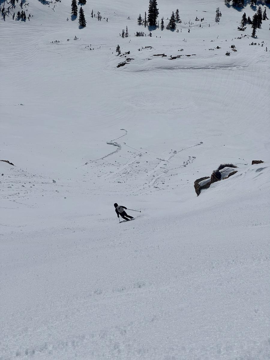
Below photo showing supportable turns on an eastern facing slope at 10,600'
Today's Observed Danger Rating
Low
Tomorrows Estimated Danger Rating
None
Coordinates


