
Observation Date
2/21/2025
Observer Name
Kelly, Grainger, Anderson
Region
Provo » American Fork » Tibble Fork » Three Temptations
Location Name or Route
Three Temptations
Comments
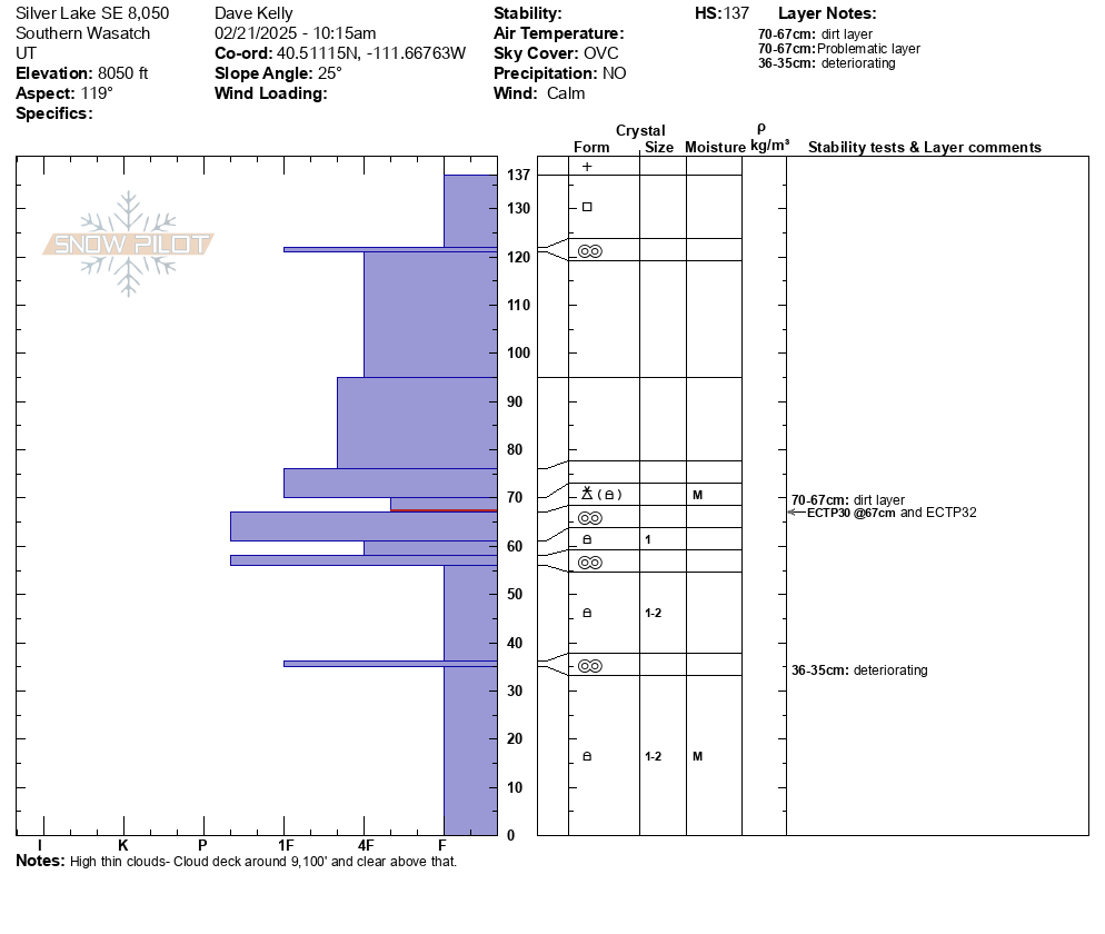
Snowpit on a southeast aspect showed a total depth of 4.5' (137cm). The weakest layer was the bottom of the graupel layer from February 7th, 2025 that had the dirt layer intact. This layer was mostly broken down graupel and rounding faceted snow. We had 2 failures here with propagation one at 30 and one at 32 taps. (ECTP 30 and 32 @ 67cm from the ground). The melt freeze crust closer to the surface had rounded grains above it and some broken precipitation particles underneath the crust. We had no failure at this layer ( 122cm).
We observed little evidence of the natural avalanches in old snow from last week's natural cycle but this SE facing slope was one example, on the receiving side of NW wind-loading and in steep, rocky terrain.

Avalanche danger is trending downward. We stayed off of exposed slopes greater than 30° in steepness and had great travel and soft turns. Moderate avalanche danger with a buried persistent weak layer is still suspect and we discussed how we would be wary of any steep slope right now.
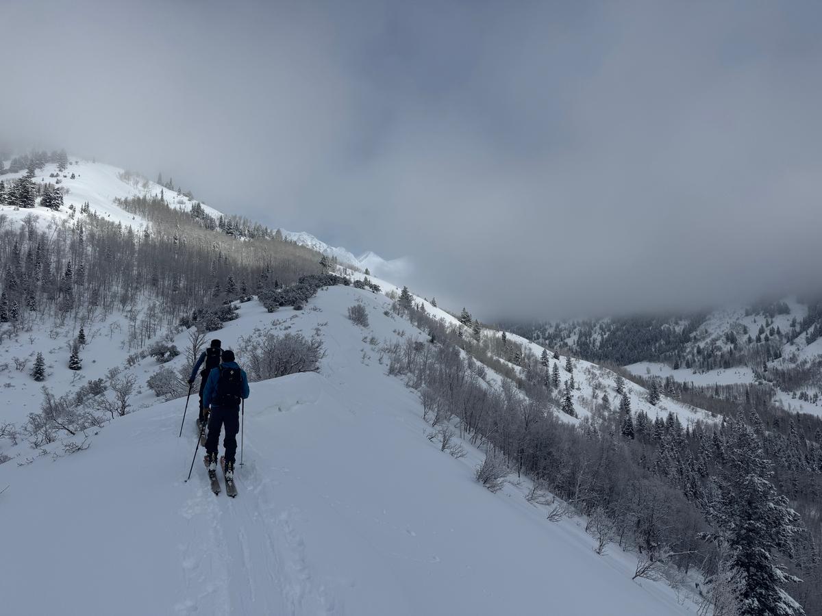

Below photo of low coverage and exposed brush at 8,000'
Below photo of surface hoar (will most likely be destroyed by sun) in a lower angle meadow at 9,200' in elevation
Today's Observed Danger Rating
Considerable
Tomorrows Estimated Danger Rating
Moderate
Coordinates


