Observation: Ben Lomond

Observation Date
2/1/2025
Observer Name
Derek DeBruin & co.
Region
Ogden » Ben Lomond
Location Name or Route
Ben Lomond, Cutler Ridge
Weather
Weather Comments
At 0815, light snow at the trailhead with wet roads but no real accumulation yet at that elevation. Snow slowly increased in intensity and fully turned on around 0930, dropping steady S2-S3 graupel and rimed stellars throughout the rest of the day. Winds were out of the W/SW down low, but we caught N/NW winds above about 7000ft.
Snow Characteristics
Snow Characteristics Comments
About 9 inches of storm snow had fallen by 1500. 1-2 inches came down overnight, with another 6-7 by mid-afternoon. The overnight rain/snow line was around 6500ft, while today's rain/snow line was somewhere below 5500ft. This meant today's precip was all snow in one form or another, yielding riding on surfy dense powder.
Red Flags
Red Flags
Heavy Snowfall
Wind Loading
Collapsing
Rapid Warming
Poor Snowpack Structure
Red Flags Comments
Checking most of the boxes today. We confined our tour to under 7500ft as the wind didn't seem compelling and we had ample snow to ride below that elevation. Consequently, we saw plenty of snow transport, but didn't see much in the way of fresh wind slab. As noted above, the new snow (plus wind) met the criteria for heavy loading. We had 2 isolated collapses around 7200ft in an easterly zone, small pockets that didn't reach much farther than the ski tips. Below 6500ft, the rain pounded the old surface facets into snowball-making material and penetrated the sub-surface crust, dampening the facets beneath. Hand shears at low elevation weren't worrisome, and pole drags indicated the surface snow was riding the line between dry loose and wet loose, not really reacting either way. Test slopes at the low elevations showed relatively cohesive storm slab, but punching through into the basement didn't yield much in the way of propagation--we couldn't really make a slab fall downhill. Higher up where the old surface was still cold and dry, it was easier to get stomps to slide on the underlying crust. However, this was a bit more effortful than I suspected it might be, and we saw no shooting cracks.
Comments
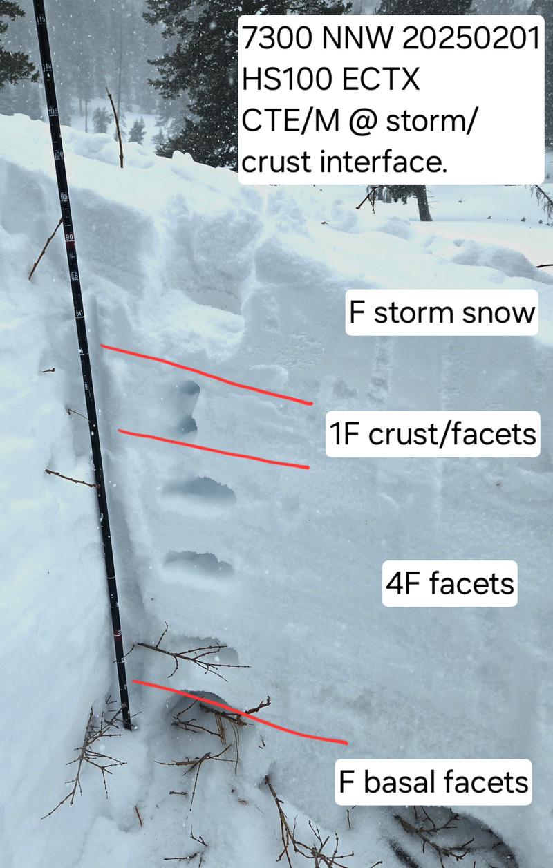
Dug a couple pits NNW at 7300ft with HS ca. 100cm. ECTX on everything we tried. CT revealed easy/mod failure at the mid-storm interface (formed in the relative lull between today's snow and last night's precip) and the new/old interface on the surface wind crust. I suspect with continued loading we might start to see easier release of slabs on the new/old interface. Structure was certainly not inspiring, but despite faceting in a large portion of the snowpack, hand hardness just wasn't that different, snow was decently cohesive, and the wind crust seemed to prevent impact from reaching deeper into the snowpack.
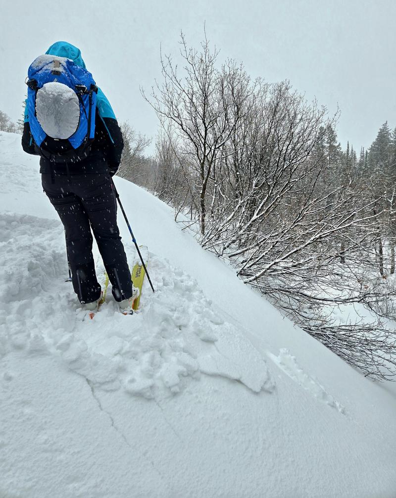
Representative photo of the most common test slope response we got. The slab was trying, some cracks and chunks were happening, but it never really quite released or slid much.
Today's Observed Danger Rating
None
Tomorrows Estimated Danger Rating
None
Coordinates