Join us at our 2nd Annual Blizzard Ball

Observation: Toledo Bowl

Observation Date
1/19/2025
Observer Name
Kelly
Region
Salt Lake » Little Cottonwood Canyon » Toledo Bowl
Location Name or Route
Toledo Bowl
Weather
Sky
Broken
Wind Direction
Northwest
Wind Speed
Light
Weather Comments
Light westerly winds, primarily blowing from the northwest. Air temperatures were cold. At 8,500' the temperature was 13 °F, at 10,500' the temperature was 1 °F, and at the snowpit the temperature was 7°F. With even the lightest winds it was cold. This morning was the coldest temp that I've noted for this season at 8,500' Clouds were in/out with high thin clouds and some sun breaking through, but not enough to warm the snow surface.
Snow Characteristics
New Snow Depth
6"
New Snow Density
Low
Snow Surface Conditions
Powder
Snow Characteristics Comments
6" settled snow depth from the last storm above 9,000' with more snow below that. Snow surface was mostly soft although on south and west facing slopes over 25° degrees you could feel the old snow surface with your tails when making turns. Lower angle terrain was better travel on these aspects. West facing terrain had old hard rollerballs from warming prior to the storm.
Avalanche Problem #1
Problem
Persistent Weak Layer
Avalanche Problem #2
Problem
Wind Drifted Snow
Problem #2 Comments
Shallow wind drifted snow with minor cracking 3"-4" deep and shooting out maybe 10' from skis. This was isolated to wind rolls below 9,000' where I traveled and I did not notice it at higher elevations.
Snow Profile
Aspect
South
Elevation
10,000'
Slope Angle
34°
Comments
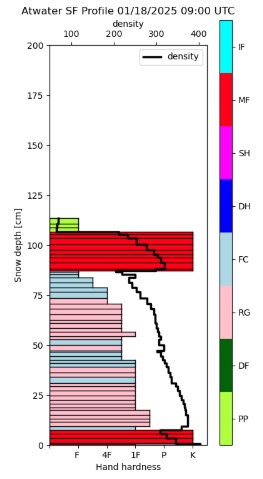
In this hand dug snowpit on a south facing aspect I found a total depth of 34" (88cm). The weakest snow was a layer of facets underneath a melt freeze crust 10" (23cm) from the surface. I was able to get non-planar propagation on this layer with extended column tests. The snow surface was new snow you could feel the melt freeze crust on your tails on all but the most shallow terrain on south and west facing aspects. The facets near the ground showed signs of rounding and the temperatures verified this in the bottom 12"-14" of the snowpack in this location. I've attached the Snowpack Model from Atwater as the bottom graph for comparison.
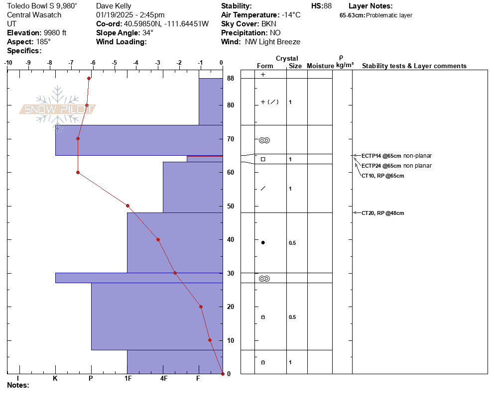

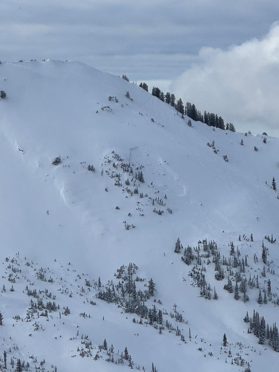
Photo of still visible crown from avalanche reported last week in Cardiff. This most recent storm snow was not enough to fill in old crown lines and repeater slopes are on my radar as places to avoid if they get filled back in with storm or wind drifted snow.
Today's Observed Danger Rating
Low
Tomorrows Estimated Danger Rating
Low
Coordinates