Observation: Wellsvilles

Observation Date
4/16/2024
Observer Name
Schumacher
Region
Logan » Wellsvilles
Location Name or Route
Wellsville mountain wilderness
Weather
Sky
Broken
Wind Direction
Northwest
Wind Speed
Light
Weather Comments
Started the morning in the dark with temps at the TH at around 40*, clear skies overhead, Calm to light NW winds. Overnight freeze line was around 6700’ following a rain/snow line around 7500-8000’. The sun was warm today affecting solar snow, while the intermittent cloud cover and northerly winds kept polar snow cool.
Snow Characteristics
New Snow Depth
1"
New Snow Density
Medium
Snow Surface Conditions
Powder
Wind Crust
Rain-Rime Crust
Damp
Snow Characteristics Comments
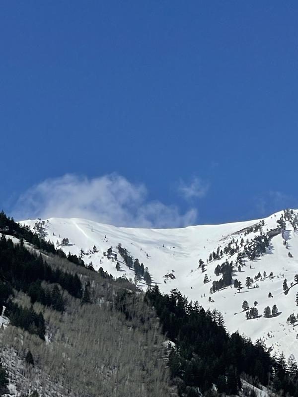
Variable surface conditions today with rain crust, wet snow, and dirt at mid/lower elevations and damp new snow, wind buff, and soft wind deposits at mid/upper elevations. Much of the new snow got blown off the more northerly aspects.
Solar aspects had Boot pen 2-5cm at low elevations in early AM. 6700'- estimated freeze line with 2" rain crust on wet snow. Rain/snow line 7500-8000' with about 1-2" of new snow and areas of wind drifted snow 2-4" above that elevation. By end of day around noon, boot pen was at boot tops. Snow on solar aspects was damp on upper elevations and wet at lower elevations by noon.
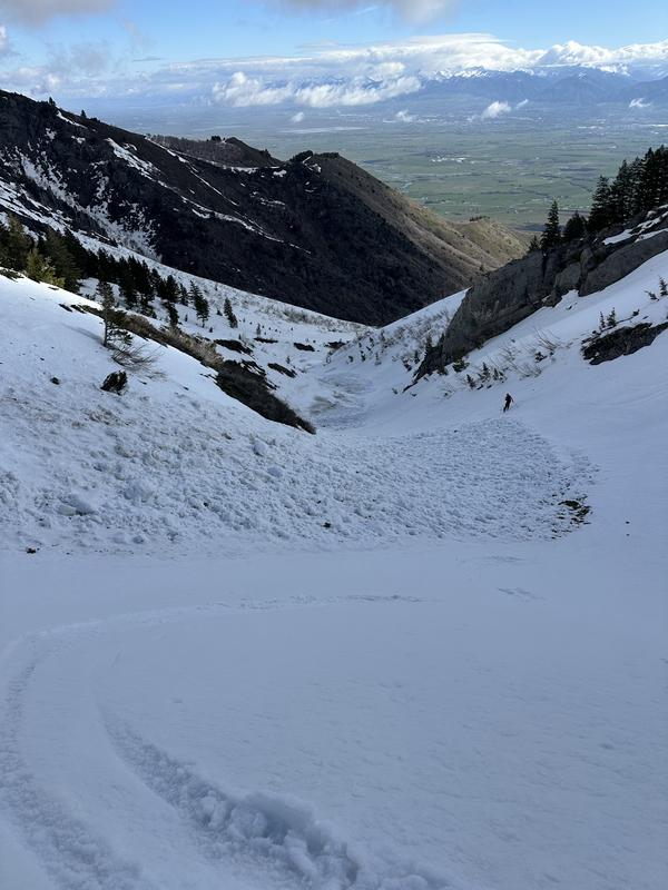
Polar aspects were still hard and supportable by noon, that made for tough ski conditions. The pine canyon drainage seemed to get a more significant refreeze overnight than rattlesnake.
Some wind blown swirling snow seen, but minimal.
Red Flags
Red Flags
Recent Avalanches
Rapid Warming
Red Flags Comments
Triggered a couple very small soft wind slabs being heated by the sun. Surface snow was becoming saturated by the sun and may have reached a Moderate type hazard level in the afternoon. Rollerballs noted around noon on East and SE aspects at mid/upper elevations.
Avalanche Problem #1
Problem
Wet Snow
Trend
Increasing Danger
Problem #1 Comments
Rollerballs, damp to wet snow, and heating of small soft wind drifts were the highest hazard today, although relatively low in the morning.
we did note an old but respectable wet avalanche debris pile on the way out (pictured). Looked to have released from some steep SE facing cliffs around 8200' and ran 1000-2000' vertical.
Avalanche Problem #2
Problem
Wind Drifted Snow
Trend
Decreasing Danger
Problem #2 Comments
Very small pockets of wind drifted snow being heated by the sun were likely our highest hazard during the morning. We triggered a couple of very small soft hot wind slabs on East aspect at about 8500' on a very steep cross loaded rollover that were about 5' wide and acted more like a wet avalanches than a traditional wind slab (not pictured).
Today's Observed Danger Rating
Low
Tomorrows Estimated Danger Rating
Low