Observation Date
4/14/2024
Observer Name
Kelly
Region
Provo » American Fork
Location Name or Route
American Fork-Mary Ellen
Comments
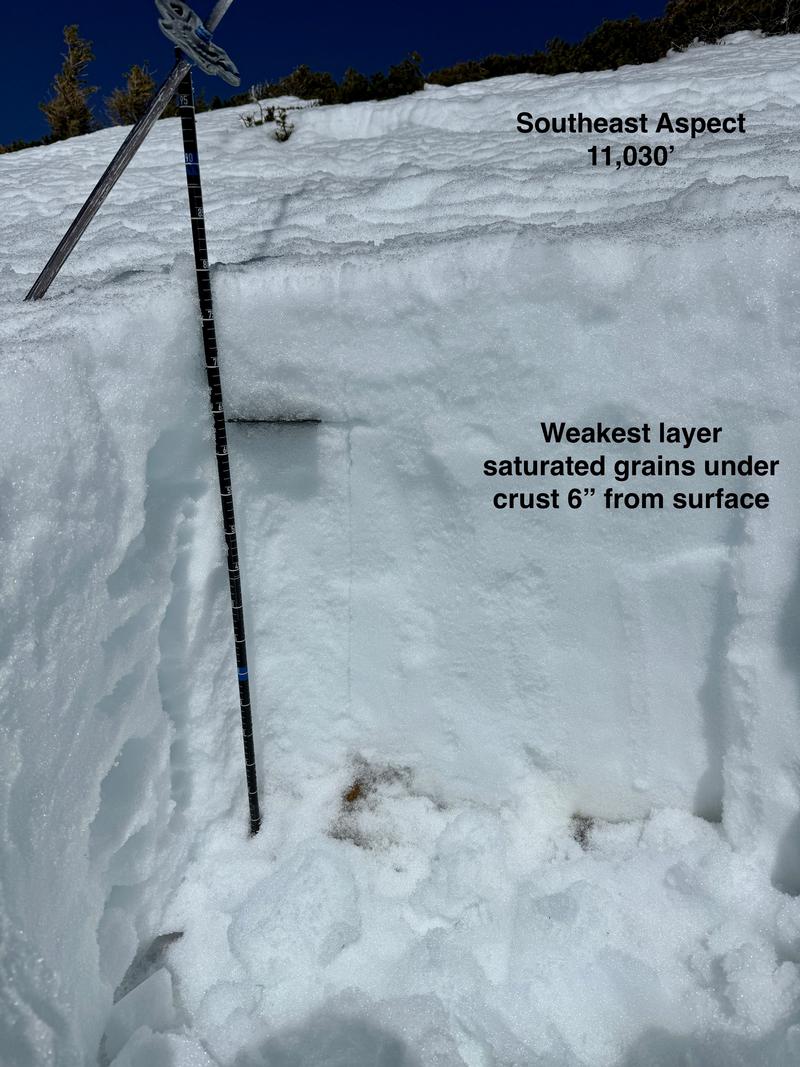
Today, was a tale of timing. The upper snowpit was dug earlier in the day at a higher elevation site that was more in the wind zone. This pit showed a supportable surface with weak wet grains 6" from the surface. This slope was skied and yielded great skiing from the peak to the drainage bottom.
The below snowpit was dug in a less windy zone later in the day with more sun affect. This second snowpit also showed weak wet grains 6" from the surface, however the surface snow was much weaker and the snow surface may have been supportable skiing, but we were too late and elected to find something else to ski that was more supportable. What is interesting is that both snowpits had percolation columns (page 10 of 13) below the crust which is a sign that the water has established a way to move through the snowpack (think of it like plumbing). The higher elevation snowpit had percolation columns from under the crust to the ground. The lower elevation pit had percolation columns going from under the crust to the dirt layer and those columns in the thicker snowpack had not made it to the ground- This is something to keep an eye out for as water may pool above the dust layer.
For a quick read about water pooling check out Drew's blog from the Thursday April 11 HERE.
For a quick read about water pooling check out Drew's blog from the Thursday April 11 HERE.


Today's Observed Danger Rating
Low
Tomorrows Estimated Danger Rating
None
Coordinates


