Observation Date
4/5/2024
Observer Name
Zimmerman-Wall/ AIARE PRO 1
Region
Salt Lake » Little Cottonwood Canyon » White Pine
Location Name or Route
White Pine
Weather
Sky
Obscured
Precipitation
Moderate Snowfall
Wind Direction
Southwest
Wind Speed
Strong
Weather Comments
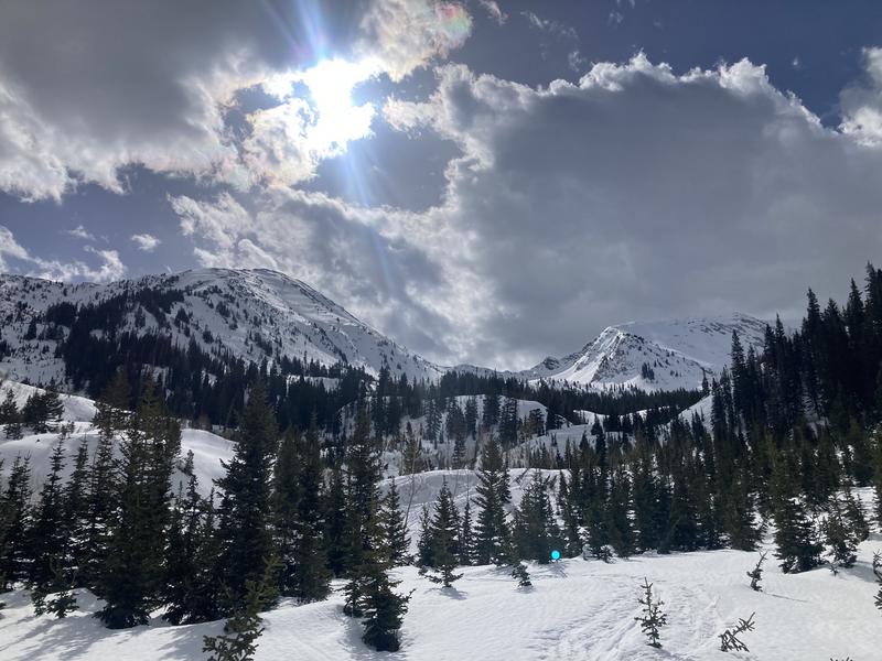
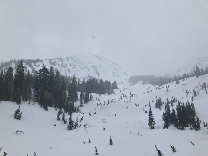
Leaving trailhead at 0900 under broken skies, mild temps, and moderate winds we anticipated storm would arrive mid afternoon. Ascending the drainage we had very brief periods of sunshine that did not change the existing snow surfaces. Wind was transporting snow and drifting it into isolated pockets on Red Baldy and the Rock and Roll Chute. By 1230 at White Pine Lake, the clouds lowered rapidly and the winds increased, prompting our exit to below treeline for fear of white out and lightning. Precipitation started as graupel and turned over to rimed stellars and plates that stuck together to form large wet flakes.
Snow Characteristics
New Snow Depth
2"
New Snow Density
Medium
Snow Surface Conditions
Melt-Freeze Crust
Snow Characteristics Comments
Completely supportable melt freeze crust on skis. Foot penetration was 20cm. We found the last bastion of dry snow on a series of 35-40 degree north facing rollovers just below white pine lake. The slightest change in aspect or reduction of slope angle to less than 30 degrees resulted in a breakable crust. Experienced a period of S2 snowfall from 1400-1530 that barely made the skiing tolerable. The graupel rolled down the steep smooth surfaces and when the precip type changed over it began to adhere to the corrugated surfaces at mid and low elevations. This layer will likely remain moist with the new snow capping it and keeping it from freezing.
In our various snow profiles on East and West facing terrain features in the mid canyon, we noted a homogenizing snowpack that is very locked up and transitioning to a spring regime. It did not appear that water had moved very far down through the snowpack, although runnels were present on the surface in many places. No percolation tubes present. A crust laminate exists on the West facing terrain 30-45cm below the current surface. No facets observed in between these layers. We did conduct a few CTs producing resistant planar and sudden collapse below these crusts in a layer of clustered rounded grains, but the shear plane was irregular. No propagation in ECT.
Comments
No avalanche problems noted today, however the drifting of new snow late afternoon was likely building shallow wind slabs in the alpine terrain. The goal today was to take a look at the wet slab reported by Gagne on 4/4 and observe what the forecast 12-24" over the weekend will land on. We expect it should initially bond well due to the warm temps at mid elevations. Our uncertainy is in how it may bond to smoother surfaces in the high alpine. With higher precipitation rates and wind, we suspect that storm slab instabilities will be present tomorrow.
Photo 1: Mid morning in middle of white pine drainage
Photo 2: Mid afternoon in middle of white pine drainage
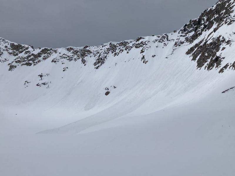
Photo 3: Wet slab reported in the Lake Peak environs from prior day.
Today's Observed Danger Rating
Low
Tomorrows Estimated Danger Rating
None
Coordinates