Observation: Black Canyon

Observation Date
3/7/2024
Observer Name
Derek DeBruin, Dave Leydet, Greg Gagne, Chris Dechet
Region
Ogden » Ben Lomond » Black Canyon
Location Name or Route
Ben Lomond, Black Canyon
Weather
Sky
Obscured
Precipitation
Light Snowfall
Weather Comments
Temps hovered around freezing at the trailhead this morning, with relatively warm conditions throughout the day. Felt like upper 20s F on the way up to 8800ft. Wind was calm to light. S- to S1 precip consistently throughout the tour until perhaps 2pm. As precip abated, cloud level rose to approx 8500ft by mid-afternoon.
Snow Characteristics
New Snow Depth
2"
New Snow Density
Medium
Snow Surface Conditions
Powder
Damp
Snow Characteristics Comments
Surface below 7000ft or so was wet. Solar aspects in mid/upper elevations held damp powder. Protected northerlies harbored medium density soft snow that made for great turns. Exposed locations showed all the signs of wind effect from the weekend's storm and the days since, include some 4F slab, stiff and well-developed wind lips, and some cornicing, too. However, a few inches of new snow sat atop the older wind affected areas. The overnight 2 inches and additional couple inches today sluffed easily underfoot on the old snow surface.
Red Flags
Red Flags
Recent Avalanches
Red Flags Comments
We saw several natural loose avalanches today, both wet and dry, D1 in size. The wet loose avalanches occurred on steep solar aspects, especially at low elevation. There was also debris from wet loose avalanches that occurred in the last day or two. The dry loose avalanches happened in the mid elevations northerlies, and seemed to be caused by spindrift releasing above rocks and small cliffs. This landed on what we suspect was pooled small-grain graupel, causing point releases in the top 5-8cm of snow, entertaining up to 10-15cm of snow before coming to rest after running a few hundred feet of vertical.
Comments
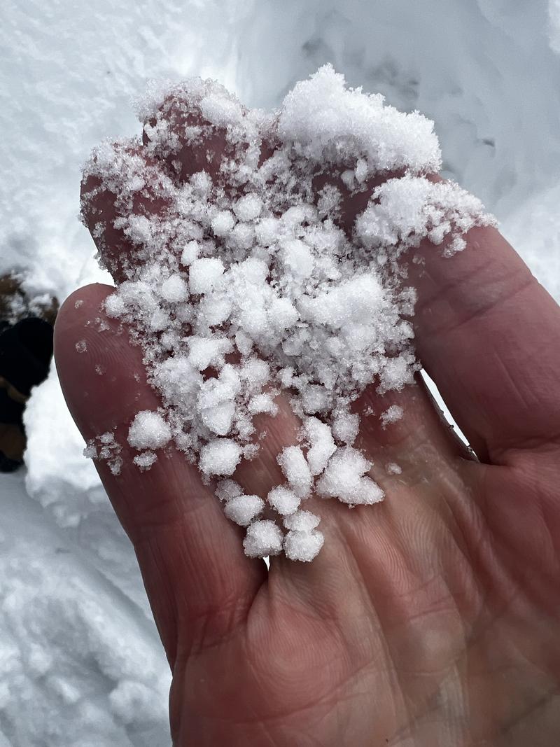
The March dust crust remained about 30cm below the snow surface, but became increasingly difficult to find higher than 8000ft. Large grain (0.5+cm) graupel sat just above the crust at low elevations, with graupel decreasing in size but still present atop the crust higher up. 
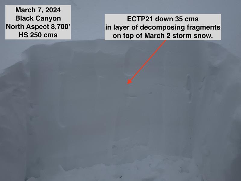
Hand shears yielded clean and easy breaks at the new/old snow interface. We dug a couple pits on a N aspect at 8700ft. One yielded ECTN18 down 35cm x2, as well as ECTP21 and ECTP22 down 35cm. The other yielded CT22 down 35cm and ECTX. We were a bit surprised at these results, as the propagation occurred in a right side up snowpack (F to 1F in the upper 50cm) at an interface that was not obvious. It occurred between two layers of 4F snow at what seemed to pass for the dust crust at that elevation.
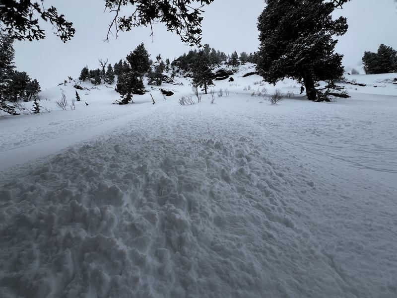
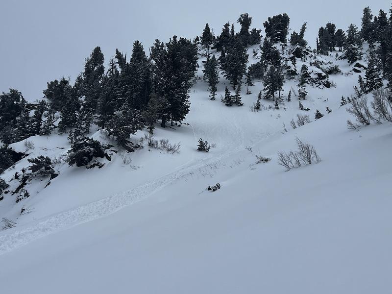
There was a natural cycle mid-morning on steep northerly aspects in the top 4-8 cms of storm snow above 7,500' with long-running sluffs and debris piles up to 45 cms deep.
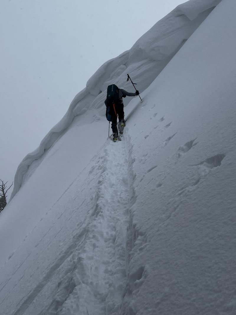
Cornices were sensitive and have grown large along exposed ridgelines.
Photo of some of the 5 mm graupel that can be found in lower elevations.
Today's Observed Danger Rating
Moderate
Tomorrows Estimated Danger Rating
Moderate
Coordinates