Observation: Provo Peak

Observation Date
2/24/2024
Observer Name
Garcia/Kelly
Region
Provo » Provo Peak
Location Name or Route
Provo Peak
Weather
Sky
Clear
Wind Direction
Southwest
Wind Speed
Moderate
Weather Comments
Winds picked up blowing from the southwest at a moderate speed above 9,700'. We observed transporting snow above 10,300' onto northeast aspects. Below 9,700' the winds were light and the air temperatures were cold enough where the snow surface was not affected until below 8,000'
Snow Characteristics
Snow Surface Conditions
Powder
Melt-Freeze Crust
Snow Characteristics Comments
Soft snow surface on northerly facing aspects. We noted surface hoar sitting on top of a melt-freeze crust in the melt stage up to 9,000' (photo 1 and 2 below). Below 8,000' was more sun affected with wet surfaces and some wet loose activity on due south facing terrain. This is worth paying attention to with our next storm lined up for early next week. If this layer of weak surface snow is buried intact we could have lingering surface instabilities.
We noted smaller grained faceted snow on northerly aspects (not associated with a crust) and isolated to the top 4-6" of the snow surface. This was not propagating unless it had received a little bit of wind.
Red Flags
Red Flags
Poor Snowpack Structure
Red Flags Comments
Poor snowpack structure on southeast facing aspects. See snowpit below.
Avalanche Problem #1
Problem
Persistent Weak Layer
Trend
Decreasing Danger
Problem #1 Comments
Poor snowpit structure on east-southeast facing aspects. These facets above a crust were rounding in this location. Still some lingering concerns for deeply buried PWL avalanches on the northern 1/2 of the compasss in high elevation terrain repeater zones (places that avalanched earlier this year and are now filled back in by wind and new snow). You will be able to identify these areas because they will be a more shallow snowpack. It is worth pulling a probe out so you know how deep the snowpack is where you plan to travel as it is variable.
Avalanche Problem #2
Problem
Wet Snow
Trend
Same
Problem #2 Comments
We observed small wet loose avalanche activity on steep southerly aspects. Trend will continue with warming temperatures.
Snow Profile
Aspect
Southeast
Elevation
8,600'
Slope Angle
29°
Comments
This snowpit showed 2 weak buried layers on a southeast aspect. The first was rounding buried surface hoar 10"-12" below the surface that did not propagate with stability tests. The layer of greatest concern was 1.5'-2' down and was rounding facets above a melt-freeze crust. This layer did fail with propagation on ECT's but not until 28 and 30 taps. These small grained (.5mm) crystals had rounding edges. This weak layer above a crust has been the layer of concern in snowpits on east-southeast aspects in many of the mountain areas of northern Utah. This layer usually settles out- but in this case it hasn't settled yet. In our travels today we chose to avoid traveling on steep east-southeast terrain over 30 ° in steepeness. On some southeast aspects over 10,000' we found over 300cm (10') of snow and not 25' feet away we could see wildflowers, rocks, and brush sticking through. This problem is interesting in that it isn't everywhere, but where we are finding it it seems to be reactive and propagating with stability tests as well as recent avalanche activity on this layer in the northern part of the Provo Region.
Read Mark Staples' write up of this close call HERE.
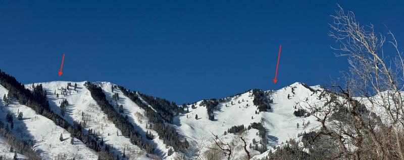
Photo of wind-drifted snow avalanches on northeast facing aspects near Provo Peak from the last storm that included wind-loading from southwest winds.
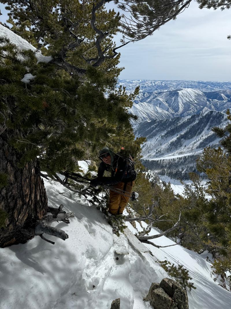
Moab Forecaster Dave Garcia checking out a tree while ascending the ridge. There is more than avalanches and scrub oak outside of Moab.
Today's Observed Danger Rating
Moderate
Tomorrows Estimated Danger Rating
Moderate
Coordinates