Observation Date
1/25/2024
Observer Name
Kelly, Miller
Region
Salt Lake » Big Cottonwood Canyon » Mill D North
Location Name or Route
Little Water
Comments
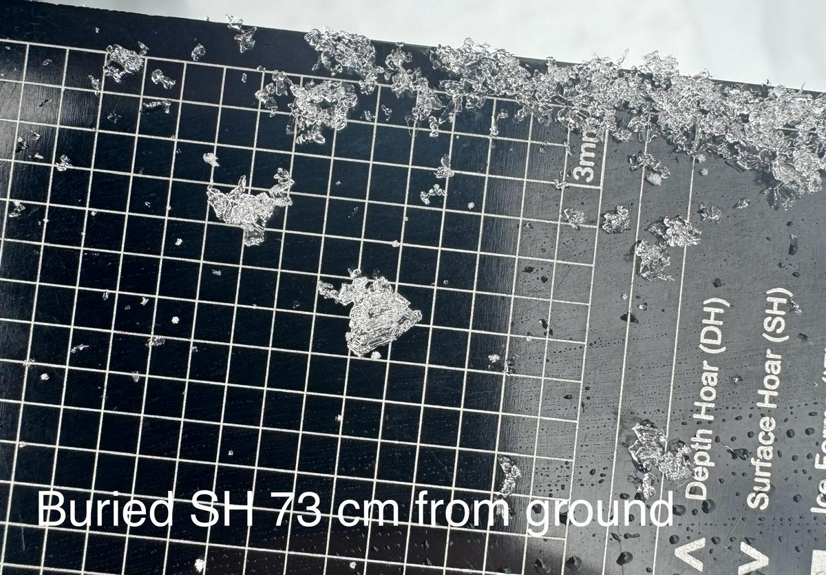
Photo of intact buried surface hoar 28" (73cm) from the ground. This isn't something we often see buried and preserved in the Central Wasatch so it is kind of cool to have it reactive in a snowpack. I would guess that it isn't widespread or found in areas that were more wind/storm affected prior to the newest snow.
Snowpit on a west facing aspect at 9300' elevation. Height of snow was 15" (40cm) and the weak layer was 8" (20cm) off the ground. ECTN18@20cm (no propagation). No slab over the weak layer, no connectivity on this slope. I would be more wary of locations that have a more connected thin snowpack with poor structure.


Above photo of dry facets under a melt freeze crust on a west facing slope at 9300'
Where we traveled today on terrain less than 30 ° slope angles we found LOW to MODERATE avalanche hazard. The structure is still poor in many locations. However we did not see or hear any collapsing or cracking in the snowpack. We observed no wind-loading and the storm did not really produce as forecasted. The snowpack structure is still poor and any additional weight may tip the scales in steeper terrain and because of this we chose to stick to lower angle slopes. The structure in steeper areas still shows weak dry facets underneath the newest snow and stability tests show that this layer is less responsive with stability tests. It's a long season and I am going to continue to give this layer more time to heal before venturing into steeper terrain.
Today's Observed Danger Rating
Moderate
Tomorrows Estimated Danger Rating
None
Coordinates


