Observation: Lake Peak

Observation Date
1/19/2024
Observer Name
Ian Dempsey
Region
Southwest » Tushers » Lake Peak
Location Name or Route
Tushars - Lake Peak
Weather
Sky
Scattered
Weather Comments
Cloudy weather cleared and became scattered clouds in the afternoon. Warm temps in the 30s and low 40s at 10,000 feet.
Snow Characteristics
Snow Surface Conditions
Powder
Dense Loose
Wind Crust
Damp
Red Flags
Red Flags
Cracking
Collapsing
Poor Snowpack Structure
Red Flags Comments
Conservative decision making is the name of the game as we have a 50 cm slab on top of 50 cm of sugary snow on many aspects. In the Tushars specifically, this poor structure is widespread and more common below treeline, as above treeline the wind scoured some areas to the ground and in others left a hard layer of sastrugi. In areas where our January snow fell over our old faceted snow from earlier in the season, you can punch through to the ground with a ski boot on. It's sometimes supportable with skis on and at other times collapses with a "whoomph". In general though, the new January snow has settled into more of a slab and travel has become easier relative to a week ago.
Avalanche Problem #1
Problem
Persistent Weak Layer
Trend
Same
Problem #1 Comments
Widespread cracking and collapsing in areas where our January snow fell on old sugary snow (i.e., areas that weren't heavily wind affected or bare ground prior to the new snow).
Snow Profile
Aspect
East
Elevation
10,800'
Slope Angle
25°
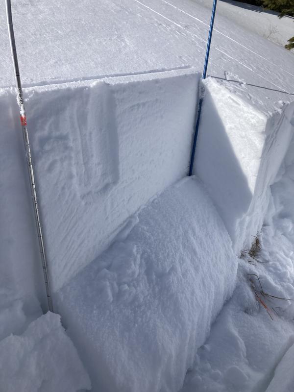
An image of my CT and ECT showing a smooth bed surface after the column was removed. While my snow profile included with this observation state my compression test had a sudden collapse (SC), in reviewing the pit more I believe it was actually a sudden planar (SP) fracture character (indicating a higher likelihood of crack propagation). In both the CT and ECT, the column of snow collapsed suddenly, and the column easily slid off with a light tug (indicating more snowpack instability in this test).
The snow turned somewhat "gloopy" once the sun came out as temps were already in the upper 30s.
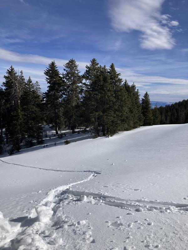
A lightly wind affected snow surface in the morning before the sun came out.
Today's Observed Danger Rating
High
Tomorrows Estimated Danger Rating
High
Coordinates