Fall Auction is now live! Check it out now

Observation: White Pine

Observation Date
1/6/2024
Observer Name
Kelly, Kazickas
Region
Salt Lake » Little Cottonwood Canyon » White Pine
Location Name or Route
White Pine
Weather
Sky
Few
Wind Direction
West
Wind Speed
Calm
Weather Comments
Cold temperatures in the mid-teens °F with calm winds until we got close to the 11,000' ridgelines around 11am when it picked up slightly, blowing from a westerly direction. Skies were mostly clear with some high thin clouds. No precipitation fell during the tour, and approximately 3-4" new low density snow fell overnight. We did not notice any wind-drifted snow, however there is snow available for transport should the winds increase.
Snow Characteristics
New Snow Depth
12"
New Snow Density
Low
Snow Surface Conditions
Powder
Faceted Loose
Melt-Freeze Crust
Snow Characteristics Comments
Snow surface was 10-12" of new low density snow on top of faceted loose or melt-freeze crusts. Lower angle northerly facing was good skiing. Solar aspects that we traveled on (west-southwest) had a melt-freeze crust under the new snow that varied in how thick it was. Some places (near trees and rocks) on north facing slopes had dry loose facets to the ground and there were a a few trapdoor moments near these obstacles.
Avalanche Problem #1
Problem
New Snow
Problem #1 Comments
We did not observe any current or previous wind-loaded terrain in locations where we traveled; elevations 7800'-11,000' and aspects (SW-W-N-E). The new snow was low density stellars and we didn't note any density changes within the new foot +/- of snow.
Photo of loose dry avalanches on northeast facing slope at 9800'
Avalanche Problem #2
Problem
Persistent Weak Layer
Problem #2 Comments
The PWL from the last few weeks of clear cold weather is present on north facing aspects. The new snow seemed to have bonded well to this layer in most locations and it took the additional weight of a rider to trigger long running dry-loose avalanches breaking into the weak faceted snow. In most locations this problem was isolated to steep terrain. Where it could be a problem is on longer, sustained steep slopes and we observed some areas where sluff management was useful to avoid being part of a loose dry avalanche that went deeper into the old faceted snow surface. I would not want to get caught up in one of these over a cliff band or run into rocks or trees.
Snow Profile
Aspect
Southwest
Elevation
10,500'
Slope Angle
35°
Comments
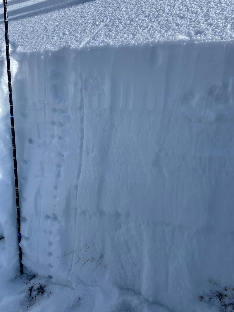
Going back through observations and snowpits on the UAC's new Data Explorer and on SnowPilot I couldn't find any snowpits on southwest facing aspects. When we at the UAC are forecasting a PWL problem we look for locations where the layer is located and whether it is reactive or not reactive by digging snowpits in various locations. We try to gather information on all aspects from all elevations below treeline, at treeline, and above treeline and these elevations roughly match the danger rose you see on our forecast.
This snowpit is only one data point and while it helps to start to make decisions about location and distribution of a weak layer it isn't enough for me to be able to say whether a layer such as the early season PWL is or isn't widespread. We still need more details, but it is a start.
Today's Observed Danger Rating
Moderate
Tomorrows Estimated Danger Rating
Moderate
Coordinates