Observation Date
12/7/2023
Observer Name
Staples, Pastrana, Kelly
Region
Ogden » Farmington Canyon » Bountiful Peak
Location Name or Route
Farmington Canyon-Farmington Lakes-Bountiful Peak
Weather
Sky
Scattered
Wind Direction
Southwest
Wind Speed
Moderate
Weather Comments
Winds were calm where we traveled. Some clouds built in over the highest ridgetops, but started to clear out at the end of the day. Winds in the basins were calm-light and moderate to strong on the ridgetops above Bountiful Peak blowing from the southwest.
Snow Characteristics
Snow Surface Conditions
Melt-Freeze Crust
Snow Characteristics Comments
Snow surface was primarily melt-freeze crust on solar aspects with a skiff of new snow. On northerly aspects the snow surface was softer and there was a thin crust with some radiation recrystallization crystals and new snow intermixed above it. The total snow depth varied from 1-3' depending on elevation. Lots of summer surface and wildflowers still sticking out of the snow. We saw some cool
settlement in the aspen trees. What was notable about this settlement was just how much it pulled away from the trunk of each tree. I don't see that often.
Avalanche Problem #1
Problem
Persistent Weak Layer
Trend
Same
Problem #1 Comments
The persistent weak layer is still intact near the ground. It seemed to be associated with crust that was starting to deteriorate in some locations. We dug on north (8070'), north (8390') and east (8590') and all aspects had similar structure. The lowest elevation snowpit (8070') we dug had moist facets near the ground. This could be attributed to lower elevation or perhaps the proximity to Farmington Lakes. The common theme was the facets associated with the crust within the lower 10-12" of the snowpack. Today it would be more difficult to trigger an avalanche on this layer of weak snow than it was earlier in the week. This means that you could get further onto the slope before it breaks or an avalanche could be triggered by the second, third, or even fourth rider on a slope.
Snow Profile
Aspect
North
Elevation
8,000'
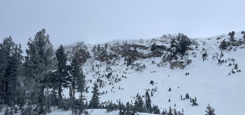
We observed some avalanche crowns on the north facing side of Bountiful Peak. This avalanche was hard to categorize because the bed surface and crown had been filled back in. It was tough to put a date stamp on it but it must have occurred sometime in the last five days.
Today's Observed Danger Rating
Moderate
Tomorrows Estimated Danger Rating
None
Coordinates