Observation: Guardsman Pass area

Observation Date
12/2/2023
Observer Name
Ambler
Region
Salt Lake » Big Cottonwood Canyon » Guardsman Pass area
Location Name or Route
Guardsman Pass Area
Weather
Sky
Overcast
Precipitation
Moderate Snowfall
Wind Speed
Calm
Weather Comments
Moderate snowfall for most of the morning waning off before noon. Winds were calm down off the ridges but members of another party reported stronger winds at ridgelines transporting snow. moderate winds with strong gusts from the west. Temperatures were mild and travel was pleasant below ridgelines.
Snow Characteristics
New Snow Depth
12"
New Snow Density
Low
Snow Surface Conditions
Powder
Snow Characteristics Comments
There is about a foot of new snow in the guardsman pass neighborhood. There are plenty of places where this is still not enough to cover all the hazards, just hide them. Travel in the woods is still challenging. We had trouble wiggling in the lowest angle meadows but the low to mid 20's were just enough pitch to enjoy the new snow.
Red Flags
Red Flags
Recent Avalanches
Heavy Snowfall
Wind Loading
Cracking
Collapsing
Poor Snowpack Structure
Red Flags Comments
If it was a little warmer maybe we could've checked every box. 6 red flags seemed like enough for now. We did not observe avalanches on our tour but members of another party saw an avalanche off the east side of 10420. We felt a few collapses, most notably the one pictured below with a shooting crack on a test slope on the road cut. There are multiple layers of persistent grains within the snowpack. Reports of wind loading. Heavy snowfall observed, 12 inches in 24 hours with more on the way.
Avalanche Problem #1
Problem
Persistent Weak Layer
Trend
Increasing Danger
Problem #1 Comments
In the lower realm of guardsman, seen in our hand pits and full pits, the most reaction we received was on a layer of buried surface hoar just below this storm. This was not found up higher by the party who ventured to the ridgelines.
Snow Profile
Aspect
West
Elevation
9,400'
Slope Angle
14°
Comments
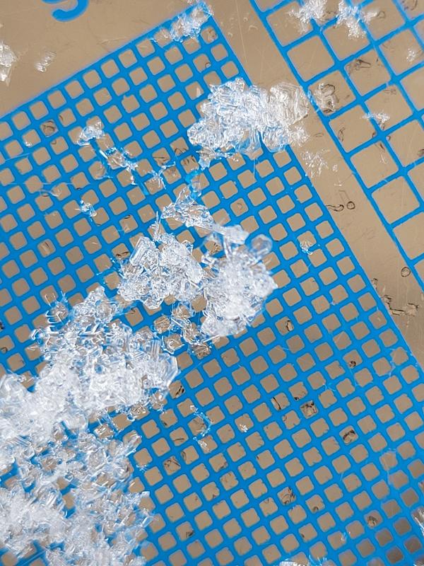
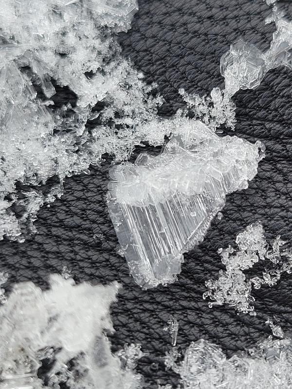
My main focus in this pit was the touchy buried surface hoar layer around 48 cm. I wasn't sure if it would have survived the time leading up to this storm. Our whole class (4 separate pits in a 50' by 50' area) found reaction on this layer from the wrist. However there was little propagation with our ect's. I imagine the overlying slab has yet to gain cohesion; very low density. However another group a couple hundred yards away had propagation from the wrist at this same layer. Below is a picture of the surface hoar in the pit, then one I took a few days prior to it's burial and the third photo is the surface hoar layer with my crystal card offering slightly better visualization, inserted behind a thin slice vertically.
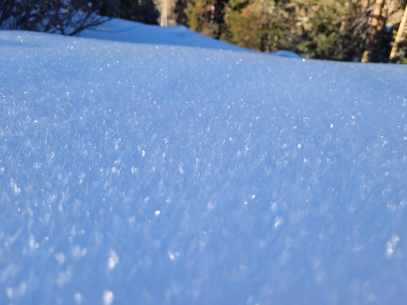
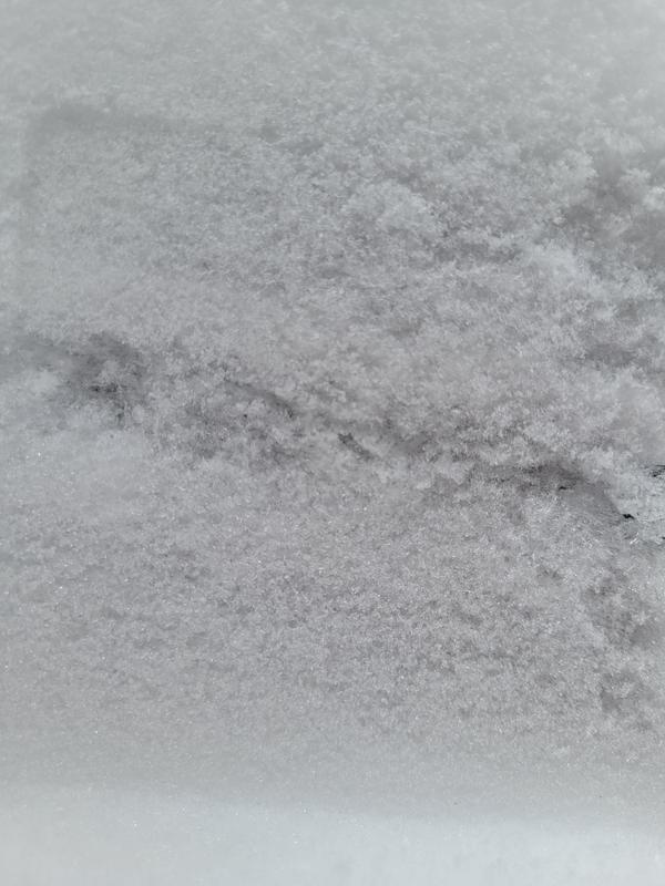
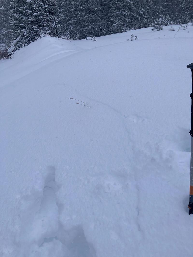
Below this is a photo of some of the larger surface hoar I found by the creek. The largest I spotted I estimated to be the size of a quarter which is apparently 24.26 mm across. Many were dime sized (17.91), and all the way down to measly 5 mm. However these seem to exist in more unique sheltered, isolated locations. But a larger concern of mine is the spotty sneaky mid elevation smaller grained surface hoar. Below that is a 15+ ish foot crack that shot out from Liam's feet early in the morning.
Today's Observed Danger Rating
None
Tomorrows Estimated Danger Rating
None
Coordinates