Observation: Days Fork

Observation Date
3/21/2023
Observer Name
L. Dunn
Region
Salt Lake » Big Cottonwood Canyon » Days Fork
Location Name or Route
LCC>Days Fork>Upper Days>Main Days
Weather
Sky
Few
Wind Direction
South
Wind Speed
Light
Weather Comments
The day started sunny and became overcast after about noon. The morning sun was enough to create a crust on the solar aspects after the overcast moved in and the snow surface was no longer being heated.
Snow Characteristics
New Snow Depth
12"
New Snow Density
High
Snow Surface Conditions
Powder
Melt-Freeze Crust
Snow Characteristics Comments
Compared to the snow we've been skiing this year, today's snow felt dense and a little slow to ski. It wasn't upside down or punchy, it just seemed slow. We were skiing between 9-10k elevation, it was cold snow on the northerly aspects, the 12 inches of uncut powder still billowed up to your thighs, but as a totally jaded Wasatch skier, it just wasn't as good as what we've been skiing most of this winter. The decent back to Alta on an Emma Ridge was a mix of dense powder and sun crust.
Red Flags
Red Flags
Recent Avalanches
Cracking
Red Flags Comments
The new snow was on the move. In some places it was sluffing, and others cracking and fracturing. The crown/crack depths were about 12", so it was just the new snow, it didn't step down.
Comments
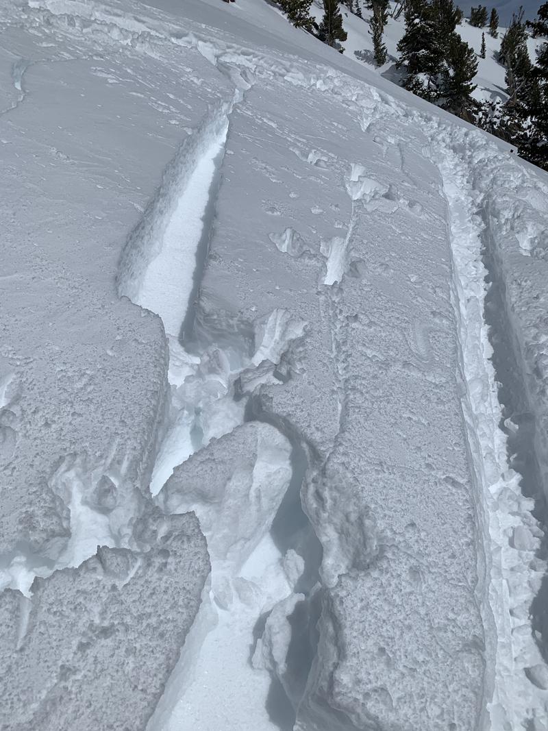
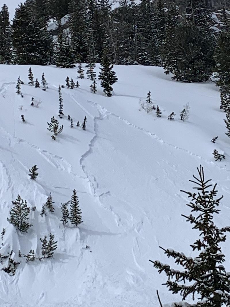
The first attached picture shows a crack caused by walking by on the skin track. The new snow separated completely from a melt freeze bed surface with a clean shear. The slope was southeast facing in Upper Days Fork. The second picture shows an avalanche on a steep east facing rollover near the bottom of Main Days. There were ski tracks nearby but this avalanche was remotely triggered. This and others like it had 12" crowns...all new snow failing to bond to the underlying surface.
Today's Observed Danger Rating
Moderate
Tomorrows Estimated Danger Rating
None