Observation: Rodeo Ridge

Observation Date
2/28/2023
Observer Name
Derek DeBruin, Dave Leydet
Region
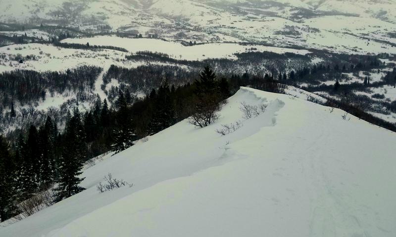
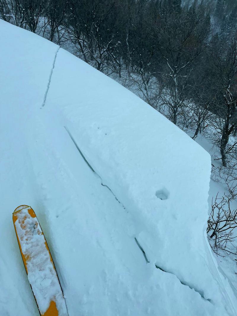
Ogden » Ben Lomond » Rodeo Ridge
Location Name or Route
Ben Lomond, Rodeo Ridge
Weather
Weather Comments
Winds were variable this morning, vacillating in both intensity and direction (everything from S-W-NE). By 11am cloud ceiling was up around 8000ft, but flat lighting made it difficult to identify potential avalanches. Snow this morning was S1-S2 until stopping around 10am.
Snow Characteristics
Snow Characteristics Comments
Picked up about 30cm of new snow since yesterday at the low elevations. Snow was a bit denser today, though still quite soft. Things were a bit more cohesive under foot and in test slopes, but more on the side of dry loose and less on the side of storm slab. Wind effects meant cross loaded gullies, corniced ridgelines, and firmer snow in windward locations.
Red Flags
Red Flags
Heavy Snowfall
Wind Loading
Red Flags Comments
Wind seemed to present the great hazard today than new snow on its own. Found 1F cornices on low elevation ridgelines that were under 1m tall, reactive, but not super sensitive. Similarly, found the occasional pocket of hollow wind slab, but at the low elevations we didn't note any cracking or collapsing with these.
Comments
Cornices today. Photo 1: DeBruin. Photo 2: Leydet.
Today's Observed Danger Rating
None
Tomorrows Estimated Danger Rating
None
Coordinates