Fall Auction is now live! Check it out now

Observation: Ben Lomond

Observation Date
2/20/2023
Observer Name
Derek DeBruin & Azissa Singh
Region
Ogden » Ben Lomond
Location Name or Route
Ogden, Ben Lomond and Mt. Ogden areas
Weather
Weather Comments
Overcast skies today, with the cloud ceiling somewhere around 9500ft or so, just obscuring the summit of Mt Ogden and nearby high points. Temps were warm at the trailhead, around freezing. Winds began out of the SW and shifted to more westerly my noon or so, with low elevation winds around 15-20mph and gusts to 35mph or so. Snow was available for transport and was actively being transported while we were out today. I watched plumes of snow work their way up and down Hell's Canyon and neighboring terrain consistently.
Snow Characteristics
Snow Characteristics Comments
Picked up an inch of new snow overnight near Snowbasin, on top of Saturday night's 3 inches. Wind rapidly turned the new snow into a 4F wind skin in many locations.
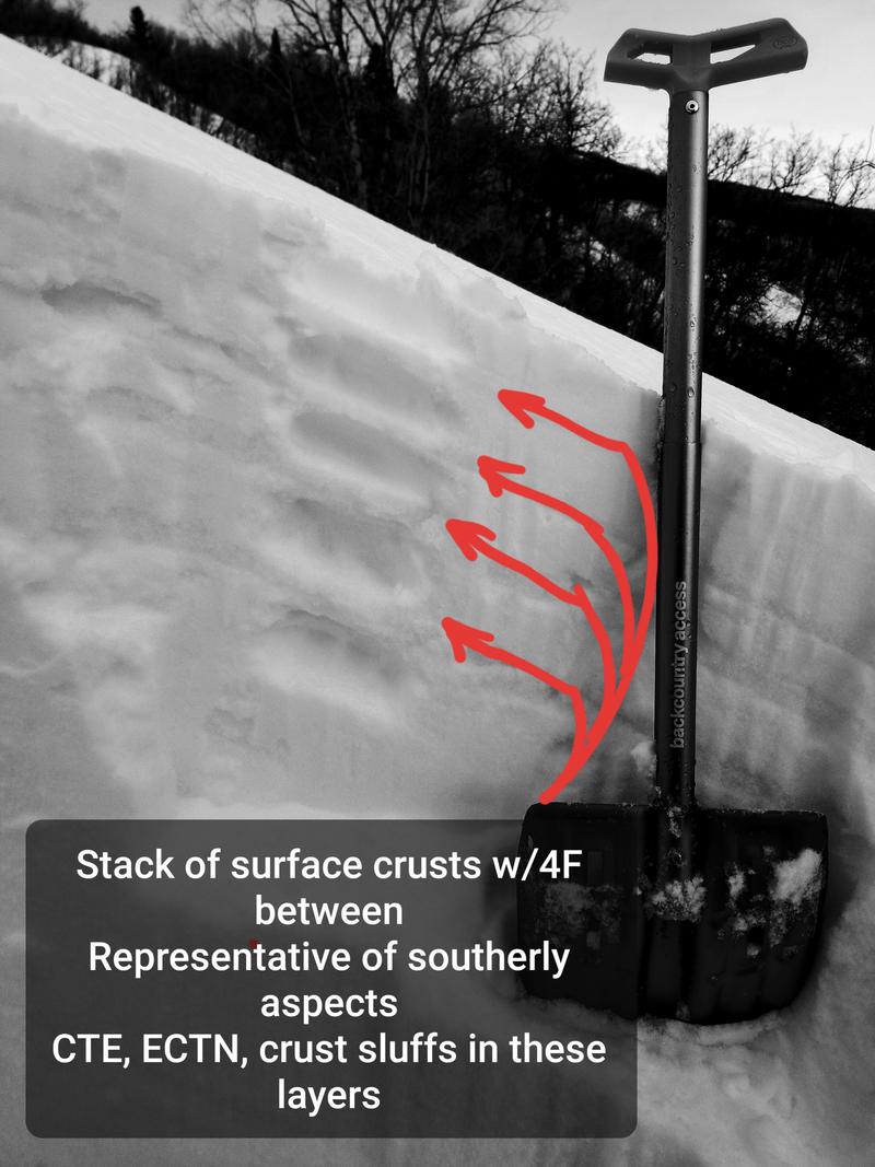
Clear skies continued to produce crusts on solar aspects over the weekend (Saturday to Monday, observed on Ben Lomond and Mt Ogden massifs), which persisted today. Crusts vary in supportability and thickness, with more melt (sun) and colder temps (higher elevation) leading to stouter crusts. Sandwiched between crusts is 4F snow, largely decomposing and mixed forms, no near-surface faceting to note despite looking a few times over the weekend. However, crust sluffing happened readily underfoot and we got CT results in the upper 15cm or so of the snowpack (example photo below of upper-pack solar aspect layering).
We found some preserved soft snow on northerly aspects between Saturday and Monday. However, much of this was wind affected, and only the most sheltered locations held preserved/recycled pow, with some surface faceting here and there. More or less across the compass, wind effects created potentially poor bonding between surface snow layers, which was a bit reactive underfoot, but without shooting cracks.
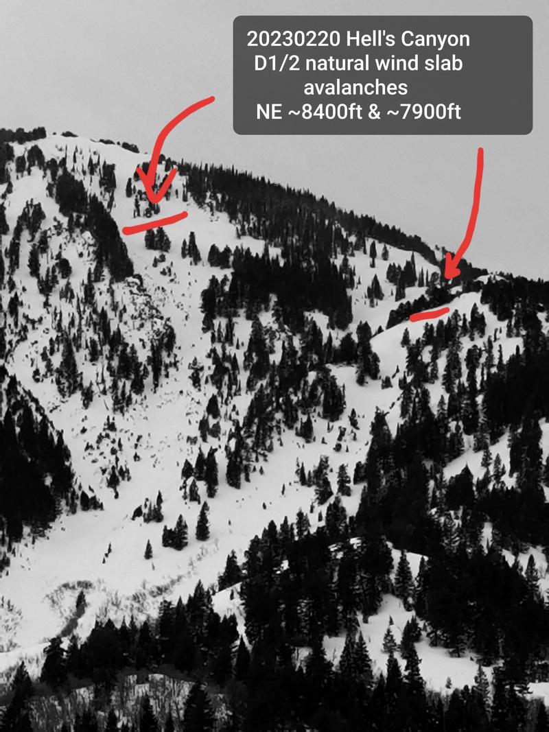
In exposed locations and ridgelines, wind slabs were about 1F to P hard, cornices were reasonably well developed, and we found some old cornice fall debris. This happened as low as 6800ft or so on Ben Lomond.
Red Flags
Red Flags Comments
Observed from a distance what seemed to be overnight natural avalanches in Hell's Canyon this morning, presumably wind slabs. A larger crown, perhaps 100ft across, was on a NE facing slope around 8400ft. Two smaller crowns, maybe 25ft or so, were on a NE aspect on nearby Rescue Ridge around 7900ft. These are noted in a photo below.
Comments
Natural wind slab avalanches in Hell's Canyon. Crowns are highlighted in red as photo quality was a bit grainy to really see the crowns well.
Representative layering on solar aspects with crust sandwiches.
Today's Observed Danger Rating
None
Tomorrows Estimated Danger Rating
None
Coordinates