Observation Date
2/14/2023
Observer Name
Garcia
Region
Moab » Gold Basin
Location Name or Route
Laurel Highway/Gold Basin
Weather
Sky
Obscured
Precipitation
Moderate Snowfall
Wind Direction
South
Wind Speed
Moderate
Weather Comments
S3 Snowfall stopped just before 3 PM. We even saw a brief window of blue sky. 5 inches fell today for a total of 9. I cleared 9 inches off the board during this break in the action around 3:15 PM.
Snow Characteristics
New Snow Depth
9"
New Snow Density
Low
Snow Surface Conditions
Powder
Snow Characteristics Comments
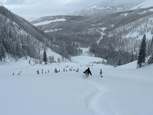
9 inches of cold smoke. You can really feel the bottom on all aspects because this snow is LOW density. Hard and slick surfaces existed around the compass before this storm. The new snow came in cold and light and it is not bonding well to the old surface. Too deep to qualify as dust on crust, but certainly felt like it at times. Best skiing was low elevation Northerlies that hadn't seen as much previous wind damage as upper elevation terrain.
Red Flags
Red Flags
Recent Avalanches
Wind Loading
Poor Snowpack Structure
Red Flags Comments
Recent avalanches: We observed natural dry loose avalanches in steep terrain in several areas. Sluffs were observed above Tele Gold, Snaggletooth Chutes, and the looker's right side of Upper Exxon's.
Wind Loading: Southerly winds were blowing and drifting snow above treeline and loading Northerly aspects.
Poor Snowpack Structure: Weak faceted snow formed in the upper part of the snowpack prior to this storm. Today I found facets beneath a thin wind crust on a North facing slope around 10,600 ft.
Avalanche Problem #1
Problem
Wind Drifted Snow
Trend
Increasing Danger
Problem #1 Comments
9 inches of low density snow available for transport and winds are forecast to blow in the moderate range tonight. I walked across the top of Coyote Chute around noon and a slab had not formed yet on that particular slope. But we observed blowing and drifting snow loading Northerly aspects above treeline. My main concern is wind drifts above weak, faceted snow that formed in the surface of the snowpack prior to this storm. This could be a recipe for easily triggered wind slabs on leeward slopes. More on these facets below.
Avalanche Problem #2
Problem
New Snow
Trend
Increasing Danger
Problem #2 Comments
It will take more snow tonight to make new snow avalanches a real concern tomorrow. We skied the Funnel and did not trigger any sluffs. We observed natural dry loose avalanches in steep terrain. The new snow is not bonding well to the old surface and loose snow sluffs and storm slab avalanches could be a problem on Wednesday.
A dry loose avalanche that ran naturally out of the steep chutes above Tele Gold.
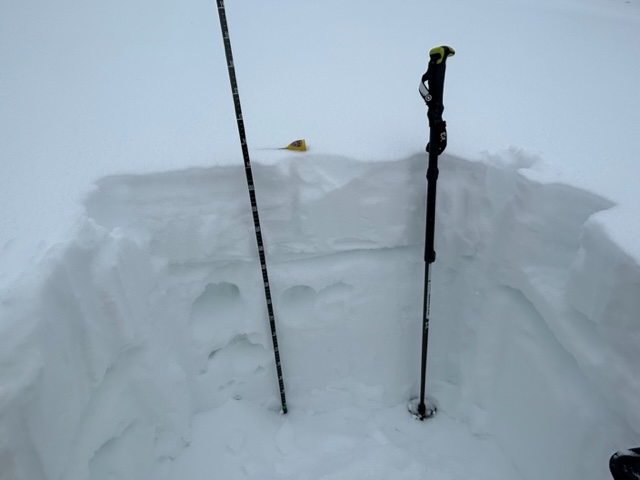
Snow Profile
Aspect
North
Elevation
10,600'
Slope Angle
21°
Comments
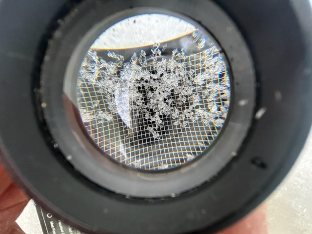
This snow pit shows weak, faceted snow in the upper part of the pack. These faceted grains are 1mm in size, they were found beneath a thin wind crust. These near surface facets will become problematic with a slab on top, like on slopes that are currently being wind loaded.
The faceted layer is down about 23 cm.
Today's Observed Danger Rating
Moderate
Tomorrows Estimated Danger Rating
Moderate
Coordinates