Observation: Moab

Observation Date
1/28/2023
Observer Name
Tim Matthews, Mark Sevenoff, Brian Sparks.
Region
Moab
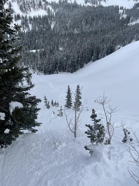
Location Name or Route
Laurel Highway, Funnel, Tele Gold, Tele Heaven.
Weather
Sky
Overcast
Precipitation
Light Snowfall
Wind Direction
Southwest
Wind Speed
Light
Weather Comments
The morning started with overcast skies and light snowfall. Snowfall at times was moderate, but was short lived and by the early afternoon had shut off, and made way for clearing skies. Yesterday's lower cloud deck deposited a thin coating of rime on west facing trees and surfaces near and above treeline, but didn't seem to affect the snows surface and skiing remains good. Winds remained light in the terrain we traveled in today and only a couple times did I note any saltation of snow on the surface.
Snow Characteristics
Snow Surface Conditions
Powder
Wind Crust
Snow Characteristics Comments
The settled powder is still skiing rather nice. I'd rate it at 3.5 out of 5 stars in sheltered terrain out of the reach of winds. In terrain above tree line there's a thin breakable wind crust on the windward aspects. Which didn't take very much descending to get out of, and back to the settled powder.
Red Flags
Red Flags
Wind Loading
Poor Snowpack Structure
Red Flags Comments
Although not observed by our touring party the wind speeds at and above the Pre-Laurel Peak wind station were blowing hard enough to transport snow from the windward aspects to the lee aspects.The PWL problem is becoming more and more unlikely to trigger, but the structure remains poor, and there is strong over weak structure in our snowpack. It's a matter of finding the shallow spot on the slope, or an area with an overall shallower snowpack which puts the PWL a lot closer to a potential trigger. Thin rocky out croppings, slopes that have already avalanched and now have another slab on top, and extreme terrain is what I am looking to avoid. I had my probe out a few times today and measured 280cm of snow in areas and 170cm in other areas.
Avalanche Problem #1
Problem
Wind Drifted Snow
Trend
Same
Problem #1 Comments
Above treeline today we were able to isolate a few shallow wind slabs and got them to fail with light to moderate force. We planned our entire day around not skiing areas that had loaded, or were actively loading, and it was pretty easy to avoid this problem. The short time we were ATL we did not note any loading snow. The winds just weren't strong enough where we were at the time. After reviewing the winds speeds from the Pre-Laurel Peak wind station for the day they were barely gusting strong enough to actively load slopes. Wind speeds of 17-25 mph account for 80% of leeward deposition. Winds could have been loading more snow up on the high peaks this morning. As long range visibility improved throughout the day I never noticed any blowing plumes of snow off the high ridges.
Avalanche Problem #2
Problem
Persistent Weak Layer
Trend
Same
Problem #2 Comments
Low probability high consequence set up. Stick to deep areas and away from rocks in steep terrain facing NW-N-E near treeline and above, or avoid the problem all together and stick to slopes less than 30 degrees in steepness and not connected to steeper slopes above, or ski south facing runs. We made sure and had a discussion about steering clear of the rocks at the top of Tele Gold today. No need to poke the dragon, so we skied a little less vert.
Comments
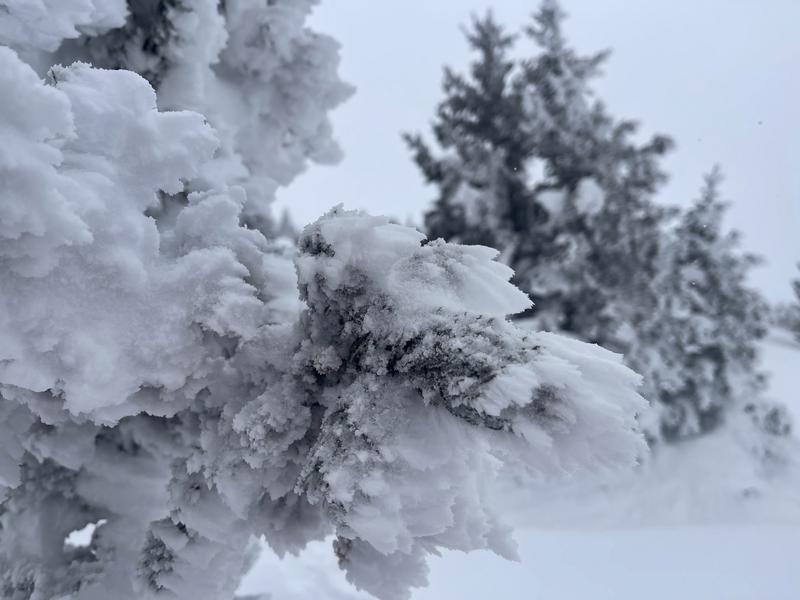
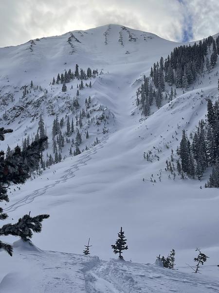
Rimed Trees from SW winds from 01/27/23, and areas of deep snow like this are ideal.
The Funnel.
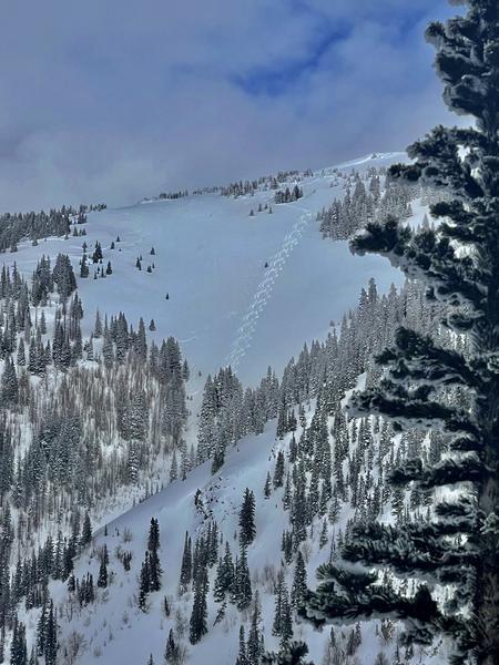
Tele Gold, and the legend Sevy.
Video
Tele Heaven.
Today's Observed Danger Rating
Moderate
Tomorrows Estimated Danger Rating
Moderate
Coordinates