Observation Date
1/10/2023
Region
Salt Lake » Little Cottonwood Canyon » Red Pine
Location Name or Route
Red Pine, Maybird
Weather
Sky
Overcast
Precipitation
Light Snowfall
Wind Direction
Southwest
Wind Speed
Moderate
Weather Comments
NWS did well forecsting the storm. Higher PI rates (S1-S2) in the am and also in PM (S2-short periods of S5), with longer lulls during mid-day. Same with the winds, light-moderate, with some strong gusts around 13:00-15:00. OVC-X skies, with what looked like a small sun break towards the upper LCC around 9:00
Snow Characteristics
New Snow Density
High
Snow Surface Conditions
Powder
Dense Loose
Damp
Snow Characteristics Comments
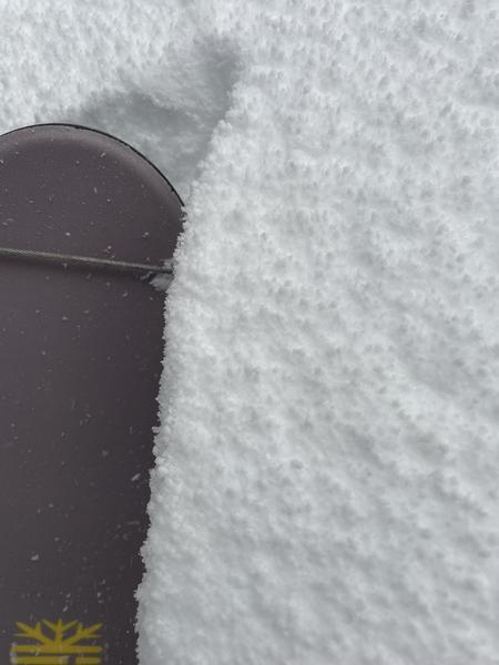
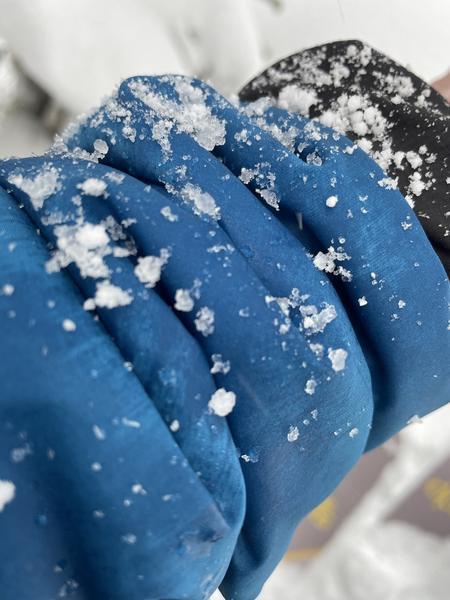
Traveled between 7,650'/White Pine TH up to about 9,600'. White pine TH was close to the snow/rain line in the morning and afternoon. Much of the precip was PPgp, with higher PI in the PM hours w/ increased gusty winds. The upside-down storm produced some of the most energy-intensive trail-breaking today (although shin-deep/limited ski pen, much more effort than some of the thigh-hip-deep days the last few weeks). Boot pen was rather deep vs the shallow ski pen. Was seeing about 4" of dense snow over lighter-density snow.
Red Flags
Red Flags
Heavy Snowfall
Wind Loading
Cracking
Collapsing
Rapid Warming
Poor Snowpack Structure
Red Flags Comments
Periods of S5/rapid loading w/ GP produced conditions for natural sluffing of the PPgp on steeper slopes. Lots of wind and moving snow, although not a ton of AST due to the denser snow. Crackig within the new snow and quiet subtle collapses, which I assumed were the thick slab on top of the lighter density powder (not PWL collapses). Lower down the canyon, the rain was producing loose avalanches. Although the upside-down snow had me suspecting new snow instabilities, even out of the wind zone, many quick hand-shear tests showed decent bonding and moderately resistant breaks within the fresh snow. Unable to initiate the storm slab out of the wind zone <35* slopes. I didn't find the opportunity or desire to test steeper slopes while out.
Avalanche Problem #1
Problem
New Snow
Trend
Decreasing Danger
Problem #1 Comments
Appeared to need >35* slopes to initiate avalanches, except for the DL graupel.
Avalanche Problem #2
Problem
Wind Drifted Snow
Problem #2 Comments
I avoided getting into the wind zone purposely today. However, very protected areas around 9,400' still had strong gusts around 14:00, leading to the assumption that wind slabs were forming on all aspects mid and upper elevations. The dense snow surface limited the AST, shallow ski and pen, deep boot pen.
Comments
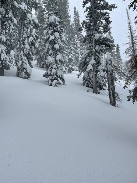
The snowpack is getting quite deep. ~200cm deep around 9,000' in very protected trees. Trees, bridges and summer trails are becoming buried and unrecognizable in places. Very northwest-esque looking out there.
Photos of the PPgp and the deep snow/snow-caked and buried trees.
Today's Observed Danger Rating
None
Tomorrows Estimated Danger Rating
None
Coordinates