
Observation Date
12/26/2022
Observer Name
Champion
Region
Salt Lake » Park City Ridgeline » Monitors
Location Name or Route
Willow Knob - Monitors
Comments
Headed out for a quick tour up Willow Knob to the Park City Ridgeline, and to the Monitors. Given the warm temperatures, and rather high rain/snowline over the last few days I was pleasantly surprised with both the skiing and the travel. An inch or so of fresh snow fell in the upper cottonwoods early this morning and provided good traction on the skin track. Along the Park City ridgeline, there was large rime formed and texture from days of wind on the snow surface. Cornices are continuing to grow along ridgelines.
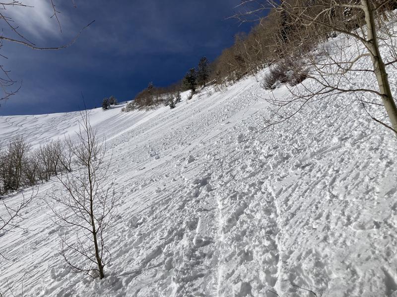
On South Monitor, the snow surface had remained generally cold, and was skiing overall well into the early afternoon. It the morning it skied as settled, dense powder, and didn't begin to get damp until 1 or 2 PM. As the sun began to come out solar aspects began warming up, and widespread wet loose avalanches began occurring. We dug a pit on a Northeast aspect at 9300', and we found 4F and 1F wind-broken particles and faceting rounds sitting atop the weak faceted snow on the bottom half of the snowpack. Even with the weak faceted snow on the ground, we were unable to get any propagation within our pit. It seems to match the general trend of the upper cottonwoods, the weak faceted snow is trending in the right direction and the likelihood of triggering an avalanche on this layer seems to be consistently decreasing, but we are going to be adding a large stressor in the form of snow and water in the coming days. This could bring this layer back to life during the storm, but overall this layer seems to be trending in the right direction within the upper cottonwoods.
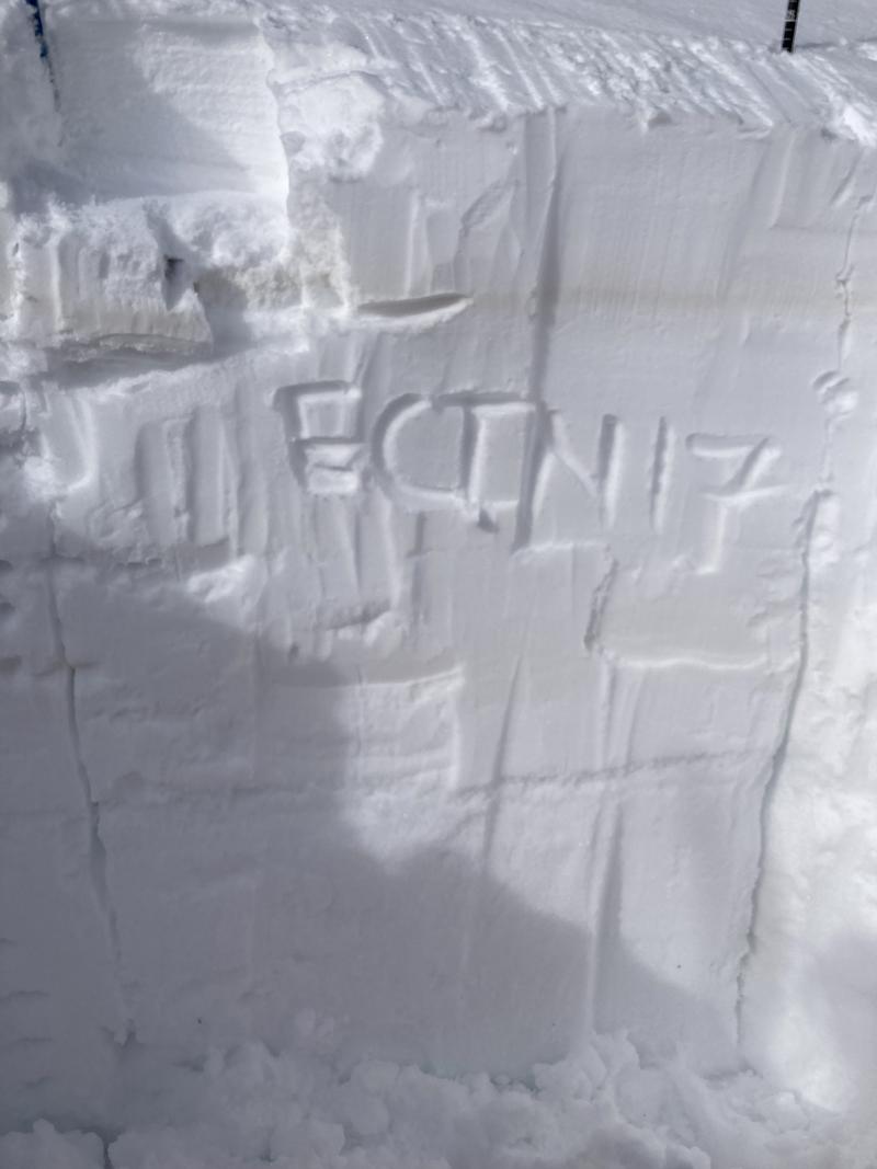
Pit profile on a NE aspect at 9300'.
Wet loose activity on solar aspects in the afternoon.
Today's Observed Danger Rating
Moderate
Tomorrows Estimated Danger Rating
Moderate
Coordinates


