Pretty much the only avalanche problem. The persistent weak layer of facets is very easy to find. When digging a snowpit, you can easil feel the weak layer with your shovel, and you can easily see it with your eyes. It does seem to be gaining some hardness.
We dug in three locations:
NW facing, 8100 ft, ECTN
N facing, 7600 ft, ECTP 24
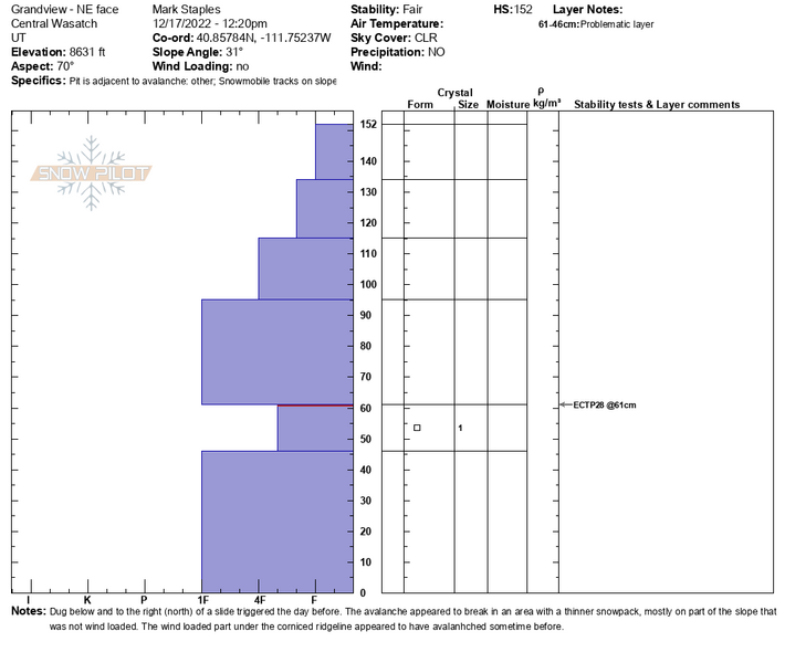
ENE facing, 8600 ft, ECTP28
We couldn't find any small slope that would collapse or crack. This area seems to mirror the upper cottonwoods sometimes and many extended columne tests continue to propagate on 20+ taps. However, other places at mid and low elevations continue to produce ECTP's with very low numbers.
As the sensitivity of this avalanche problem decreases (aka the likelihood of triggering a slide on the PWL), it is doing so at different rates in different areas and different slopes.
Below is a profile dug below and to the north of the
Grandview avalanche triggered yesterday on this layer.