Observation Date
12/15/2022
Observer Name
Derek DeBruin
Region
Ogden » Snowbasin Backcountry
Location Name or Route
Snowbasin periphery
Weather
Weather Comments
22F at the trailhead (6300ft) around 2pm, but felt more like upper teens once up the slope just a bit. Partly cloudy, shifting skies, with no new precip this afternoon. Light wind out of the W/NW; no snow transport observed, including overhead at ridgelines around 7500ft.
Red Flags
Red Flags
Recent Avalanches
Heavy Snowfall
Cracking
Collapsing
Poor Snowpack Structure
Red Flags Comments
Saw 3 small natural sluffs from presumably earlier in the day. The conifers were laden with enough snow that they began dropping large amounts today, and it appears that a few of these were sufficient to cause small point release avalanches in steep E and NE terrain some time before I arrived. Slope angle estimated at 40 degrees, ca 7300-7400ft, running in the new snow for 20-30ft perhaps 6" deep. Did not get close enough to actually check or get good photos of these because it was obvious avalanche terrain.
Snowpack initially seemed much less touchy than my recent forays on Cutler Ridge. Very easy shears in hand pits, but beyond that, no real cracking/collapsing on SE-E-NE test slopes below 6800ft. Didn't seem like there was enough snow on the ground before this storm system. A tiny bit of basal depth hoar here and there and a few inches of crusty junk. Above that was 1F to F right side up snow.
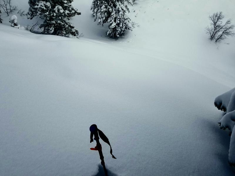
HOWEVER, above 6800ft it seemed like someone flipped the switch to the "unstable" setting. Had localized collapsing/cracking at my skis on E and SE zones. More frequent and a bit longer cracks (1m past ski tips) on NE and N terrain. Also had a somewhat puckering large collapse on a 28deg NE slope at 6900ft. Felt and heard the whumpf reverberating in waves down the entire slope, an area of approx 25ft across by 50ft down.
Comments
Photo of the slope that collapsed. Snow depths from 6800 to 7300ft elevation ranged from 120-150cm. About 20-30cm of basal facets began to appear beneath otherwise right side up snow, explaining the difference in stability compared to just a few hundred feet lower.
Today's Observed Danger Rating
None
Tomorrows Estimated Danger Rating
None
Coordinates


