Observation Date
12/10/2022
Observer Name
Ted Scroggin
Region
Uintas » Gold Hill
Location Name or Route
Gold Hill
Weather
Sky
Obscured
Wind Direction
Southwest
Wind Speed
Moderate
Weather Comments
Partly cloudy this morning with a few hours of sun, but clouds and gusty southwest winds increased by mid morning.
Snow Characteristics
Snow Surface Conditions
Powder
Wind Crust
Snow Characteristics Comments
Maybe a trace to a couple inches overnight and the snow conditions are quite good with mostly supportable snow. I did find a couple stumps while riding in and out of Gold Hill today, but no sled damage.
Red Flags
Red Flags
Wind Loading
Cracking
Collapsing
Poor Snowpack Structure
Red Flags Comments
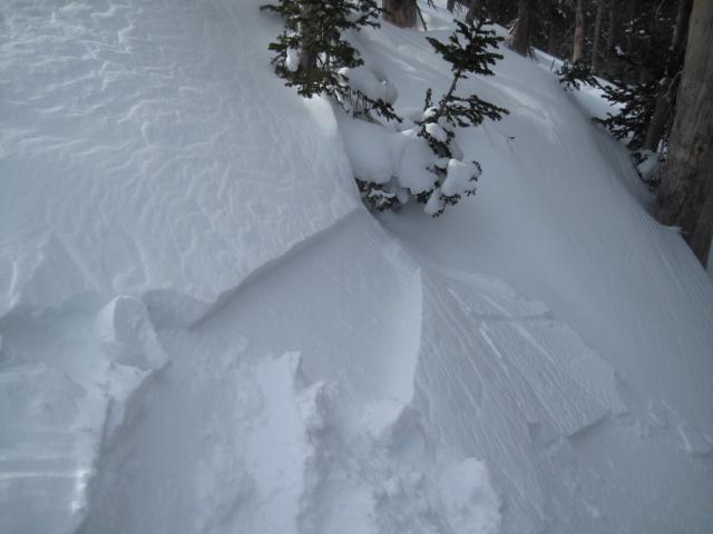
Strong southwest winds blew all day and I could see the plumes of snow off the high peaks on the drive to the forest this morning. A few collapses of the buried weak layer while moving around and some cracking of fresh wind drifted snow along the exposed ridge lines. It felt like a day of changing avalanche conditions.
Avalanche Problem #1
Problem
Persistent Weak Layer
Trend
Increasing Danger
Problem #1 Comments
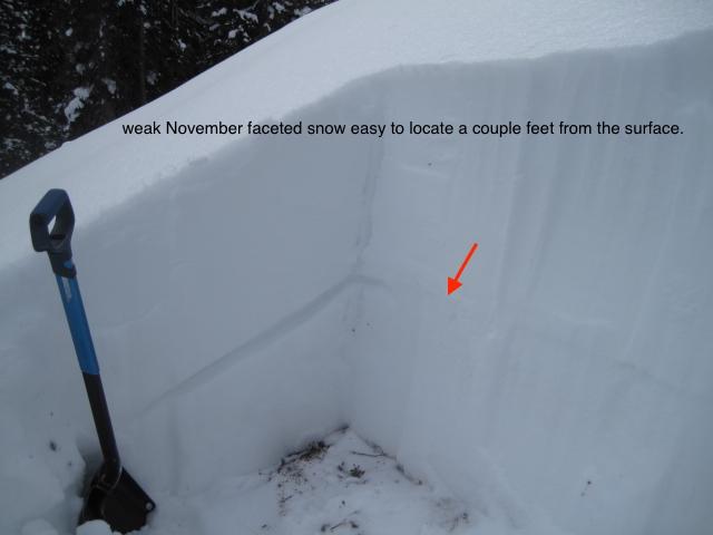
The buried persistent weak layer is still quite easy to locate on most of the aspects I traveled on today. In the Gold Hill Basin it is down about a foot and a half from the snow surface and this layer consistently propagates a crack across an isolated column of snow which is a great clue to unstable snow. This weak layer could get quite active with new snow, strong winds and some water weight.
Avalanche Problem #2
Problem
Wind Drifted Snow
Trend
Increasing Danger
Problem #2 Comments
Moderately strong southwest winds had no problem finding snow to blow around and create fresh wind drifts. I was finding these wind drifts to be shallow this afternoon, but will increase in depth and size as the storm develops tomorrow.
Comments
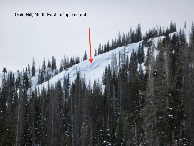
As I rolled into Gold Hill this morning I noticed this natural avalanche from a few days ago. This slope will get wind loaded from a southerly direction and the rocky terrain probably had some really weak and shallow snow that got overloaded.
The weather forecasted the next few days could really stress the persistent weak layer with strong winds, deep snow and some water weight. I would sure think the area could go through a decent natural avalanche cycle.
A few shallow sensitive wind drifts starting to develop with the gusty south winds.
Today's Observed Danger Rating
Considerable
Tomorrows Estimated Danger Rating
Considerable
Coordinates