Observation: Willows

Observation Date
12/1/2022
Observer Name
John Lemnotis
Region
Salt Lake » Big Cottonwood Canyon » Willows
Location Name or Route
Willow fork
Weather
Sky
Overcast
Wind Direction
Southwest
Wind Speed
Strong
Weather Comments
The forecast was correct, it was all about the wind today! Steady strong winds from the SW, mostly, with gusts to extreme. The sky was obscured over the cottonwoods while you could still see blue towards the valley and the Oquirrah's.
Snow Characteristics
Snow Surface Conditions
Powder
Dense Loose
Wind Crust
Snow Characteristics Comments
Soft snow could still be found in the most protected terrain today, although there was a LOT of wind affected snow. Anything that was even mildly exposed to the wind had a harder snow surface. Skiing and riding through trees was variable, some turns were great while others were firm from the strong SW winds. Exposed terrain consisted of supportable wind crusts, sastrugi, and developing wind slabs. Snow started falling during our exit from the willows around 1515.
Red Flags
Red Flags
Recent Avalanches
Wind Loading
Poor Snowpack Structure
Red Flags Comments
The wind has been the obvious offender over the last couple days. Cornices and wind slabs have been sensitive, displaying shooting cracks or failure from a distance (cornices). The new snow and wind drifted snow is sitting on top of NSF on NW-N-E facing slopes. This is where our poor structure comes into play. Wind has created strong snow (wind slabs) over weak snow (NSF). Again, we are about to add some storm snow as well, caution is certainly warranted moving forward.
Avalanche Problem #1
Problem
Wind Drifted Snow
Trend
Same
Problem #1 Comments
You don't need to be a weather person to know which way the wind blow... It was blowing hard the last 2 days. Cornices are forming and are sensitive and wind slabs are abundant. Cross loading is occuring on slopes that arent directly affected by the SW winds and wind slabs are stout N-E facing ridges. Today we noted cracking in wind affected snow and sensitive cornices, picture below of the W monitor zone where a relatively small cornice collapsed upon approaching the ridge. With the winds forecasted to be downright brutal overnight this problem will not go away.
Avalanche Problem #2
Problem
Persistent Weak Layer
Trend
Increasing Danger
Problem #2 Comments
If there were any deniers out there I will be someone to say that we will have a PWL for some amount of time. The snow surface that was buried on 11/29 was indeed faceted and now we will have significant wind loading as well as storm snow to start to determine how weak it is. The previous storm didn't overwhelm the layer too much but we are about the add water weight and that can change the game. We dug a pit today and found the following results; WNW slope 20 degrees 9700' CTM down 30cm on 1mm fc ECTPE down 30 on 1mm fc
Comments
Below
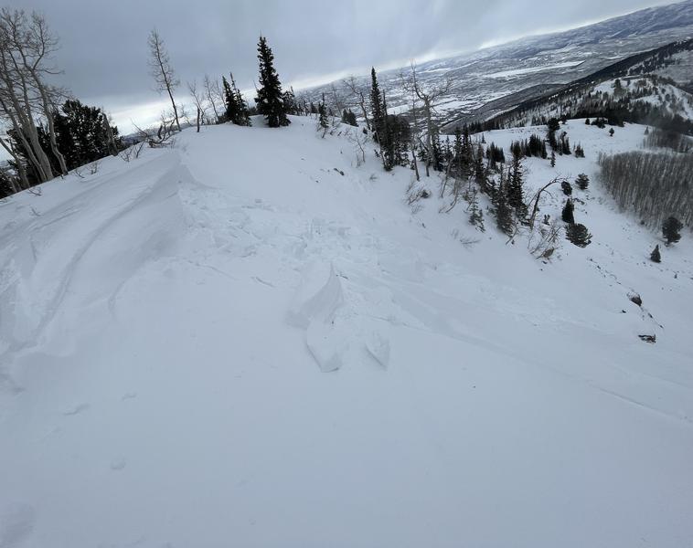
P1- cornice collapse upon approach, W Monitor ridgeline
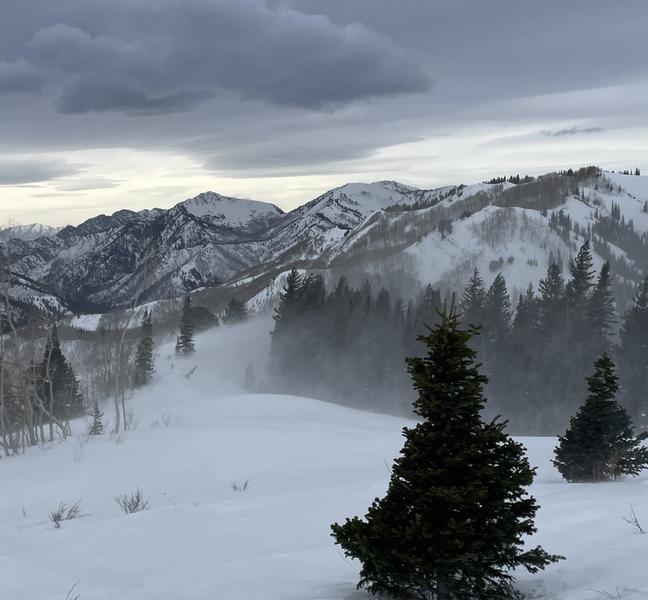
P2- Wind transport that was the norm all afternoon
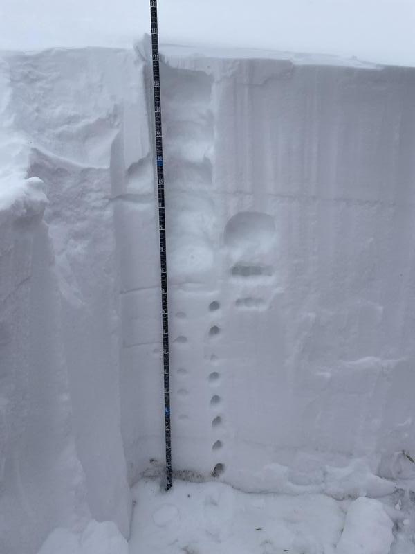
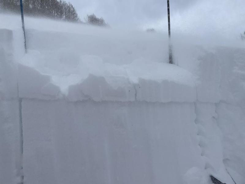
p3- snow profile WNW 20 degree slope 9700'
p4- ECTPE down 30cm on 1mm fc
Today's Observed Danger Rating
None
Tomorrows Estimated Danger Rating
None
Coordinates