
Observation Date
11/13/2022
Observer Name
M Talty
Region
Salt Lake » Big Cottonwood Canyon » Mineral Fork
Location Name or Route
Mineral Fork
Comments
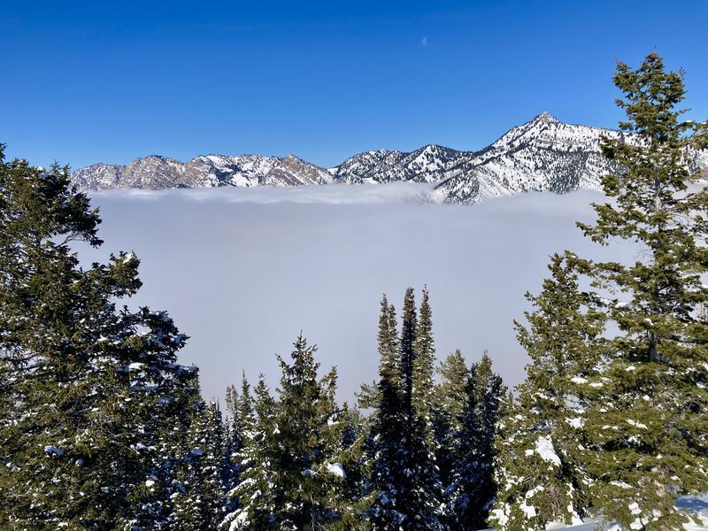
A beautiful day in the Wasatch above the clouds. Went for a tour up Mineral Fork to search for rain crusts below the new snow that may have formed at the start of the 11/08 storm. Clear skies this morning were pushed out by clouds moving up the valley at 11:00 AM. Cloud level was capped at 8500', with clear sunny skies blessing mid and upper elevation terrain. Hasty pits below 8400' showed a stout rain crust (4cm thick, P hardness) below the new snow. I stopped for a full snowpit profile on a N facing slope at 8700', when pole probes indicated the crust was not as hard. At this location, I found a 5cm 1F layer of clustered rounded grains beneath the 50cm of new snow. No evidence of faceting or shenanigans above and below this layer at this point in time. This layer was an excellent barrier and prevented any test results at lower depths. A compression test resulted in CT15 (PC) at 84cm above the ground within the new snow, and an extended column resulted in ECTX.
Riding conditions were excellent above 8500', it felt as if there was a big sponge beneath the new snow. Solar aspects held a zipper crust, and slopes below 8000' are rideable yet thin. I did not see any SH, NSF, or faceting within the new snow, however, with a full week of cold clear nights in the forecast I expect that to change.
Today's Observed Danger Rating
Low
Tomorrows Estimated Danger Rating
Low
Coordinates


