Observation: White Pine

Observation Date
4/24/2022
Observer Name
Bruce Tremper
Region
Salt Lake » Little Cottonwood Canyon » White Pine
Location Name or Route
White Pine
Weather
Sky
Scattered
Wind Direction
West
Wind Speed
Light
Weather Comments
Sunny in the morning with increasing clouds in and around the mountains due to daytime heating of moist, unstable air. The scattered to broken, low clouds provided lots of greenhouse warming of the snow on all aspects.
Snow Characteristics
New Snow Depth
12"
New Snow Density
Medium
Snow Surface Conditions
Powder
Snow Characteristics Comments
Snow was quite good in the morning with about a foot of new powder but the strong, spring sun combined with broken clouds among the mountains provided greenhouse warming that quickly made the snow manky and moist by about 1:00 pm. Gotta get it quick in the spring. The snow got noticeably denser and damper with each run and we called it quits around 1:00 pm when it was quite manky even on steep, northerly slopes at 10,000'. The lower elevations were quite wet by afternoon.
Red Flags
Red Flags
Heavy Snowfall
Wind Loading
Red Flags Comments
The new snow seemed to be well behaved and staying in place on all the slopes I could see in White Pine. The trailhead was extremely crowded with lots of vehicles filling the parking lot and parked on the road. But as usual with the White Pine trailhead, it's the access point for a huge area and we found that people spread out quite well and we were even breaking trail to popular areas. Skiers and boarders were really getting after it on all the popular runs, even the steep and committing lines such as Red Baldy, Lake Peak, Birthday Chutes, Tri Chutes, etc. No one was triggering avalanches but just a few small stuffs within the new snow. By the afternoon there was quite a few point-release stuffs from heating on all the steep, sun exposed slopes. I could see lots of signs of previous wind loading along the high ridges and peaks but none in other areas but no one triggering slabs in those areas that I could see. I would call the hazard moderate because of the new snow and some wind loading in wind exposed terrain, plus some sluffs from heating. By tomorrow I would guess it will have settled out considerably.
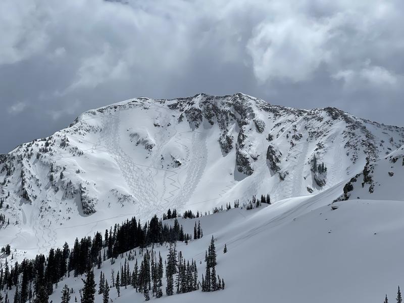
Photo of Red Baldy with lots of tracks and no avalanches that I could see. Ditto on Lake Peak, Tri Chutes and Birthday Chutes.
Today's Observed Danger Rating
Moderate
Tomorrows Estimated Danger Rating
None