Observation: Big Springs

Observation Date
4/6/2022
Observer Name
Hardesty and Coyne
Region
Provo » Provo Canyon » South Fork Provo R. » Big Springs
Location Name or Route
Big Springs
Weather
Sky
Clear
Wind Direction
Northwest
Wind Speed
Moderate
Weather Comments
Glorious
Snow Characteristics
New Snow Depth
3"
New Snow Density
High
Snow Surface Conditions
Powder
Melt-Freeze Crust
Rain-Rime Crust
Snow Characteristics Comments
Three inches of new snow; high density: well rimed, graupel with another inch or two on top. Winds have had their way with this and alternately scoured and drifted the new snow in the open terrain.
Red Flags
Red Flags
Wind Loading
Poor Snowpack Structure
Red Flags Comments
The unceasing NW winds over the past 24 hours probably have led to some isolated wind slab development. Poor but improving snowpack structure, see below -
Avalanche Problem #1
Problem
Persistent Weak Layer
Trend
Decreasing Danger
Problem #1 Comments
Went to look for the drought layer facets on north facing terrain.
On Saturday, Bo Torrey found these facets in Big Springs buried 80cm at 9200' (possibly wind drifted area) on a northeast facing slope.
"Found the weak layer gaining strength but still propagating. Some moisture in the layer but not totally solid yet. Ectp’s in mid 20’s."

Today, on a north facing slope at 9300', we found these facets buried 45cm. Dry. HS of 200cm.
Tests yielded ECTX x 2 and PST 90/100 (End) and PST 40/100 SF. Facets were 2mm, rounding with a hand hardness of 4F+.
Photo shows blue line of this interface. The top 25cm includes a couple layers of graupel, a couple dust wind events, and rounding nsf from last week.
* Some uncertainty still exists with this layering, particularly in the higher elevations. Caution and analysis is recommended in the high north country of the Provo mountains.
Comments
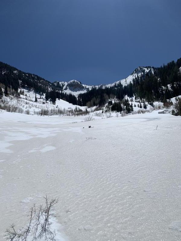
1 -Access - We walked an hour before putting on skis. Photo of 'variable-at-best' conditions.
2 - Evidence of likely cornice triggered pocket on NE facing slope probably from last week.
Today's Observed Danger Rating
None
Tomorrows Estimated Danger Rating
None