Join us at our 2nd Annual Blizzard Ball

Observation: Moab

Observation Date
3/6/2022
Observer Name
Tim Matthews
Region
Moab
Location Name or Route
Laurel Highway, Julie's, The Funnel, Gold Miners.
Weather
Sky
Overcast
Precipitation
Moderate Snowfall
Wind Direction
Northwest
Wind Speed
Calm
Weather Comments
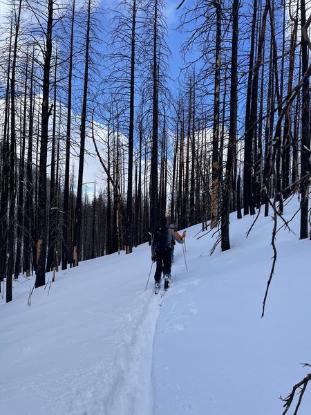
Overcast skies with light (S1) snowfall rates leaving the TH at 10:00am. As we gained elevation the snowfall rates bumped up to moderate (S2) before dying off around 12:25 in the afternoon. Skies went from overcast in the morning to scattered by around 2:00pm. Calm winds remained until we were well above treeline where they bumped up to light. NW winds transitioning to the W throughout the day.
Snow Characteristics
New Snow Depth
21"
New Snow Density
Low
Snow Surface Conditions
Powder
Snow Characteristics Comments
Started the morning off with the Gold Basin Snowtel site reporting 16" new inches of snow. Picked up about another 5" throughout the morning into the early afternoon ending with a storm total of about 21" and adding another 2" or so, of snow water equivalent, or SWE to the snowpack. Above treeline solar aspects never got damp today, and I don't expect them to have a crust on them in the morning, but they did see some afternoon sunlight and that helped to firm them up a bit. South at 2:30 still skied really nice.
Red Flags
Red Flags
Recent Avalanches
Heavy Snowfall
Collapsing
Poor Snowpack Structure
Red Flags Comments
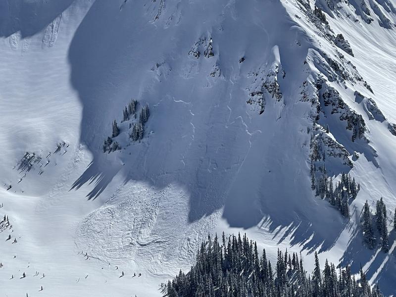
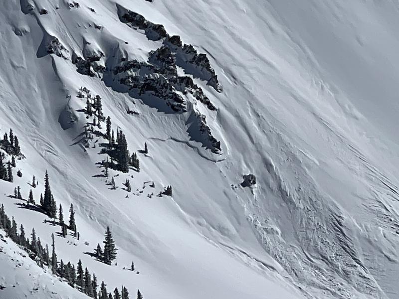
Lots of recent avalanches to look at in the big alpine terrain today. Roughly 2" of water has been rapidly added to the snowpack which in big terrain was enough to trigger a natural avalanche cycle on the buried facets that formed during our January and February dry spell. Those facets are now buried 2 to 3+ feet deep. Still got some collapsing, but it wasn't as widespread as last week.
Avalanche Problem #1
Problem
Persistent Weak Layer
Trend
Same
Problem #1 Comments
Today we observed several recent avalanches that failed on buried persistent weak layers on NW, N, and NE aspects in the alpine terrain. I wouldn't be surprised at all to see avalanches also, failing in more sheltered below treeline terrain on steep slopes facing W-N-NE-SE. And although, the natural avalanche cycle is over I think it's still likely a human could still trigger one of these persistent slabs.
Avalanche Problem #2
Problem
Wind Drifted Snow
Trend
Decreasing Danger
Problem #2 Comments
Today the winds remained light in the terrain above treeline and very little blowing snow was observed. Because of this I'll say the danger of triggering a wind slab is decreasing, but we must remind ourselves that these are the La Sals and the wind likes to blow here. Only now there's a bunch of new low density snow available for transport, and if the winds do pick up, so will the danger.
Video
Beautiful blower pow in the morning during the storm.
Today's Observed Danger Rating
Considerable
Tomorrows Estimated Danger Rating
Considerable
Coordinates