Observation: Moab

Observation Date
2/25/2022
Observer Name
Nauman, Grote
Region
Moab
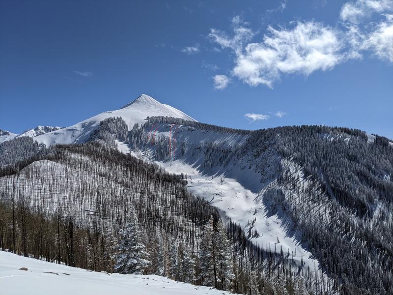
Location Name or Route
Noriegas Ridge
Weather
Sky
Scattered
Wind Direction
South
Wind Speed
Light
Weather Comments
Mostly sunny today with periods of snow. The air temp stayed pretty low, but the sun and clouds kept us changing our layers. The wind was blowing light to moderate in exposed areas, enough to keep us from getting warm.
Snow Characteristics
Snow Surface Conditions
Powder
Wind Crust
Snow Characteristics Comments
We found mostly soft snow on the west aspects we toured today. Southern aspects we encountered had been raked pretty hard by the wind during the recent storm cycle and were very thin. All that snow was deposited on northerly aspects. We encountered regular and consistent collapses in the snow pack that felt like they were adjustments in the old snow interface that had been weakened by the extended dry period. However, the new snow was supportable and felt right side up for really nice skiing. We steered clear of avalanche terrain given the reactive snowpack.
Red Flags
Red Flags
Recent Avalanches
Wind Loading
Collapsing
Poor Snowpack Structure
Red Flags Comments
We had consistent collapsing of the snowpack with a small amount of associated cracking. Northerly aspects were loaded, we saw a couple point release slides on north faces that ran >500 vertical feet, but no big avalanches. We did see some pictures from friends of larger avalanches that clearly broke on the old snow surface on Tele Gold, Tele Heaven, and Red snow cirque (or one of the BG cirques) so there had been some larger slab avalanches (>200' width). Slopes >30 degrees are suspect until proven otherwise right now. If the wind stays reasonable as suggested in the forecast, I think tomorrow will be a 'scary moderate' day barring other observations of broader avalanche activity.
Avalanche Problem #1
Problem
Wind Drifted Snow
Trend
Decreasing Danger
Problem #1 Comments
The north faces with the worst snowpack structure are all loaded right now from the last snow cycle and associated winds. North facing avalanche terrain is out for now until tested otherwise. I would lump this in with new snow that is still settling out a little. Think another day or two for the last interface to become less reactive. We had a lot of collapsing today.
Avalanche Problem #2
Problem
Persistent Weak Layer
Trend
Same
Problem #2 Comments
The old snow surface could easily become a persistent weak layer where facets had formed in our previous dry spell. More investigation is needed, and it will be highly variable. It's also good to keep in mind that we still probably have a lot of basal facets lurking beneathe everything. It doesn't seem like the deep facets were awakened with this last cycle. Some hole digging and shovel slapping are an order order in the near future...
Comments
Couple point releases that coverd some vert in Dory Canyon.
Wind scour from the southerly winds over Noriega's ridge
Today's Observed Danger Rating
Considerable
Tomorrows Estimated Danger Rating
Moderate
Coordinates