UDOT PLANNED AVALANCHE CLOSURES!!

Observation: Scotts Bowl

Observation Date
12/21/2021
Observer Name
Champion & Mullen
Region
Salt Lake » Park City Ridgeline » Scotts Bowl
Location Name or Route
Scott's Bowl
Weather
Sky
Clear
Wind Direction
West
Wind Speed
Calm
Weather Comments
It was a beautiful clear day! Temperatures were in the high 20's most of the day with calm winds primarily to the west.
Red Flags
Red Flags
Recent Avalanches
Poor Snowpack Structure
Avalanche Problem #1
Problem
Persistent Weak Layer
Trend
Increasing Danger
Problem #1 Comments
The Persistent weak layer (PWL) problem has been lingering over us for quite some time, and won't be going anywhere shortly. With another storm approaching, this will add additional stress to the PWL. With clear cold nights, it is no surprise that in the field we noticed the surface snow beginning to weaken, and we saw both near-surface facets on ridgetops and surface hoar in protected valleys and terrain features. Since the snow surface has begun to weak, I expect the new snow to bond poorly to the old snow. As the new snow begins to come in, I would expect to see fast and far running sluffs and soft slab avalanches on the new snow old snow interface, especially during periods of high PI rates. Once water and snow totals begin to stack up, we may hit the tipping point in which the snowpack becomes unglued, and we see new snow and wind drifted snow avalanches stepping down more deeply into the weak faceted snow. Moving into this next storm system the avalanche danger will be on the rise.

As mentioned in previous forecasts, the best way to manage a PWL problem is avoidance. There is still fun riding on slopes less than 30 degrees!
Snow Profile
Aspect
East
Elevation
9,600'
Slope Angle
21°
Comments
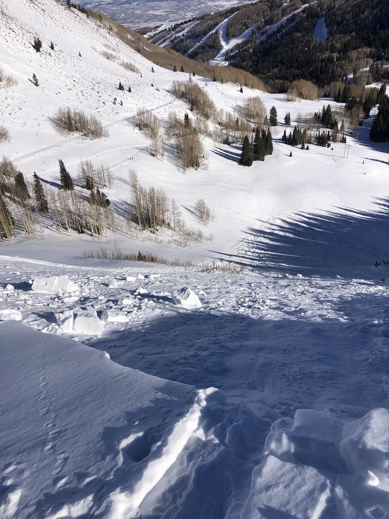
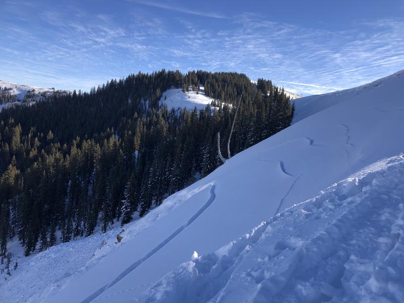
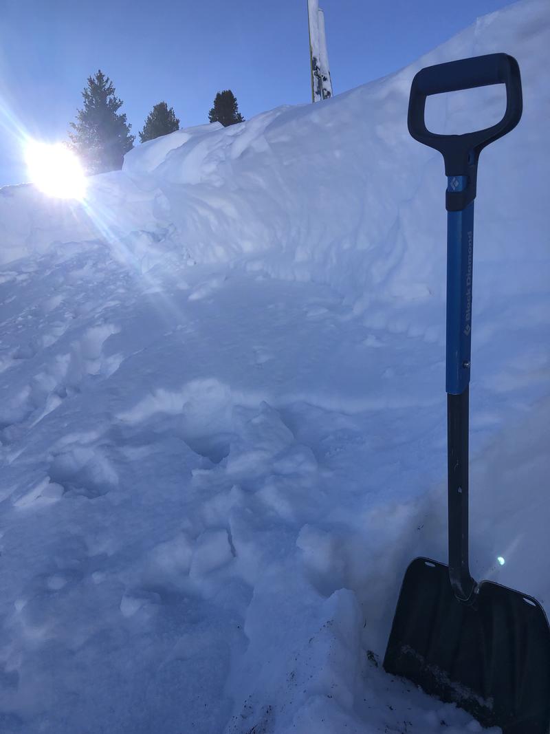
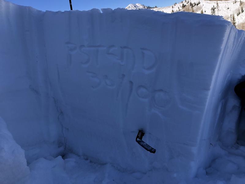
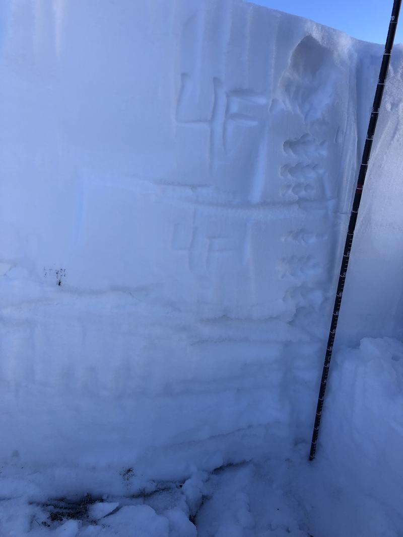
Scott's Bowl was remotely triggered on Saturday, December 18. We were able to safely get onto the avalanche today, December 21, to asses what layer the avalanche potentially slid on. We performed a Propagation Saw Test and observed results, PST 30/100 (End), @ 60 cm. We anticipate that this avalanche failed 60 cm deep, on the facet layer right above the top crust about 60 cm below the surface.
As new snow is expected to fall in the coming days, avalanche danger is expected to rise , resulting in our snow pack being more sensitive than it is now. The name of the game will be avoidance and sticking to slopes less than 30 degrees.
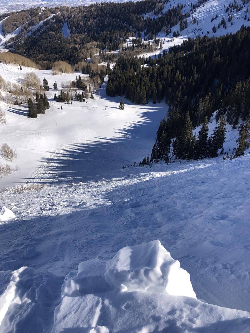
Photos from the avalanche and crown profile

Photo of hand hardness of crown profile and PST results PSTEND30/100 down 60cm on 2mm facets above an old melt freeze crust.
Video
Today's Observed Danger Rating
Considerable
Tomorrows Estimated Danger Rating
Considerable
Coordinates