Observation Date
2/4/2021
Observer Name
Mark Staples
Region
Uintas » Bear River Ranger District » Bear River West Fork » Moffit Basin
Location Name or Route
Moffit Basin
Comments
We know that any northerly facing slope near and above treeline is weak and probably unstable especially with any wind drifted snow on it. I assessed E, S, and SW facing slopes below treeline. All have very poor structure and many persistent weak layers. Stability tests fractured 1 to 2.5 feet deep sometimes in the middle of the snowpack and sometimes closer to the ground.
Overall the snowpack is weak, faceted, sugary, bottomless, and basically garbage. The greatest variability from one location to the next is the load and the slab on top of the persistent weak layers. The good news is that it is slowly getting more supportable for riding and skiing. ANYTIME you step off your sled or out of your skis, you sink to the ground. The good news is that coverage is slowly improving, and snow depths on a south aspects near 10,000 on sheltered slopes are about 2 feet.
Despite some very poor stability test results, I could not get any collapsing or cracking but I only sampled a small area and slopes that did not have wind drifted snow. I would set parallel sidehill tracks and the snow seemed stubborn. Basically it needs more of a load to be stressed. Closer to treeline, that load can be found from recent winds and I bet you could get collapsing and cracking. The photo below shows my tracks with no cracking between them. BUT, this only tells me that things aren't very sensitive. The structure and my stability tests told me not to trust things.

Below are profiles and photos from four snowpits that I dug:
First one is E facing at 9600 ft. The extended column test fractured across the column about 2.5 ft deep and JUMPED out after 16 taps (ECTP16).


The next one was SW facing at 9580. The extended column test fractured across the column about 1.5 feet deep after 10 taps (ECTP10)


Two more snowpits below.
First (photos 1&2) - due south facing at 9750 feet. ECTP13 on facets between two ice crusts.
Second (photos 3&4) - east facing at 8860 feet. Poor structure but not enough of a slab or enough of a load. The extended column test broke about 10 inches deep but did no propagate across the column (ECTN10). If this location had wind drifted snow, it would be a different story.
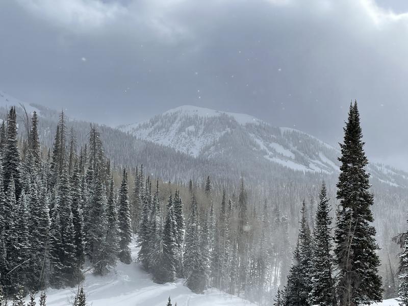
Lastly (photo 5) - shows the weather around Moffit Pk. Beautiful with clouds, some sun poking through occasionally, and snow flakes falling off and on.


Today's Observed Danger Rating
Considerable
Tomorrows Estimated Danger Rating
Considerable
Coordinates


