Observation: Mineral Basin

Observation Date
1/21/2021
Observer Name
CBrown
Region
Salt Lake » Little Cottonwood Canyon » Snowbird periphery » Mineral Basin
Location Name or Route
Mineral Basin, Mary Ellen
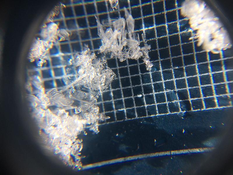
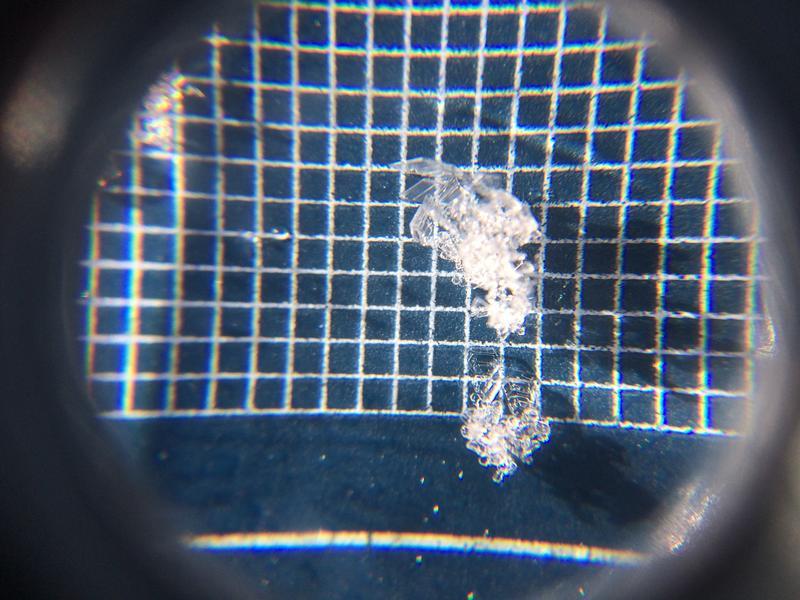
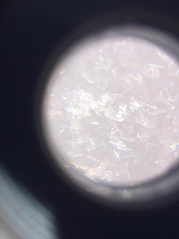
Weather
Sky
Scattered
Wind Direction
West
Wind Speed
Light
Weather Comments
Light to Calm winds noted today from the west. Cold temps on the shadies and warm in the sun. Increasing clouds through day with approaching front.
Snow Characteristics
Snow Surface Conditions
Powder
Faceted Loose
Wind Crust
Melt-Freeze Crust
Damp
Snow Characteristics Comments
Mixed bag out there. Sheltered low angle north with out old tracks is still skiing well. Recent winds, especially the Easterlies worked on the exposed terrain. Supportable and unsupportable wind board/HS, MF on southerlies softened a little today. Old tracks are hard. Main objective today was tracking the snow surface with incoming storm.
Red Flags
Red Flags
Poor Snowpack Structure
Red Flags Comments
Poor structure exists. Variable slab cohesiveness noted over the last two days. Some places it's broken down enough to shot ECTN results, other places have enough slab. Looked at ESE and SE in upper elev today, poor structure abounds. More 9,800' SSE shows two stout MF that are bridging the FC below but produced CTM Q1 results when the MF were cut. ESE 9,800' HS 65cm had one major MF, not as stout and showed CTM SP below MF (down 4cm) and CTH Q1 down ~40 cm on FC. I think ESE could become active with enough load, SSE would probably need a HUGE load to collapse through the stout MF. Other big take away was weak snow surface. North showed about 1cm of FCsf and ~3-4mm SH up to the ridge lines at 9,800' (hopefully the front comes in with some wind...)
Avalanche Problem #1
Problem
Persistent Weak Layer
Trend
Same
Problem #1 Comments
Structure remains, highly variable with the slab, but with new load..... Surface conditions show a new PWL being formed with incoming storm above an already fragile weak snow pack. If this much needed storm produces expect to see a very active cycle
Comments
Images of SH at 9,800' N at ridgeline
Today's Observed Danger Rating
Moderate
Tomorrows Estimated Danger Rating
None
Coordinates