Observation: Elizabeth Pass

Observation Date
1/21/2021
Observer Name
Ted Scroggin
Region
Uintas » Bear River Ranger District » Mill Creek » Elizabeth Pass
Location Name or Route
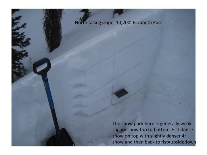
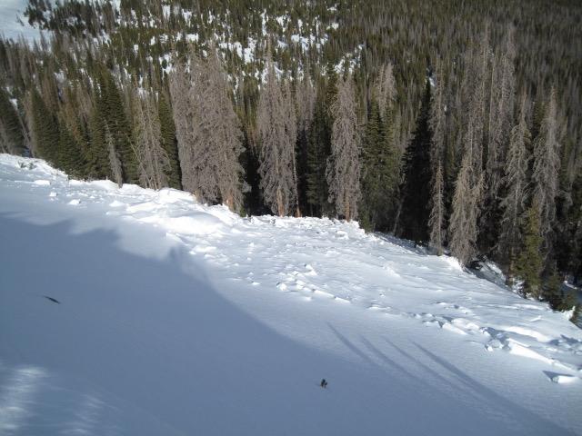
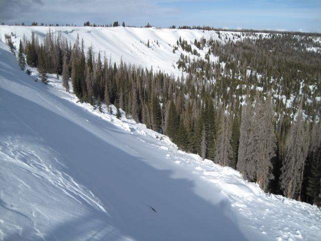
Elizabeth Pass-north side
Weather
Sky
Broken
Wind Direction
Southwest
Wind Speed
Moderate
Weather Comments
Mostly cloudy today with some periods of sunshine and moderate southwest winds on the exposed ridge lines. Felt like a change is in the air as a possible decent storm arrives tomorrow afternoon and what a welcome site to see some good snow-fingers crossed.
Snow Characteristics
Snow Surface Conditions
Dense Loose
Faceted Loose
Wind Crust
Snow Characteristics Comments
The snow surface today was a mix of some stout wind crust where the winds have been blowing from different directions this week and out of the wind some small surface hoar has developed from a few clear cold nights. Some of this weak surface snow may get buried with the approaching storm, but hopefully the wind should destroy most of it.
Red Flags
Red Flags
Wind Loading
Poor Snowpack Structure
Red Flags Comments
I was expecting to have collapsing and cracking today, but the wind and poor snow structure were the main red flags.
Avalanche Problem #1
Problem
Persistent Weak Layer
Trend
Increasing Danger
Problem #1 Comments
The snow pack around the Elizabeth Pass area is nothing but bottomless weak sugary snow that was not all that great riding in today. Throw a dense heavy wind slab on this poor snow structure and lots of avalanching has occurred in this area over the last several days and maybe weeks.
Avalanche Problem #2
Problem
Wind Drifted Snow
Trend
Increasing Danger
Problem #2 Comments
The winds this past week have been blowing from all directions and there was not much loose snow to blow around, but there was some minor wind drifting today mainly on those slopes facing north through northeast. I was able to crack out some very minor shallow wind drifts, but these were small and not a big issue today.
Comments
The avalanche conditions could get pretty interesting when it snows again. The current snow pack set up is kind of scary once a load of snow and wind is put on top.
Video
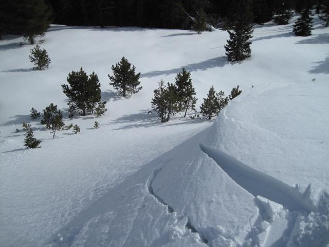
A couple pictures of more natural avalanche activity fairly recently on the north side of Elizabeth Pass. More dense wind blown snow overloaded a weak snow pack and this slope avalanched. This is not a big steep slope, but the debris stacks up against the trees quite deep.
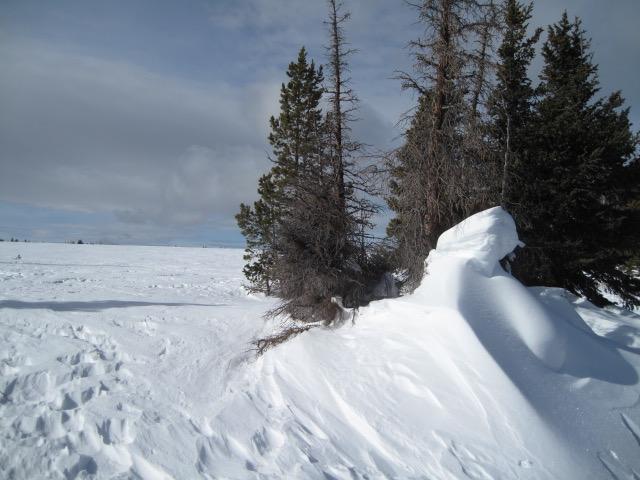
You know the wind blows when the drifts start to get as high as the trees.
There were a few very isolated wind drifts that cracked, but were not too deep or connected. These could get deeper and more connected as wind and snow are forecasted.
Today's Observed Danger Rating
Moderate
Tomorrows Estimated Danger Rating
Moderate
Coordinates