Observation: Powder Mountain

Observation Date
11/14/2020
Observer Name
Wilson, Hardesty, Davis
Region
Ogden » Powder Mountain
Location Name or Route
Lightning Ridge
Weather
Sky
Broken
Wind Direction
West
Wind Speed
Moderate
Weather Comments
Temperatures remained in the low teens after dropping last night. Over the course of our afternoon tour, wind speeds fell from moderate to light, and the skies cleared from overcast to scattered.
Snow Characteristics
New Snow Depth
14"
New Snow Density
High
Snow Surface Conditions
Dense Loose
Wind Crust
Snow Characteristics Comments
Hadn't planned to ski today, but then we saw the water values from Ogden weather stations: Mid-bowl recorded nearly 2 inches overnight, with 1.5 inches falling in just 6 hours! Would we find rain, hail or graupel layers? Had the strong westerly winds stripped and loaded the whole region? Had the mountains had an early-morning "case of the come-aparts", failing on the weak surface noted by Kory Davis earlier in the week? We went on a short afternoon tour up Lightning Ridge at Powder Mountain to check it out.
Surprisingly, the snow seemed well behaved. The surface was indeed impacted by wind everywhere, forming slabs that were soft in some locations and hard in others. There was scalloping and pillowing not just on the ridglines but down towards the road as well. But nowhere on our tour were the wind slabs sensitive or easy to trigger.
Snow depth was variable, and ranged from 85cm in the deeper areas to 10cm along scoured ridges. Most of our tour was on dense snow, 30cm-60cm deep.
Red Flags
Red Flags
Heavy Snowfall
Wind Loading
Comments
We dug test pits on a north-northeast aspect at 8,500 feet, and on a more protected north aspect at 8,920.
Only in the higher elevation pit did we get propagation of fracture across the column (ECTP23), failing mid-storm under the surface windslab. The fracture was difficult to initiate, and the surface block did not slide easily after fracture. In both pits, compression tests failed easily (CT5, CT7) down 10-15 cm below the surface wind slabs, with resistant planar fracture character. I expect these failure planes to heal quickly.
In both pits, the new snow accounted for over half the total snow depth. In the higher pit but not the lower pit, the new snow was dusty and darker than the older snow. Great storm marker, where it exists!
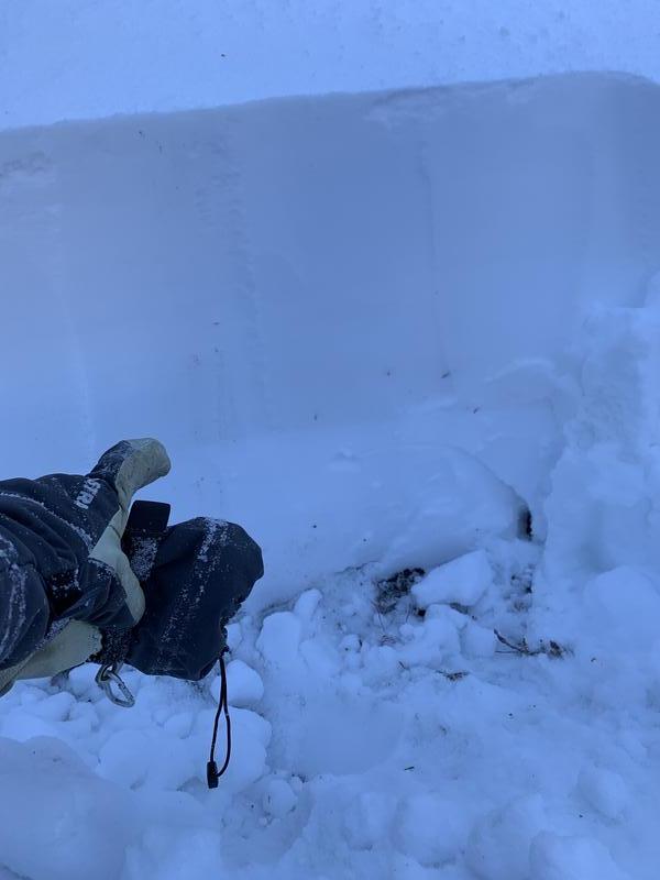
Top picture shows 10 cm thick 1-Finger slab, over 2cm of graupe,l and then 4Finger hardness to the ground.
In the bottom picture, the dust makes the new snow easy to differentiate from the previous storm.
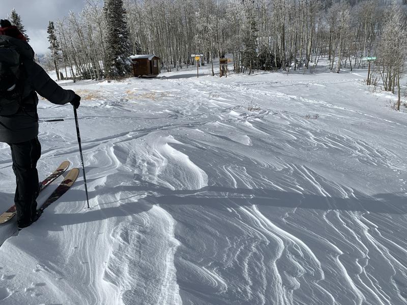
Photos show wind impact on ridglines and on the slopes below.
Today's Observed Danger Rating
Moderate
Tomorrows Estimated Danger Rating
None
Coordinates