Observation Date
3/21/2020
Observer Name
Garcia/Grote/Bateman
Region
Moab
Location Name or Route
Laurel Highway/Goldminer's/Cabin Trees
Weather
Sky
Broken
Precipitation
Light Snowfall
Wind Direction
South
Wind Speed
Moderate
Weather Comments
Light snowfall was on and off all day. Trace accumulation. We got occasional glimpses of the sun that only lasted a few minutes. The snow got little to no sun affect today.
Snow Characteristics
New Snow Depth
10"
New Snow Density
Medium
Snow Surface Conditions
Powder
Snow Characteristics Comments
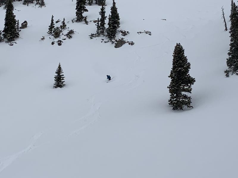
Almost two feet in the high country since Wednesday night. I was skiing today with Casey and he said Thursday was 10 to 12 inches of high density, and the sun came out Thursday afternoon and cooked things. Then we got the next round of snow with another 10 to 12 of medium density by this morning. Skiing on the windward side of things the snow was supportable, creamy, and really fun.
Red Flags
Red Flags
Recent Avalanches
Wind Loading
Poor Snowpack Structure
Red Flags Comments
Recent Avalanches: The only recent activity observed today were sluffs and point release avalanches. There was a small, but long running sluff off the summit of Tuk going down the NE face. The meat cleavers dropped some sluffs into Middle Snow Cirque. Some sluffs ran into Red Snow Cirque from the steep North facing terrain above. No photos, vis was low today.
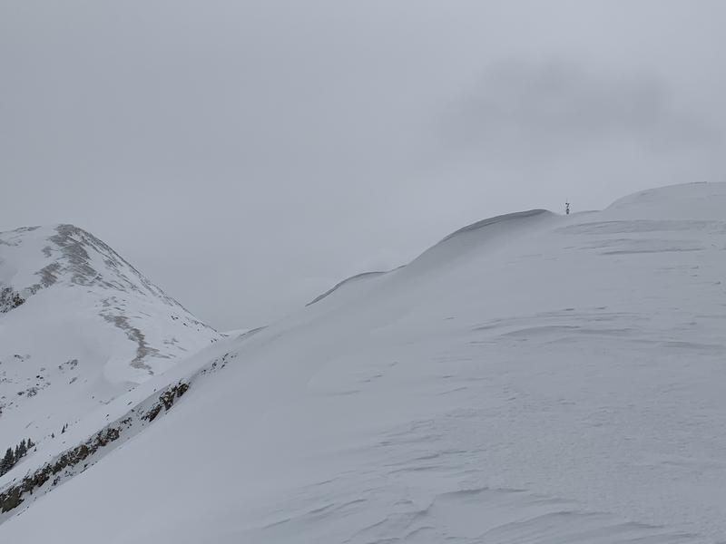
Wind Loading: North and East facing terrain NTL and ATL had been previously loaded by Thursday's storm. Those slopes continued to load today. Moderate winds from the south were blowing and drifting snow onto lee slopes. A decent sized cornice is developing on pre laurel peak. When we got the occasional look across Gold Basin, it was obvious the North and East facing terrain over there was freshly loaded.
Poor Snowpack Structure: When traveling up the Laurel Highway there is a dramatic difference in the snowpack from the windward/solar aspects compared with the lee slopes that face North and East. I walked around a bit on Julie's Backside and the snowpack feels upside down right now. Dense storm snow is sitting on top of weak facets on these slopes. This is fairly obvious with a pole probe. Once you hit the facets your pole will go deeper and deeper without feeling the bottom. I wouldn't be skiing that side right now. This problem is compounded by wind drifted snow putting an additional load on these facets.
Avalanche Problem #1
Problem
Wind Drifted Snow
Trend
Same
Problem #1 Comments
Most of the new snow since Wednesday night has been accompanied by moderate to strong winds. Snow was still blowing around today and there is plenty of new snow available for transport. Wind drifted snow can be getting rather deep and should be avoided for the time being.
Avalanche Problem #2
Problem
Persistent Weak Layer
Trend
Same
Problem #2 Comments
We have a persistent grain type now buried by two feet of snow from the sky, plus additional loading from the wind. We have been identifying this problem in steep shady terrain that faces North and East, but with the additional load I would avoid all steep terrain facing North and East for the time being.
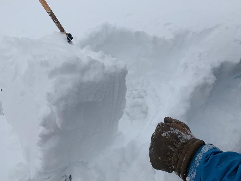
Photo 1 shows a fresh cornice forming above Old Reliable. Photo 2: Lot's of hand shear tests today. In a lot of places I could not pull a cohesive block out of the snow. The photo is an example of where I could. This is South facing on Gold Miner's. Here the storm snow is sitting on top of an ice crust. The snow must have come in warm and wet, because it is well bonded. Mostly the new snow would fall apart in my hand shears today. If I did pull a block out, shears were moderate to hard. We skied on the windward side today. This was strategic to avoid skiing in two feet of storm snow. On the windward side it was more like 15 inches of settled snow and it was not behaving like a slab. There are places out there with low danger right now. But on the North and East side of the compass I'm still leaning towards a considerable danger. Especially with the combination of buried facets, two feet of new snow, and fresh wind loading on top of that. These are the places you will run into trouble.
Today's Observed Danger Rating
Considerable
Tomorrows Estimated Danger Rating
Considerable
Coordinates