Observation Date
2/15/2020
Observer Name
Jake Hutchinson
Region
Salt Lake » Parleys Canyon » Mt Aire
Location Name or Route
Mt Aire
Weather
Sky
Overcast
Wind Direction
West
Wind Speed
Light
Weather Comments
Cloudy and warm, light breeze with an occasional moderate/strong gust on the ridge.
Snow Characteristics
Snow Surface Conditions
Rain-Rime Crust
Snow Characteristics Comments
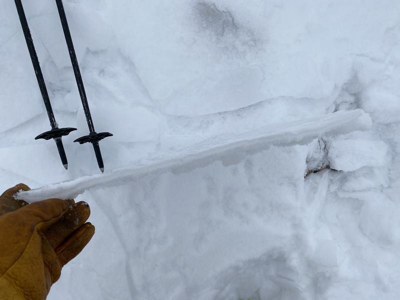
The surface is interesting. From full blown ice (up to 5mm thick) down low, to barely noticeable in certain leeward locations. It was surprisingly supportable while skiing, despite being an unpredictable nightmare on the uptrack.
Red Flags
Red Flags
Poor Snowpack Structure
Red Flags Comments
The crust will be problematic with a load. Places where there is snow above the crust, it is thin and weak, providing an excellent weak layer/bed surface combo waiting for a slab. I am more interested in the weakening snow below the crust, I suspect it will wait for a significant load until break on this layer, setting us up for a potential PWL problem down range.
Avalanche Problem #1
Problem
Persistent Weak Layer
Problem #1 Comments
Pay attention to the facets below the crust. It is eerily similar to the 2001-02 structure that led to two separate widespread avalanche cycles.
Video
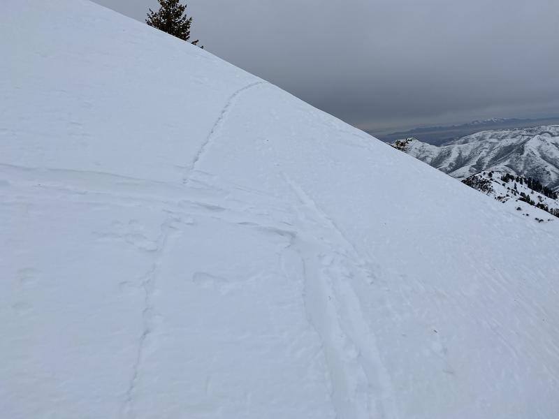
Top photo is a glimpse of the crust at about 8000 feet, shows a crown, where the slab released but couldn't overcome residual friction and stopped after moving a few inches. No idea how long ago this occurred, but my guess is late or immediately after the last storm. This is the NW aspect on Mt Aire at 8500'
Today's Observed Danger Rating
Low
Tomorrows Estimated Danger Rating
Moderate
Coordinates


