Observation Date
2/2/2020
Observer Name
Wilson, Hardesty
Region
Salt Lake » Big Cottonwood Canyon » Mill B South
Location Name or Route
Mill B South
Weather
Sky
Overcast
Wind Direction
Southwest
Weather Comments
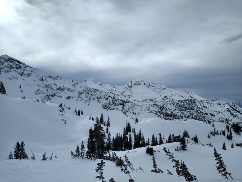
Warm temps, skies from broken to overcast. Our location at the head of Mill B South was protected from the southwest winds, but we could see snow blowing off peaks and over ridges throughout the day.
Snow Characteristics
Snow Surface Conditions
Dense Loose
Wind Crust
Melt-Freeze Crust
Damp
Snow Characteristics Comments
Wind and clouds kept the snow surface cool at the higher elevations, but low elevation south through east was crusted, and low elevation north was damp under the canopy.
Lots of wind damage up high, soft snow still present in the protected areas.
Red Flags
Red Flags
Wind Loading
Rapid Warming
Red Flags Comments
Driving up Little Cottonwood Canyon we saw wet activity on south aspects from yesterdays bright sun and warm temps. Temps stayed above freezing overnight and today was another warm "spring" day, but no wet activity noted on our tour.
Avalanche Problem #1
Problem
Wind Drifted Snow
Trend
Increasing Danger
Problem #1 Comments
Ridges and upper elevation bowls were heavily wind impacted. Cracking was limited to the top several inches of snow, and just around our skis. Wind was moving snow today, and the forecast calls for more wind and snow tonight into tomorrow.
Avalanche Problem #2
Problem
Persistent Weak Layer
Trend
Same
Problem #2 Comments
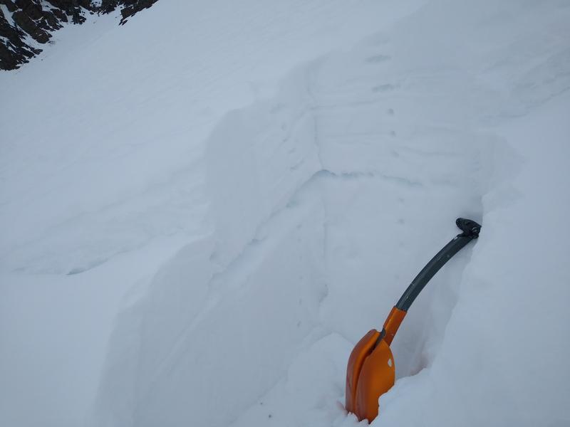
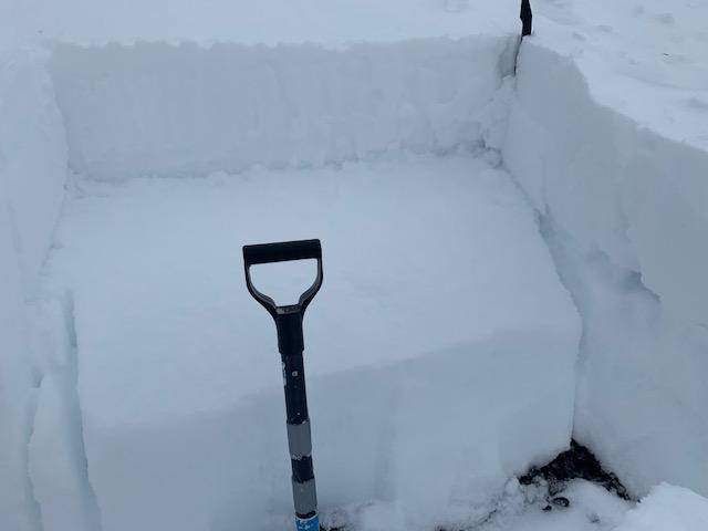
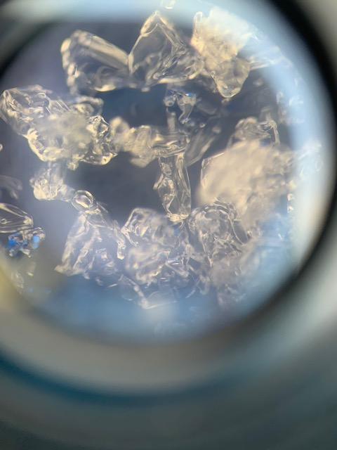
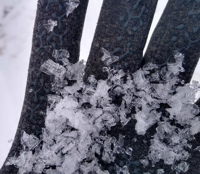
Avalanching on a persistent weak layer is the exception to the rule, but it's still possible in isolated locations. We went to the head of Mill B to investigate the 2/1/2020 avalanche reported by Mletschnig and others. This avalanche failed on a thick layer of 2mm facets just below the New Year's crust (though this crust not consistent across the crown), and tracks suggest it happened at the feet of the touring party. How did they awaken a layer that's been quiet throughout most of the Wasatch? The location gets wind-scoured and at the trigger point--at the top of the avalanche--the snow depth was only 70cm and the facet layer was merely 30cm down. Compare this to a snowpack of over 170cm on the other side of the ridge in Cardiac bowl. On the lower left flank (shown in the photo below) the slab was thicker and contained 4 crusts.
Snow Profile
Aspect
Southwest
Elevation
10,700'
Slope Angle
38°
Comments
This avalanche is a reminder that PWL avalanches are still possible in isolated locations.
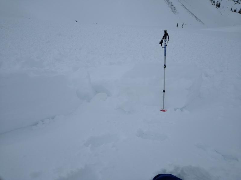
The good news for skiers is that a quick pit would have shown the structure, and extended column tests did show propagation at the weak layer with 22, 24, and 21 taps. Where is it worth pulling out the shovel for an ECT? A couple jabs with the probe would identify shallow snowpack, where the problem is more likely.
Photos below: 4 cm of weak snow where the avalanche failed, the planar surface after an ECT at the crown, and facets at the failure plane
Video
Closer to Cardiac pass the snowpack was even shallower, and the facets were more developed.
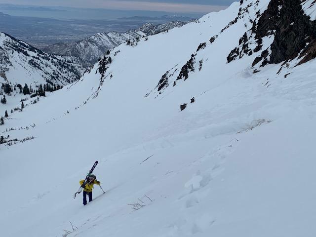
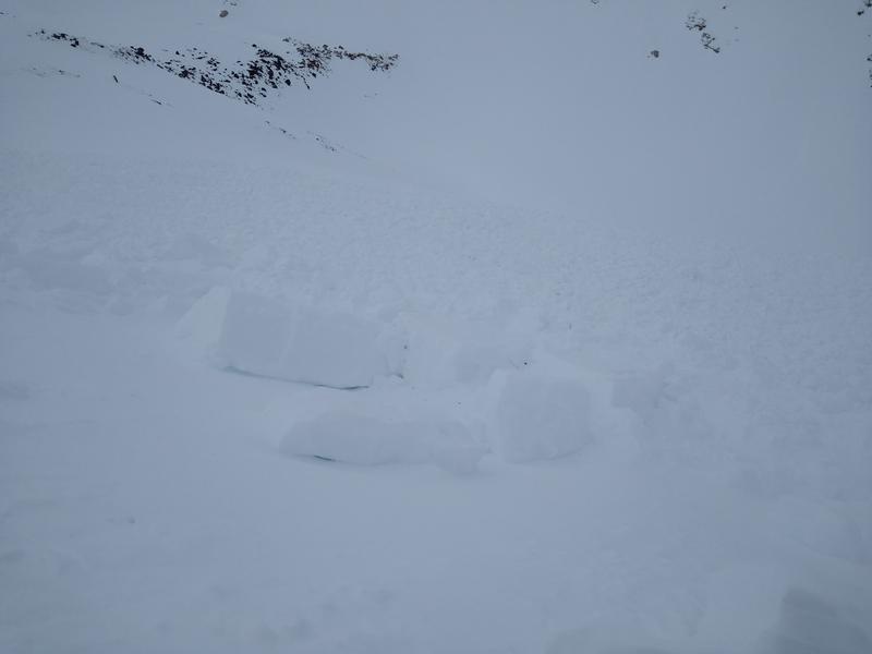
A couple photos for perspective: walking across the bed, debris at the bottom
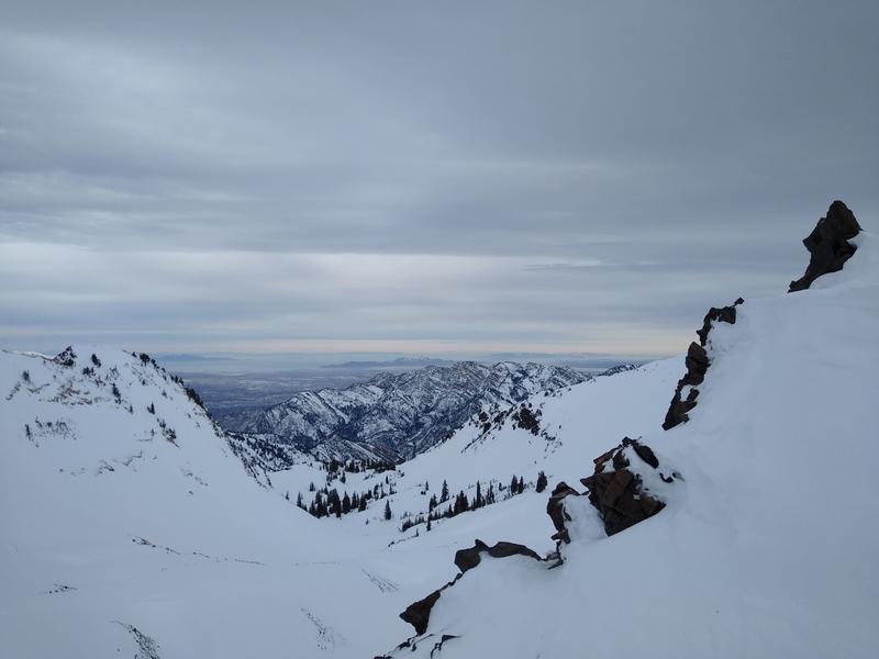
Weather shots: Graybird skies, and wind on the ridge lines.
Today's Observed Danger Rating
Moderate
Tomorrows Estimated Danger Rating
Considerable
Coordinates