Observation Date
1/6/2020
Observer Name
Bo Torrey, Drew Hardesty
Region
Salt Lake » Mill Creek Canyon » Wilson Fork
Location Name or Route
Wilson Peak
Red Flags
Red Flags
Recent Avalanches
Wind Loading
Poor Snowpack Structure
Avalanche Problem #1
Problem
Persistent Weak Layer
Trend
Same
Problem #1 Comments
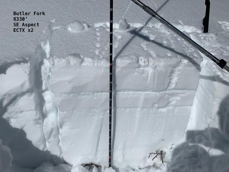
Today we traveled from BCC up Butler Fork to check out yesterday's human triggered avalanche on Wilson Peak. We dug several times on mid and upper elevation Southerly aspects and found the same structure that was likely responsible for the avalanche on Wilson peak. The weak layer was 20-30 cm below the surface. We did not have propagation results on the weak layer in our stability tests.
SE Slope @ 8330' ECTX
SE Slope @ 9020' ECTX
SE Slope @ 9800' ECTX
South Facing Persistent Weak Layer- This is an unusual set up for us. I told Drew today that I feel conditioned to seeing weak snow on the northern aspects, seeing a recent human triggered avalanche, digging a snowpit nearby and seeing the correlation in the stability tests so often that it's become a familiar and predictable weak layer set up. What we have now is different and unfamiliar to me. Over the last several days I've dug a number of snowpits, and the stability results I have seen haven't been that alarming to me, but when human triggered avalanches are happening, and I hear avalanche forecasters using the word "Spooky" to describe current avalanche conditions I know that my calibration of the snow stability must be off and that my snowpits might not be as reliable as I previously thought. The facts speak for themselves. There is weak faceted snow adjacent to a buried crust on southerly aspects. There have been several avalanches that have failed on this layer since Thursday including a very large avalanche in South Facing Tanners Gulch in upper Little Cottonwood Canyon. That is enough information to have me stepping back on my south-facing terrain for the time being.
Avalanche Problem #2
Problem
Wind Drifted Snow
Trend
Decreasing Danger
Problem #2 Comments
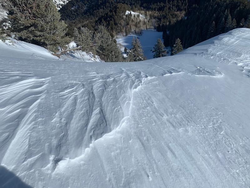
More predictable and easily observed today was the wind loading. We went to view the recent slide on Wilson Peak but because of the recent wind drifted snow most of the crown line had been filled back in. The Wind Slabs were confined to just below exposed ridges and were quite firm hard slabs. Wind slabs are usually responsive to ski cuts and cornice drops however when the slab is hard it might not respond as predicted so approach these with some extra caution and consideration of potential consequences.
When traveling along upper ridges, if you're not sure which way the wind was blowing look around at features that might provide hints to which way the wind blew. The easiest way to observe this is to identify which side of the ridge is stripped of snow and which side of the slope looks to have been filled with snow. Also look at the etching - the steep etching faces the wind direction.
Comments
Photo 1: Pit with Crust and facet combo 20 cm below the surface.
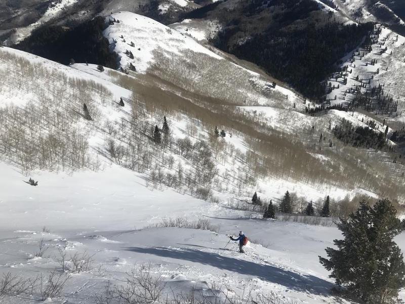
Photo 2: Looking down Sunday's Human Triggered Avalanches. Drew is standing at the crown line. Looked like a nasty ride, thankful to hear the party made it out uninjured.
Photo 3: Looking into the Wilson Chutes from the Top of the peak. Wind has stripped snow from the ridge and deposited into the upper starting zones of this chute. Blind roll anyone?
Today's Observed Danger Rating
Considerable
Tomorrows Estimated Danger Rating
Considerable
Coordinates


