Observation Date
12/26/2019
Observer Name
Gagne
Region
Salt Lake » Big Cottonwood Canyon » Days Fork
Location Name or Route
Days Fork from Spruces
Comments
Overall storm snow instabilities had settled out by today, and it took very steep slopes (> 40 degrees) to get any sluffing. Also - on Wednesday some observations indicated the the storm snow was acting as a cohesive slab and propagating. We could not get any propagation in the storm snow today.
Sluffs were generally running at the old-snow interface, and temperature crusts and old wind slabs were providing an ideal bed surface for sluffs to run on. (Likely explaining why sluffs were running long and fast on Wednesday.)
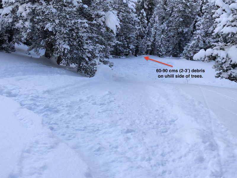
The photo below shows a ski cut on a ~45 degree rollover which resulted in a sluff moving downhill and depositing 60-90 cms (2-3') of snow on the uphill side of trees.

For those venturing into steeper terrain on Friday, ski cuts are a very effective tool for working with this avalanche problem of soft-snow instabilities near the surface. (Keep in mind ski cuts can only address surface instabilities and not deeper instabilities such as our current persistent weak layer down near the ground.)
On 12/21 Drew referred to a recent study on ski cutting, and although it can be effective, it can also sometimes be dangerous (link).
Today I skied some of the steepest, north-facing lines that I have all season. I knew the persistent weak layer down near the ground existed, and I'd like to explain my thinking as I worked through this terrain:
1. Our first steep run was on a SE aspect where the persistent weak layer problem did not exist. We ski cut steep rollovers to first address instabilities at the surface. Once we felt comfortable with how surface instabilities were behaving, and how we could manage the problem, we moved onto steeper terrain on northerly aspects where the persistent weak layer down near the ground existed.
2. I had traveled in this area already this season and knew the season history of avalanching. We avoided slopes that had slid this season as they would have a thinner & weaker snowpack.
3. I was constantly doing a pole probe looking for a deeper snowpack. In areas where it was too thin (less than ~120 cms) with weak snow near the ground I made sure I kept to lower-angled (< 35 degrees) terrain.
4. I stayed away from steep, rocky terrain where the snowpack is thinner.
5. When I rode steep lines, I made sure the snowpack was deep (> 1.5 meters / 5')
My partners and I communicated plans, and we moved through terrain from islands of safety where we could watch one another.
Today's Observed Danger Rating
Moderate
Tomorrows Estimated Danger Rating
Moderate


