Observation Date
12/19/2019
Observer Name
John Pikus
Region
Skyline » Huntington Canyon
Location Name or Route
Huntington Canyon
Weather
Sky
Clear
Wind Direction
East
Wind Speed
Moderate
Weather Comments
Beautiful and clear day out there today. Winds seemed to be coming from the east in the morning and switched to more westerly in the afternoon. It felt quite warm in the sun in the morning but winds seemed to increase a little bit in the afternoon and keep heating of the snow surface in check. Winds were transporting snow throughout the day but it seemed like most available snow had already been moved over the past few days.
Snow Characteristics
Snow Surface Conditions
Dense Loose
Faceted Loose
Wind Crust
Melt-Freeze Crust
Damp
Snow Characteristics Comments
I experienced a cornucopia of different snow surface conditions in my travels today. Mostly shallow and stubborn wind drifts were liberally scattered below ridgelines on all aspects. Some south facing slopes I traveled on had a thin crust but many did not. After noon south facing slopes were starting to get a little bit damp. My west-facing exit route still had dry snow at 3:30pm. On non-south facing slopes the top couple inches of snow has faceted significantly, especially on the north half of the compass where snow travel was noticeably loud. This will be something to keep an eye on over the next few days. It made skiing conditions fun and fast but could become a weak layer once we get more snow.
Red Flags
Red Flags
Recent Avalanches
Wind Loading
Red Flags Comments
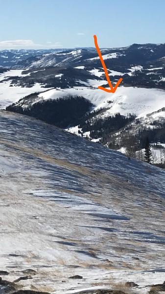
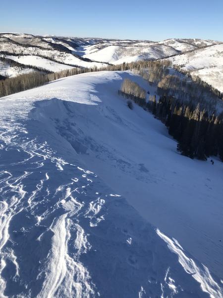
It was clear that the winds had transported lots of snow over the past couple days. I did observe several cornices that had presumably collapsed sometime over the past few days on northeast and east facing slopes. I attached a photo of some of these below. Also I did see what appeared to be a small recent avalanche on an east facing slope to the northeast of the Miller Flat reservoir. I was far enough away that I couldn't really get a great view of it but I would guess that it was a shallow windslab avalanche that occurred naturally. See photo below.
Avalanche Problem #1
Problem
Wind Drifted Snow
Trend
Decreasing Danger
Avalanche Problem #2
Problem
Persistent Weak Layer
Trend
Decreasing Danger
Comments
I toured today in the Candland Mountain area on all aspects, at elevations ranging from 8,400 feet to 10,350 feet. Main avalanche problem in this area today is probably wind drifted snow, although I did not encounter any cracking or collapsing today in my travels. If I had to guess these probably wouldn't pose too much of a danger unless you were in radical terrain or on steep slopes with old sugary snow at the base. Estimated danger ratings are for areas I traveled through today. Main eye-opener was how fast the surface snow is faceting.
Today's Observed Danger Rating
Low
Tomorrows Estimated Danger Rating
Low
Coordinates


