Observation: Silver Fork

Observation Date
4/10/2019
Observer Name
Greg Gagne
Region
Salt Lake » Big Cottonwood Canyon » Silver Fork
Location Name or Route
Silver Fork from BCC
Weather
Sky
Obscured
Precipitation
Moderate Snowfall
Wind Direction
Northwest
Wind Speed
Moderate
Weather Comments
Winds began to increase late morning. Upper BCC doesn't fare as well with NW flow, and heavier snowfall rates were occurring mid-canyon than at the top of the canyon.
Snow Characteristics
New Snow Depth
15"
New Snow Density
Low
Snow Surface Conditions
Powder
Snow Characteristics Comments
Up to 40 cms new above 10,000', with 15 cms down at 8500'. New snow bonded well to old snow surface. Old snowpack saturated and unsupportable below about 9200' Above that the old snow surface begins to form a supportable crust, with a stout, supportable crust above 9500'.
Red Flags
Red Flags
Heavy Snowfall
Avalanche Problem #1
Trend
Increasing Danger
Problem #1 Comments
Overall the storm snow was unreactive to stability tests other than a slight density inversion, and this seemed to be settling out rapidly. Some wind-drifting, but only along ridges and not cracking out very widely. Upper BCC doesn't do as well with NW flow, and we never experienced the heavy snowfall rates that are showing up on the Collins station. So it may be possible that areas that do better with NW flow (upper LCC, and some drainage in mid BCC such as Mineral) were seeing a more reactive storm snow. Where we were the hazard was Moderate, with only sluffing on steeper (> 40 degrees) aspects.
Will call for an increasing trend with this problem with more snow and wind expected overnight.
Avalanche Problem #2
Problem
Wind Drifted Snow
Trend
Increasing Danger
Problem #2 Comments
We were only seeing wind-drifting along the upper elevation ridges, and could only get minor cracking in pockets of fresh wind drifts. With plenty of loose snow available for transport, and increased winds forecasted overnight, wind-drifted snow is likly to be a concern for Thursday.
Comments
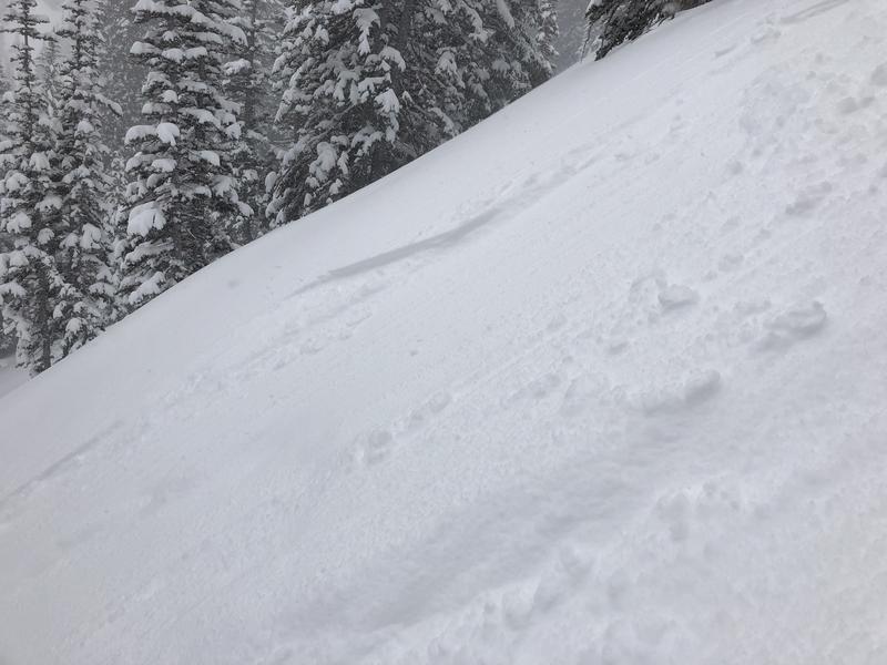
Photo below showing the only avalanche activity we were able to gt today, some sluffing in top 5-10 cms of storm snow on steep (> 40 degree) aspects.
Moderate where we were traveling today, but with more snow and wind in the forecast, would expect Considerable for Thursday
Today's Observed Danger Rating
Moderate
Tomorrows Estimated Danger Rating
Considerable