Observation: Cutler Ridge

Observation Date
3/23/2019
Observer Name
Wilson, Hardesty
Region
Ogden » Ben Lomond » Cutler Ridge
Location Name or Route
Cutler Ridge
Weather
Weather Comments
Trace of graupel in the early afternoon, otherwise no precip. Temps climbed into the high 30s and felt warmer. Periods of clearing and sunshine, but primarily overcast.
Snow Characteristics
New Snow Depth
12"
New Snow Density
High
Snow Surface Conditions
Damp
Snow Characteristics Comments
At low elevations the snow was damp and isothermal from top to at least the last crust/interface. Northerly mid elevations had a damp surface but some dry snow below. Skiing was great up high, but devolved to double polling down hill through grabby wet glop at the lower reaches.
Despite signs of instability, we saw another pair ski beautiful long lines off the NE face of Ben Lomond without consequence.
Red Flags
Red Flags
Recent Avalanches
Collapsing
Red Flags Comments
A pleasure to have interesting conditions again! Numerous collapses noted between 7500 and 8500', on Northwest aspects. One step I took on the flats collapsed snow around Drew on a test slope, 150' away. We saw the avalanches Bill https://utahavalanchecenter.org/observation/46280 triggered yesterday, but nothing today aside from wet loose activity below a rock band on south facing.
Avalanche Problem #1
Problem
Wet Snow
Trend
Same
Problem #1 Comments
Push-alanches at lower elevations, the kind that don't propagate wider than your skis but that keep sliding on the crust after you've stopped pushing. On mid elevation south facing below rock bands we saw large-ish wet loose activity, but not wet slab. That said, a northerly pit at 7000k showed water pooling at the interface between this week's storm snow and the older snow surface.
Tomorrow should be less sunny than today, with similar temperatures. Still, with overnight cloud-cover likely and barely-freezing temperatures in the forecast, our mid and lower elevations might not get much of a refreeze...
Avalanche Problem #2
Problem
Persistent Weak Layer
Problem #2 Comments
Several quick pits where we collapsed the slope showed near surface facets and surface hoar buried 3/20. AT 8000k NW facing, we got and ECTP17 on this layer; in others we had CT5 Q1, although no propagation.
I suspect this layer is concentrated between 7500 feet and above, in protected slopes NW through NE. To the southeast a stout crust underlies the new snow, and presumably the same is true on S through SW.
The cautious skier would dig the 18" necessary to see if the weak layer is present in their area before committing to a consequential line.
Rain runnels and push-alanches at low elevation.
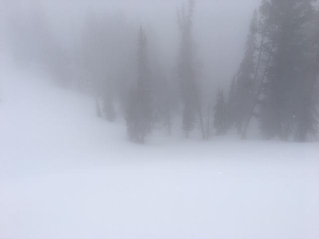
Overcast and obscured skies kept wet activity in check.
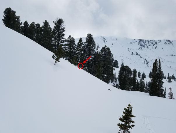
I took one step and Drew, barely visible across the slope, felt the collapse around him.
Today's Observed Danger Rating
Moderate
Tomorrows Estimated Danger Rating
Moderate
Coordinates