Observation Date
3/7/2019
Observer Name
Garcia/Kennard
Region
Moab
Location Name or Route
Laurel Highway
Weather
Sky
Broken
Precipitation
Light Snowfall
Wind Direction
West
Wind Speed
Moderate
Weather Comments
In the morning the sky was completely obscured. We had an intense shot of graupel around noon for about two minutes. After that the sun would poke through every now and then. Winds were moderate on the ridgelines.
Snow Characteristics
New Snow Depth
5"
New Snow Density
High
Snow Surface Conditions
Dense Loose
Snow Characteristics Comments
Five inches of new snow on the board in Gold Basin. At the trailhead there was about an inch. I think the rain/snow line was right at the winter TH. Something to keep in mind if you are planning to ski from the Trans La Sal TH. It could have rained there. The new snow is dense, supportable, fast, and really fun skiing.
Red Flags
Red Flags
Wind Loading
Red Flags Comments
Winds were blowing in the moderate range today. The new snow is pretty dense and the winds were not moving this snow around today. Yesterday was a different story. Reed reported strong winds at mid elevations. So strong that he had to lean into the wind to keep from falling over. Vis was limited today, but we had the occasional glance at North and East facing terrain which appeared to be freshly loaded.
Avalanche Problem #1
Problem
Wind Drifted Snow
Trend
Same
Avalanche Problem #2
Problem
New Snow
Trend
Decreasing Danger
Problem #2 Comments
The new snow is somewhat variable depending on aspect/elevation/exposure. The snow is certainly dense. Some hand shears would pull out nice cohesive blocks, and others would crumble. I found cohesive, slabby storm snow in more open and exposed areas. Places where the snowfall was more wind driven. In more sheltered areas the new snow was less cohesive and would fall apart more easily. We did not experience any cracking in the storm snow as we traveled today. I would expect any storm slab problems to settle quickly, but I would still have my guard up if skiing steep terrain tomorrow.
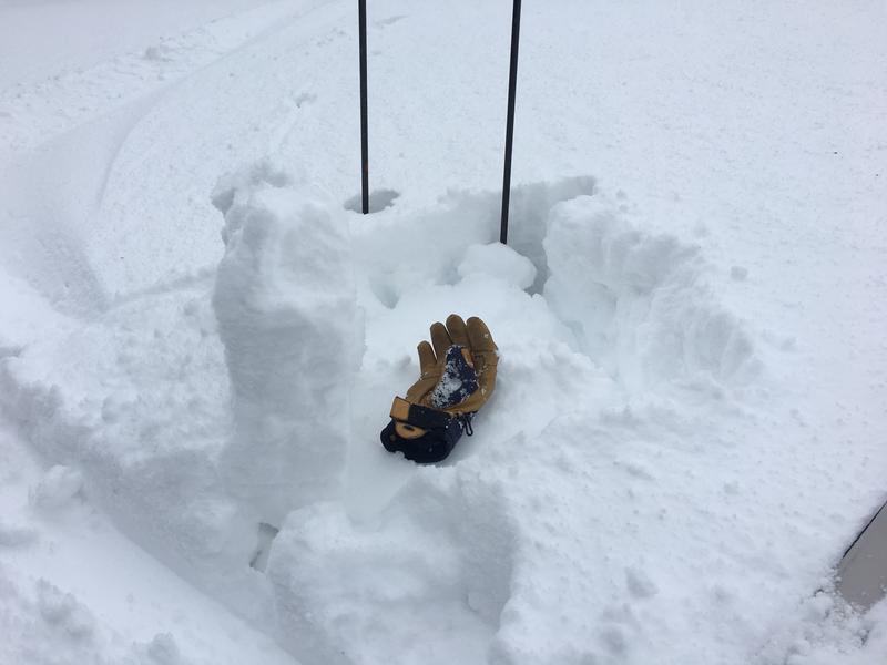
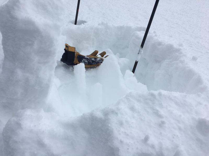
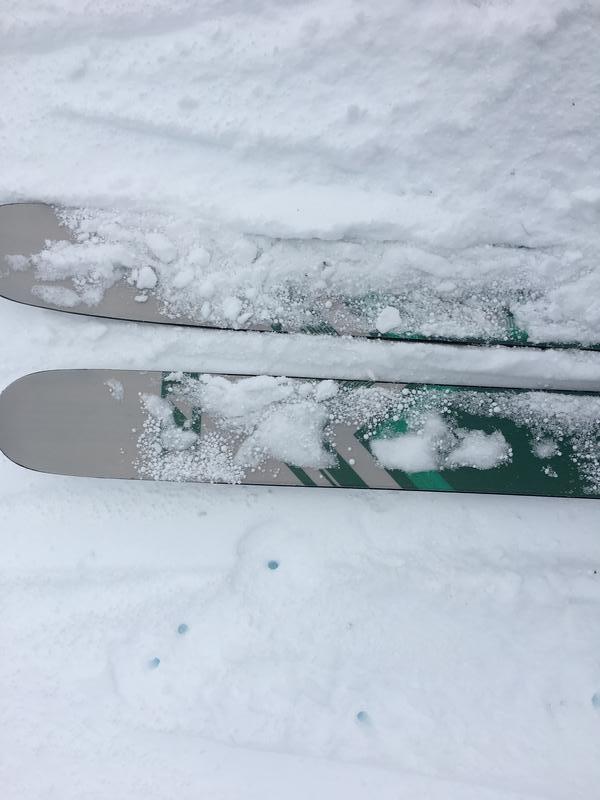
Photo 1: Hand shear on a west facing slope on the top of Julie's. The storm snow was pretty cohesive here and you can see the block that pulled out. Photo 2: Underneath this block was a thin sun crust that formed on Tuesday. This photo shows the thickness of this crust. I did not find any faceted snow above or below this crust. Photo 3: You can see the amount of Graupel in the surface snow on top of my skis.
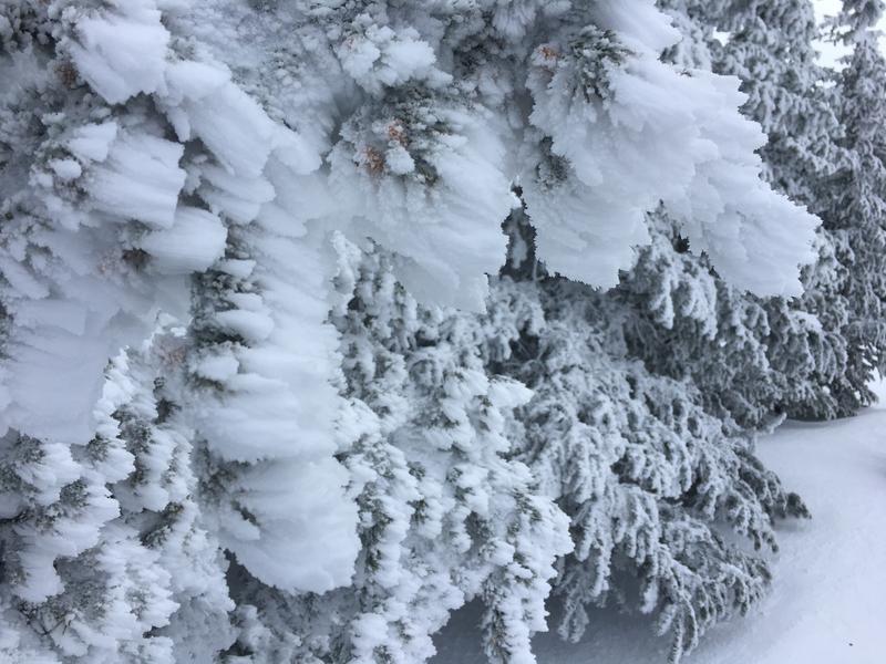
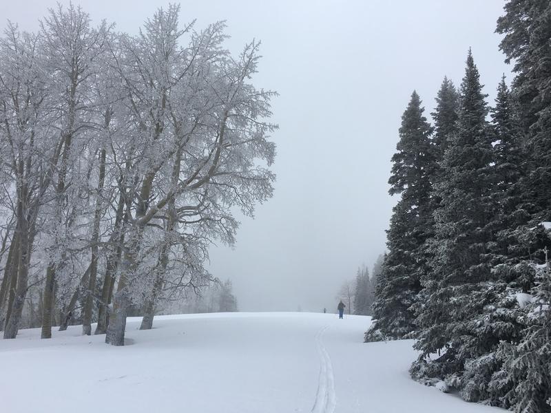
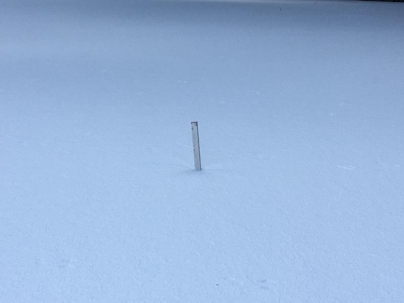
Photo 4: Serious rime forming at mid and upper elevations. Photo 5: Clouds were socked in for most of the day. Photo 6: Snow stake is disappearing. 90 inch base?
If we don't get the forecasted amounts of snow I think tomorrow's danger will be moderate with pockets of considerable in the wind zone.
Today's Observed Danger Rating
Considerable
Tomorrows Estimated Danger Rating
Moderate