Observation Date
1/20/2019
Observer Name
Kathy, Alejandro
Region
Southwest » Tushers » City Creek Peak
Location Name or Route
City Creek Peak
Comments
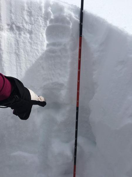
Generally, snowpack is pretty crummy in the Tushars right now and we chose to stick to low angle slopes because of what we were seeing in the snow as well as lacking any forecast information for the Southwest region. Our compression test backed up what we were suspecting with a significant collapse at 70cm in the weak sugary snow. South facing slopes at low angles felt safe.
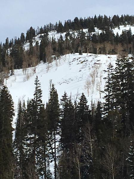
We did witness a slide on a NW facing aspect higher up on City Creek Peak. From a distance it looks like it was a slab that released potentially all the way to the ground based on visible rocks under the propagation line. It is unclear if this was natural or human caused, there were tracks probably 50 feet skier's right of the slide.
We are still fairly new to taking observations but trying to practice and be vigilant since the area we frequent doesn't get a lot of observations or forecasts. We felt it was important to take as much information as we were able and share it.
FORECASTER COMMENTS: Kathy's comments on the weak snow deeper in the snowpack are congruent with what I've been seeing on the Manti Skyline which is the nearest range with regular avalanche forecasting. Unfortunately, the mid December dry period was hard on the snowpack and weakened it more than we care to see. Kathy is also "spot on" about the last two storms adding higher density snow creating a stronger layer over the weaker layers. Brett Kobernik
Video
Today's Observed Danger Rating
Moderate
Tomorrows Estimated Danger Rating
Considerable
Coordinates


