
Observation Date
12/20/2018
Observer Name
Greg Gagne/Dave Pease
Region
Provo » American Fork » Dry Fork
Location Name or Route
Dry Fork
Comments
Wanted to look at the existing snow surface ahead of what will hopefully be a prolonged period of unstable weather, beginning Friday. The past week has had at least several wind events, sun, and warm temperatures. Underneath the snow surface are 2 or 3 different pencil-hard wind slabs from these different wind events. These slabs are strong and supportable, with decomposing fragments sandwiched between. There is some weak snow at the surface (surface hoar and near-surface facets, as well as Wednesday's graupel) but overall not especially weak as the recent warmth/wind/sun has routinely disturbed the snow surface thereby preventing weak snow at the surface from developing.
We are not expecting a significant amount of storm snow over the next week, and the current forecast is suggesting the snow will slowly stack up. However winds may increase at different periods which can quickly overload the existing snowpack. I would expect avalanche activity will be within storm snow, or in some cases will fail in the existing snow surface, with one of the underlying wind slabs acting as a bed surface.
Did not look at the buried facets at the ground, but above 9500' the snowpack was 1.2 - 1.5 meters where I was traveling.
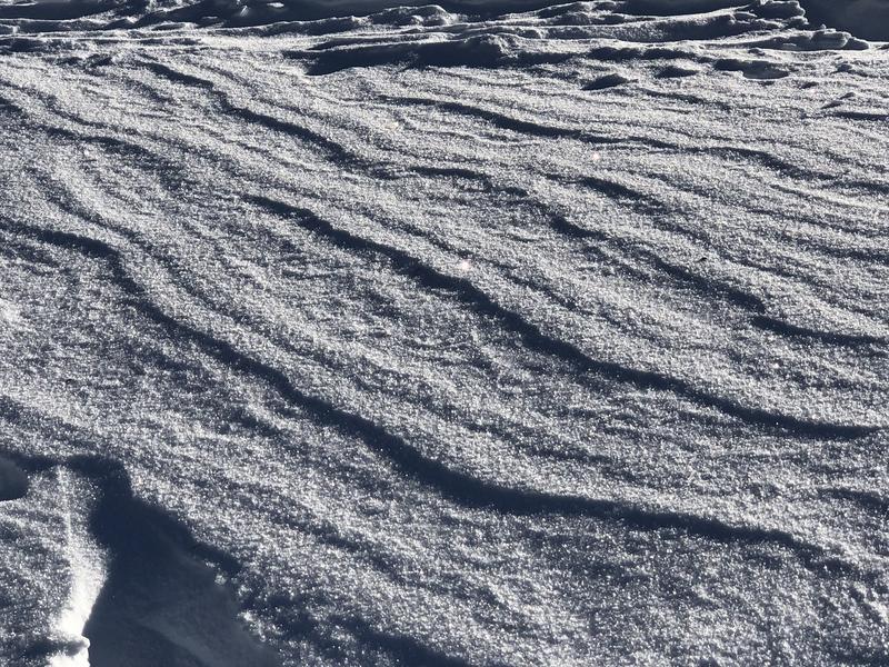
Photo of some 5 mm surface hoar on wind-scoured surface. Video discussion of existing snow surface.
Video
Overall am feeling quite positive with the snowpack in the central Wasatch. The snowpack is over a meter in most places, and is strong and supportable. We have had very little snow so far in December, but when it hasn't snowed the weather cooperated with warmth, sun, and wind. These different weather events either prevented weak snow from developing, or where it did develop at the surface, destroyed it before it got buried.
The areas that concern me most are the typically thinner snowpack areas outside of the Cottonwoods such as Millcreek, PC ridgeline, and Lambs Canyon. For example, on Tuesday I was in Millcreek where I was finding some mid-pack facets in thinner snowpack areas. Other areas of concern are slopes that have slid one or more times this season where the snowpack is thinner.
Hopefully the upcoming weather systems will slowly add to our snowpack and help it continue to gain strength.
Today's Observed Danger Rating
Low
Tomorrows Estimated Danger Rating
Low
Coordinates


