Observation Date
12/7/2018
Observer Name
Greg Gagne & Doug Wewer
Region
Ogden » Snowbasin Backcountry
Location Name or Route
Snowbasin backcountry
Comments
Overall stable snowpack in Ogden area mountains.
We searched for October facets and and did not find them in mid and upper elevation northerly aspects, including where we traveled in Hells Canyon (but we did not enter from upper elevation starting zones). The only location where we had found them was on a NW aspect at 8600', and it is possible this was an outlying region, but we suspect there are a few pockets where they remain. (Video below).
Video
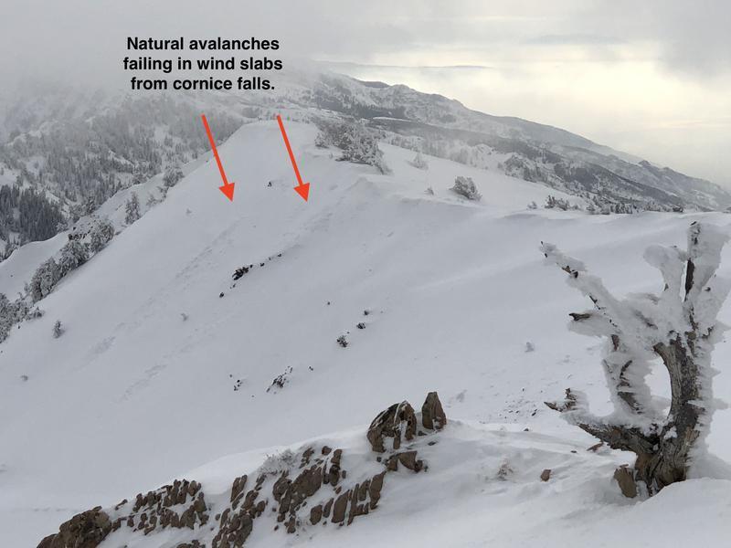
Recent wind drifts which were reactive on Wednesday (see excellent observation from Kory Davis & Doug Wewer) had largely settled out. Cornices from SW winds have formed on leeward aspects of upper elevation ridgelines, be sure to give them a wide berth when cruising ridges. We saw evidence of natural avalanches on leeward easterly aspects from recent westerly winds. These were from natural cornice falls which triggered small, fresh wind slabs.
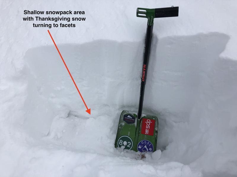
With an overall Low hazard rating, the only concerns we noted going forward was in thinner snowpack areas where the Thanksgiving storm snow that is found down near the ground is faceting. This is not a concern for now, but something to keep in mind if high pressure lingers and thinner snowpack areas begin to facet.
Today's Observed Danger Rating
Low
Tomorrows Estimated Danger Rating
Low


