Observation: Wolverine

Observation Date
3/30/2018
Observer Name
Evelyn
Region
Salt Lake » Little Cottonwood Canyon » Wolverine
Location Name or Route
Wolverine
Weather
Sky
Few
Wind Direction
West
Wind Speed
Light
Weather Comments
Another stunning day.
Snow Characteristics
Snow Surface Conditions
Faceted Loose
Wind Crust
Damp
Snow Characteristics Comments

Upper to mid elevation northerly facing slopes still have cold, dry snow, though it's mixed with wind damage and thin crusts in places. Crusts and wind drifts are starting to break down with faceting. Wind sheltered shady spots can have some good consistent turning.

On the sunny slopes, this weeks snow is sitting on top of the hard rain crust, and have settled to just an inch or two. On smooth slopes, it softened into excellent "corn" like turning today. Timing for "corn" will be tricky for the next couple of days - warm temperatures, but intermittent clouds and periods of wind will counteract the sun and warm temperatures.

Red Flags
Red Flags
Recent Avalanches
Wind Loading
Red Flags Comments
A few rouge wind slabs, and evidence of very small, past wind slabs that had released in Wolverine Cirque. Resort control work released a D2 slide on an upper elevation, wind drifted northerly slope facing that failed on the graupel layer.
Avalanche Problem #1
Problem
Normal Caution
Problem #1 Comments

Mostly stable snow...mid and low elevations are "locked up" with a stout, strong crust on or just below the surface. Today's clouds and wind kept the snow mostly cool today, with perfect surface softening on the sunny slopes. No wet issues where I was through mid afternoon.

Wind drifted slopes the most widespread concern, and shallow, snow pack areas at the highest elevations.

Comments

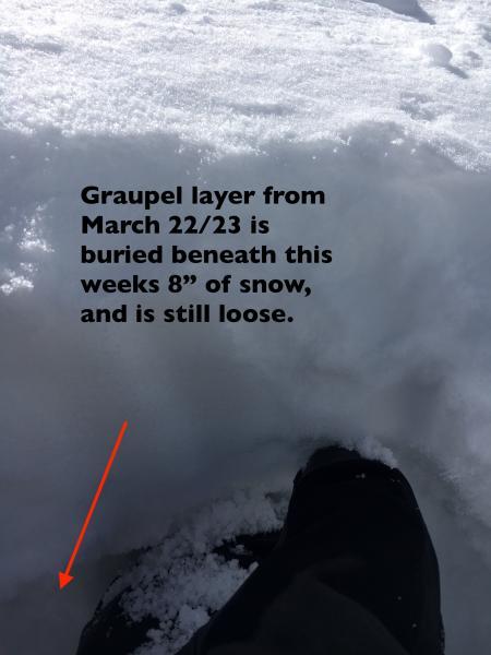
With storms in the long range forecast, my main interest was the snow on upper elevation, northerly facing slopes. In general, the snow is faceting and loose, crusts breaking down. I was also looking for any buried graupel, and found it. Photo below (10,200', northerly facing) - the graupel from March 22/23 remain loose and weak, and has about 8" of snow above it at the upper elevations, more where wind drifted.

So the surface snow on mid to upper elevation, northerly facing slopes will be worth making mental notes about for the next few days if the forecast snow for late next week stays on track.

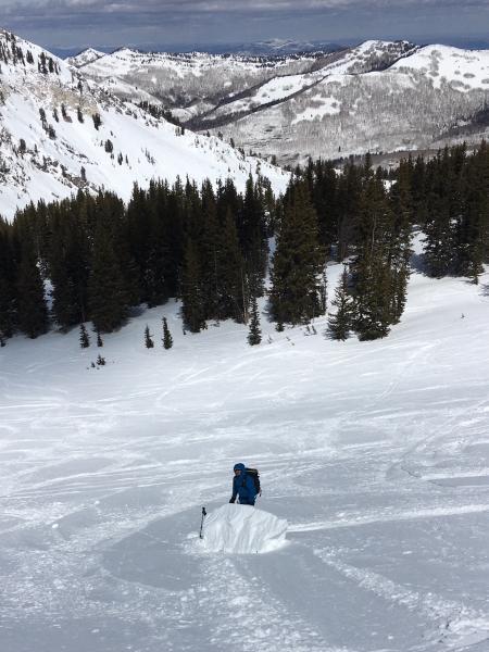
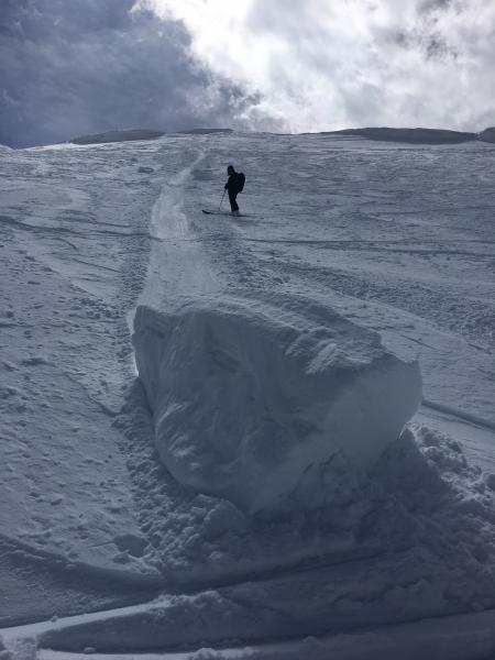
Not much going on - snow unreactive to a cornice drop.

The upper Cottonwoods are white and smooth.

Today's Observed Danger Rating
Low
Tomorrows Estimated Danger Rating
Low