Observation: Chalk Creek

Observation Date
12/21/2017
Observer Name
Toddeo
Region
Southwest » Pahvant Range » Chalk Creek
Location Name or Route
Pahvant Foothills - Chalk Creek Road
Weather
Sky
Obscured
Precipitation
Light Snowfall
Wind Speed
Calm
Weather Comments
Light snow with some clearing, the bulk of the snow was over by time I started skinning at noon. Partial clearing late in the day.
Snow Characteristics
New Snow Depth
22"
New Snow Density
Medium
Snow Surface Conditions
Powder
Snow Characteristics Comments

Looks like the Pahvants may have been in the sweet spot. My wife told me she heard from a farmer in Kanosh (12 miles south of Fillmore) who had 18" at his house, I called shenanigans until I spent the afternoon breaking trail in it!

8" @5000' in Fillmore

12" @ 5400' at the Chalk Creek Trailhead

18" @ the intersection of Mountain Sheep Creek @ 6000'

22" @ 6300'

Trail breaking was ridiculous! I kept thinking i should have brought my sled........

Red Flags
Red Flags
Heavy Snowfall
Poor Snowpack Structure
Red Flags Comments
Red flags are speculation for the high country which I did not get to today. I am not sure how much snow fell in the high country, see snotel discussion below. Based on recent hikes, there there are facets, there was a new load and wind. Even if the totals are less than the max of 22" I observed, there would likely be hazard on upper elevation Norths in this area.
Avalanche Problem #1
Problem
New Snow
Trend
Same
Problem #1 Comments

High elevation norths:

I would speculate the hazard on upper elevation norths would be the storm snow sitting on top of the basal facets. I would guess moderate hazard.

Avalanche Problem #2
Problem
New Snow
Trend
Decreasing Danger
Problem #2 Comments

Low elevations:

In lower elevations that received over a foot, there appears to be a mid-storm instability based on some shear testing I conducted on steep road cuts (see photo below). I would expect that this will settle out quickly.

Low to moderate hazard.

Comments

Photos below:

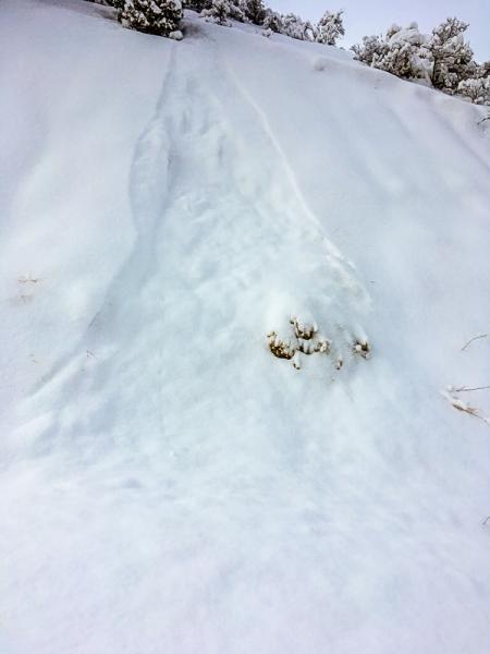
1. Point releases on the Chalk Creek Road were entraining a lot of snow. 5800' elevation. HST 18"

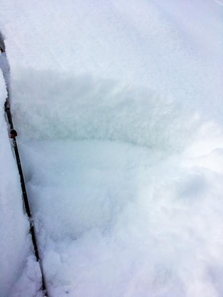
2. Mid storm instability, I was not able to isolate the new snow column in this area, 5800' elevation and 35 to 40 degrees.

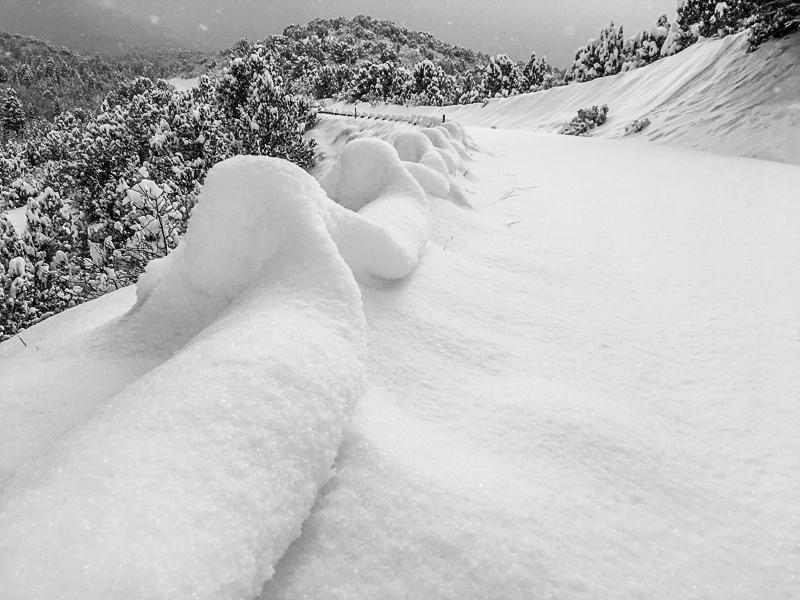
3. Snow cover, creep on guardrail and point releases on right side of photo.

Snow totals in the 2 Pahvant snotels may not be accurate today.

Pine Creek - No HS, 1.4" water

Bob's Hollow - HST 6", 2." water. This is a new site and it seems to be lower than Pine Creek based on 1 year of data.

Tushers:

Big Flat - HST 5"

Kimberly Mine - 15" , 8" water, The nearest UDOT traffic cams on I-15 do not have a lot of new snow showing.

I will hopefully be able to get into the high country this weekend and see if this truly was a lower elevation storm. Would have been nice if it fell on a base....

My moderate hazard is based on what I speculate it might be for the upper elevation norths - new snow, facets and wind.....

Today's Observed Danger Rating
Moderate
Tomorrows Estimated Danger Rating
Moderate