Observation: Moab

Observation Date
1/20/2017
Observer Name
Dave Garcia
Region
Moab
Location Name or Route
Noriega's
Weather
Sky
Overcast
Precipitation
Light Snowfall
Wind Direction
South
Wind Speed
Light
Weather Comments
Heavy snowfall at the Trans La Sal TH lasted for maybe an hour and then became light. It was on and off light snow throughout the remainder of the day and even a patch of blue sky on our exit back to the truck. Winds out of the south were mostly light in our neck of the woods today, moderate on Noriega Peak.
Snow Characteristics
New Snow Depth
10"
New Snow Density
Medium
Snow Surface Conditions
Powder
Snow Characteristics Comments
8 to 10 inches of new snow today. A lot of graupel fell with this most recent snow. The upper three inches contained a lot of graupel. This made for a very loose surface layer. If we get dense or more cohesive snow on top of today's surface I would expect it to act as a weak layer. We kept our slope angles low today, but I would expect sluffing and point release slides within the new snow on steeper terrain.
Red Flags
Red Flags
Heavy Snowfall
Cracking
Collapsing
Red Flags Comments
Collapsing and cracking was localized today, but a good indicator that the snowpack is receiving some good stress from the new snow. We got a couple collapses with shooting cracks as we made our way up the low angled west facing meadows of Noriega's. When we reached the top we walked the ridge above the steep NNE face of Noriega's. We experienced quite a bit of whoomphing and collapsing with small shooting cracks as we walked the ridge line. Definitely plenty of energy in the snowpack on that face. We maintained our distance from the steep rollover, but my guess is that with the weight of a skier that face would slide. It did not appear to be wind loaded, the weight of the new snow was enough to make it sensitive. Snowfall was heavy this morning, and tonight we are forecast 4 to 8 inches and 6 to 10 tomorrow. The scales seemed tipped right now and things could be tricky tomorrow with additional snowfall.
Avalanche Problem #1
Problem
New Snow
Trend
Same
Problem #1 Comments
As mentioned above, the surface snow today was very loose and filled with lots of graupel. It's rare to see graupel accumulate as deep as it was this morning. I would expect loose snow sluffs on steep terrain on all aspects. Furthermore this could be our next weak layer if we receive the snow that is currently forecasted.
Avalanche Problem #2
Problem
New Snow
Trend
Increasing Danger
Problem #2 Comments
In a lot of places today the surface snow was too loose to behave like a slab. However I found some variation in the surface snow as we traveled, and in some spots the new snow was starting to take on slab like properties. Shooting cracks in the snow like the ones we saw today are a good indication of slab formation.
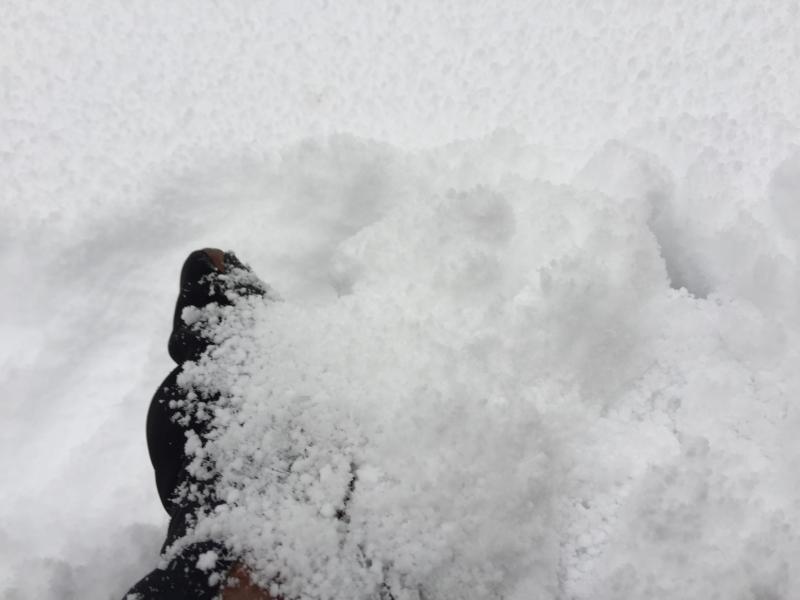
This is what the top three inches of snow looked like today, lots of graupel, very loose.
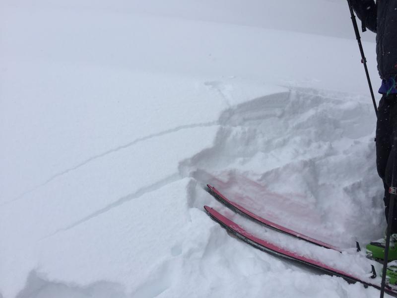
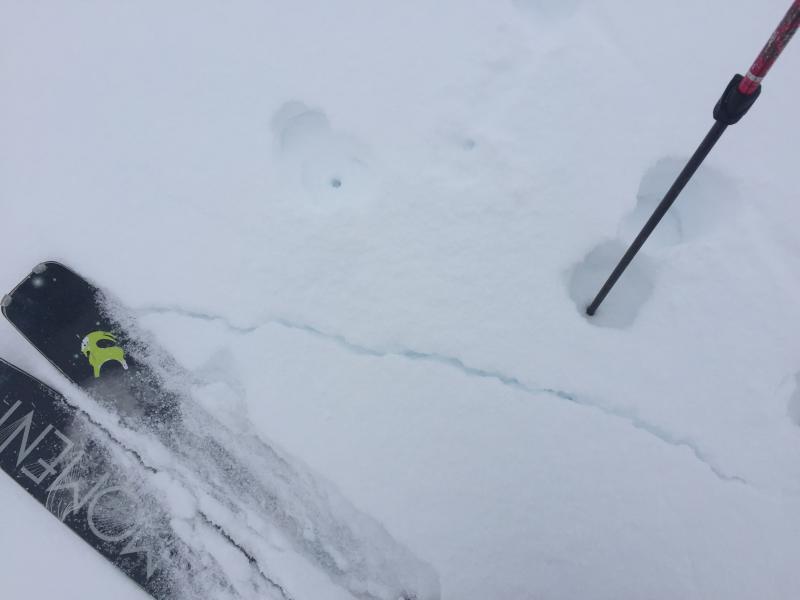
Small cracks shooting out from our skis. Loud whoomphing associated with collapses on the ridge line.
Today's Observed Danger Rating
Considerable
Tomorrows Estimated Danger Rating
Considerable